
GLOVIS SAFETY
Cargo
Current Trip
| Time Travelled | 3 days |
|---|---|
| Remaining Time | 23 days |
| Distance Travelled | 1387.97 nm |
| Remaining Distance | 10237.50 nm |
| AVG Speed | 16.1 Knots |
| MAX Speed | 18.9 Knots |
| AVG Wind | 15.2 knots |
| MAX Wind | 29 knots |
| MIN Temp | 9.4°C / 48.92°F |
| MAX Temp | 17.7°C / 63.86°F |
| Dybgang | 9.6 m |
| Position Modtaget | 9 m siden |
Current Position
| Longitude | -14.05598° |
|---|---|
| Latitude | 30.98112° |
| Status | Under way using engine |
| Fart | 18.1 Knots |
| Kurs | 195.7° |
| Område | North Atlantic Ocean |
| Station | T-AIS |
| Position Modtaget | 9 m siden |
Info
Information
The current position of GLOVIS SAFETY is in North Atlantic Ocean with coordinates 30.98112° / -14.05598° as reported on 2024-05-02 23:21 by AIS to our vessel tracker app. The vessel's current speed is 18.1 Knots and is heading at the port of SINGAPORE. The estimated time of arrival as calculated by MyShipTracking vessel tracking app is 2024-05-26 09:12 LT
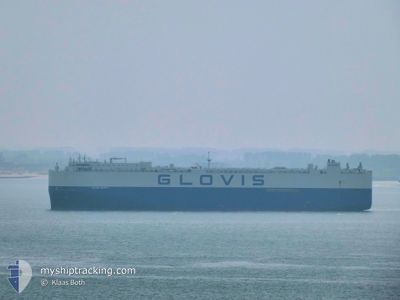
The vessel GLOVIS SAFETY (IMO: 9798399, MMSI: 538007438) is a Cargo It's sailing under the flag of [MH] Marshall Is.
In this page you can find informations about the vessels current position, last detected port calls, and current voyage information. If the vessels is not in coverage by AIS you will find the latest position.
The current position of GLOVIS SAFETY is detected by our AIS receivers and we are not responsible for the reliability of the data. The last position was recorded while the vessel was in Coverage by the Ais receivers of our vessel tracking app.
The current draught of GLOVIS SAFETY as reported by AIS is 9.6 meters
Weather
| Temperature | 17.7°C / 63.86°F |
|---|---|
| Wind Speed | 18 knots |
| Direction | 45° NE |
| Pressure | 1020.4 hPa |
| Humidity | 67.5 % |
| Cloud Coverage | --- |
Featured Company
Last Port Calls
| Port | Arrival | Departure | Time In Port |
|---|---|---|---|
| 2024-04-29 05:00 | 2024-04-29 16:18 | 11 h | |
| 2024-04-24 03:32 | 2024-04-26 23:08 | 2 d | |
| 2024-04-21 16:24 | 2024-04-23 03:51 | 1 d | |
| 2024-04-19 06:30 | 2024-04-20 10:56 | 1 d | |
| 2024-04-19 05:27 | 2024-04-19 06:22 | 54 m | |
| 2024-04-16 20:28 | 2024-04-18 20:35 | 2 d | |
| 2024-04-15 04:23 | 2024-04-16 05:36 | 1 d | |
| 2024-03-11 02:27 | 2024-03-11 10:39 | 8 h | |
| 2024-03-05 09:53 | 2024-03-10 03:05 | 4 d | |
| 2024-03-03 22:29 |
Most Visited Ports (Last year)
| Port | Arrivals | |
|---|---|---|
| 6 | ||
| 5 | ||
| 4 | ||
| 4 | ||
| 3 | ||
| 3 |
Last Trips
| Origin | Departure | Destination | Arrival | Distance | |
|---|---|---|---|---|---|
| 2024-04-27 01:08 | 2024-04-29 06:00 | 538.41 nm | |||
| 2024-04-23 04:51 | 2024-04-24 05:32 | 337.33 nm | |||
| 2024-04-20 12:56 | 2024-04-21 17:24 | 256.73 nm | |||
| 2024-04-19 08:22 | 2024-04-19 08:30 | 0.33 nm | |||
| 2024-04-18 22:35 | 2024-04-19 07:27 | 119.45 nm | |||
| 2024-04-16 06:36 | 2024-04-16 22:28 | 181.45 nm | |||
| 2024-03-11 19:39 | 2024-04-15 05:23 | 14527.00 nm | |||
| 2024-03-10 12:05 | 2024-03-11 11:27 | 60.00 nm | |||
| 2024-03-03 23:04 | 2024-03-04 07:29 | 129.60 nm | |||
| 2024-02-16 13:27 | 2024-03-03 15:15 | 6087.30 nm |
Events
| Tid | Hændelsen | Detaljer | Position / Dest | Info |
|---|---|---|---|---|
| 2024-05-02 23:30 | Status er ændret | Under way using engine Default |
30.93888 / -14.06988
SG SIN
|
Fart: 18.2 kn Kurs: 196° |
| 2024-05-02 23:24 | Status er ændret | Default Under way using engine |
30.96881 / -14.06001
SG SIN
|
Fart: 18.1 kn Kurs: 195.7° |
| 2024-05-02 23:21 | Status er ændret | Under way using engine Default |
30.98112 / -14.05598
SG SIN
|
Fart: 18.1 kn Kurs: 196° |
| 2024-05-02 23:18 | Status er ændret | Default Under way using engine |
30.99719 / -14.05066
SG SIN
|
Fart: 18.2 kn Kurs: 195.7° |
| 2024-05-02 23:10 | Ændre havområde | Spanish (Canary Islands) part of the North Atlantic Ocean United Kingdom part of the English Channel |
31.03709 / -14.03743
North Atlantic Ocean
SG SIN
|
Fart: 18.2 kn Kurs: 195.7° |
| 2024-05-02 23:10 | Status er ændret | Under way using engine Default |
31.03709 / -14.03743
SG SIN
|
Fart: 18.1 kn Kurs: 196° |
| 2024-05-02 23:06 | Indenfor Dækning |
31.03709 / -14.03743
North Atlantic Ocean
SG SIN
|
Fart: 18.2 kn Kurs: 195.7° |
|
| 2024-04-30 02:58 | Status er ændret | Default Under way using engine |
49.52138 / -4.25425
SG SIN
|
Fart: 17.5 kn Kurs: 242.2° |
| 2024-04-30 02:51 | Udenfor Dækning |
49.53792 / -4.20636
English Channel
SG SIN
|
Fart: 17.5 kn Kurs: 242.2° |
|
| 2024-04-29 23:47 | Ændre havområde | United Kingdom part of the English Channel Guernsey part of the English Channel |
49.96455 / -3.03080
English Channel
SG SIN
|
Fart: 16 kn Kurs: 241.4° |