
GLOUCESTER EXPRESS
Other Type
Current Trip
AU DRW
| Time Travelled | 2 days |
|---|---|
| Remaining Time | --- |
| Distance Travelled | 820.30 nm |
| Remaining Distance | --- |
| AVG Speed | 14.6 Knots |
| MAX Speed | 16.4 Knots |
| AVG Wind | 5.4 knots |
| MAX Wind | 12 knots |
| MIN Temp | 27.1°C / 80.78°F |
| MAX Temp | 30.2°C / 86.36°F |
| Dybgang | 5.9 m |
| Position Modtaget | 1 d siden |
Current Position
| Longitude | --- |
|---|---|
| Latitude | --- |
| Status | Under way using engine |
| Fart | 15.1 Knots |
| Kurs | 284.3° |
| Område | Timor Sea |
| Station | T-AIS |
| Position Modtaget | 1 d siden |
Info
Information
The current position of GLOUCESTER EXPRESS is in Timor Sea with coordinates -11.69593° / 128.19564° as reported on 2025-12-16 07:32 by AIS to our vessel tracker app. The vessel's current speed is 15.1 Knots
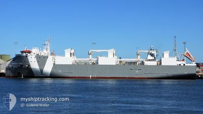
The vessel GLOUCESTER EXPRESS (IMO: 9733765, MMSI: 255915565) is a Other Type It's sailing under the flag of [PT] Portugal.
In this page you can find informations about the vessels current position, last detected port calls, and current voyage information. If the vessels is not in coverage by AIS you will find the latest position.
The current position of GLOUCESTER EXPRESS is detected by our AIS receivers and we are not responsible for the reliability of the data. The last position was recorded while the vessel was in Coverage by the Ais receivers of our vessel tracking app.
The current draught of GLOUCESTER EXPRESS as reported by AIS is 5.9 meters
Weather
| Temperature | 28.8°C / 83.84°F |
|---|---|
| Wind Speed | 10 knots |
| Direction | 318° NW |
| Pressure | 1007.5 hPa |
| Humidity | 72.4 % |
| Cloud Coverage | 62 % |
Featured Company
Last Port Calls
| Port | Arrival | Departure | Time In Port |
|---|---|---|---|
| 2025-12-16 06:43 | |||
| 2025-12-08 19:48 | 2025-12-10 03:52 | 1 d | |
| 2025-12-03 05:26 | 2025-12-04 06:26 | 1 d | |
| 2025-11-24 12:09 | 2025-11-25 19:12 | 1 d | |
| 2025-11-17 04:53 | 2025-11-18 05:20 | 1 d | |
| 2025-11-10 13:03 | 2025-11-11 17:51 | 1 d | |
| 2025-11-05 05:21 | 2025-11-06 06:33 | 1 d | |
| 2025-10-30 14:43 | 2025-10-30 14:55 | 12 m | |
| 2025-10-29 17:19 | 2025-10-29 18:06 | 47 m | |
| 2025-10-24 06:12 | 2025-10-25 04:48 | 22 h |
Last Trips
| Origin | Departure | Destination | Arrival | Distance | |
|---|---|---|---|---|---|
| 2025-12-04 06:26 | 2025-12-08 19:48 | 1521.01 nm | |||
| 2025-11-25 19:12 | 2025-12-03 05:26 | 2238.75 nm | |||
| 2025-11-18 05:20 | 2025-11-24 12:09 | 2223.27 nm | |||
| 2025-11-11 17:51 | 2025-11-17 04:53 | 1522.45 nm | |||
| 2025-11-06 06:33 | 2025-11-10 13:03 | 1516.72 nm | |||
| 2025-10-30 14:55 | 2025-11-05 05:21 | 1620.68 nm | |||
| 2025-10-29 18:06 | 2025-10-30 14:43 | 2.93 nm | |||
| 2025-10-25 04:48 | 2025-10-29 17:19 | 1596.14 nm | |||
| 2025-10-18 20:15 | 2025-10-24 06:12 | 1515.20 nm | |||
| 2025-10-17 15:15 | 2025-10-18 03:55 | 126.34 nm |
Events
| Tid | Hændelsen | Detaljer | Position / Dest | Info |
|---|---|---|---|---|
| 2025-12-16 07:34 | Status er ændret | Default Under way using engine |
-11.69333 / 128.18500
AU DRW
|
Fart: 15.1 kn Kurs: 284.3° |
| 2025-12-16 07:32 | Udenfor Dækning |
-11.69593 / 128.19564
Timor Sea
|
Fart: 15.1 kn Kurs: 284.3° |
|
| 2025-12-16 05:27 | Ændre havområde | Australian part of the Timor Sea Indonesian part of the Savu Sea |
-11.81976 / 128.69836
Timor Sea
|
Fart: 14.5 kn Kurs: 282.1° |
| 2025-12-16 05:27 | Status er ændret | Under way using engine Default |
-11.81976 / 128.69836
AU DRW
|
Fart: 14 kn Kurs: 285° |
| 2025-12-16 05:19 | Indenfor Dækning |
-11.81976 / 128.69836
Timor Sea
|
Fart: 14.5 kn Kurs: 282.1° |
|
| 2025-12-15 21:13 | Afsejlet fra sidste havn |
|
-12.39054 / 130.75264
AU DRW
|
Fart: 10.9 kn Kurs: 320° |
| 2025-12-12 05:17 | STOP Sejllads |
-9.34108 / 120.68744
AU DRW
|
Fart: 0.1 kn Kurs: 221° |
|
| 2025-12-12 02:25 | Status er ændret | Default Under way using engine |
-9.08667 / 120.08167
AU DRW
|
Fart: 15.3 kn Kurs: 115° |
| 2025-12-12 02:20 | Ændre havområde | Indonesian part of the Savu Sea Indonesian part of the Java Sea |
-9.07829 / 120.06373
Savu Sea
AU DRW
|
Fart: 15.3 kn Kurs: 115° |
| 2025-12-12 02:20 | Udenfor Dækning |
-9.07829 / 120.06373
Savu Sea
AU DRW
|
Fart: 15.3 kn Kurs: 115° |