
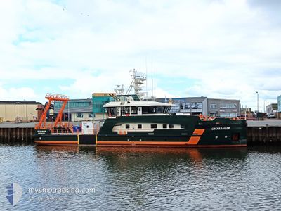
GEO RANGER
Other Type
Current Trip
| Time Travelled | 1 day |
|---|---|
| Remaining Time | 13 h, 28 mins |
| Distance Travelled | 213.83 nm |
| Remaining Distance | 74.88 nm |
| AVG Speed | 5.9 Knots |
| MAX Speed | 11.6 Knots |
| AVG Wind | 14 knots |
| MAX Wind | 18 knots |
| MIN Temp | 10.1°C / 50.18°F |
| MAX Temp | 14.7°C / 58.46°F |
| Dybgang | 2.4 m |
| Position Modtaget | 1 m siden |
Current Position
| Longitude | 5.94043° |
|---|---|
| Latitude | 54.25213° |
| Status | Restricted manoeuverability |
| Fart | 6.1 Knots |
| Kurs | 240.3° |
| Område | North Sea |
| Station | T-AIS |
| Position Modtaget | 1 m siden |
Info
Information
The current position of GEO RANGER is in North Sea with coordinates 54.25213° / 5.94043° as reported on 2024-05-04 11:07 by AIS to our vessel tracker app. The vessel's current speed is 6.1 Knots and is heading at the port of DELFZIJL. The estimated time of arrival as calculated by MyShipTracking vessel tracking app is 2024-05-05 00:36 LT
The vessel GEO RANGER (IMO: 9885831, MMSI: 245893000) is a Other Type It's sailing under the flag of [NL] Netherlands.
In this page you can find informations about the vessels current position, last detected port calls, and current voyage information. If the vessels is not in coverage by AIS you will find the latest position.
The current position of GEO RANGER is detected by our AIS receivers and we are not responsible for the reliability of the data. The last position was recorded while the vessel was in Coverage by the Ais receivers of our vessel tracking app.
The current draught of GEO RANGER as reported by AIS is 2.4 meters
Weather
| Temperature | 10.7°C / 51.26°F |
|---|---|
| Wind Speed | 10 knots |
| Direction | 199° SSW |
| Pressure | 1015 hPa |
| Humidity | 82.7 % |
| Cloud Coverage | 99 % |
Featured Company
Last Port Calls
| Port | Arrival | Departure | Time In Port |
|---|---|---|---|
| 2024-05-01 05:07 | 2024-05-02 20:09 | 1 d | |
| 2024-04-23 19:02 | 2024-04-24 21:30 | 1 d | |
| 2024-04-19 00:44 | 2024-04-21 11:22 | 2 d | |
| 2024-04-14 05:51 | 2024-04-17 10:13 | 3 d | |
| 2024-04-09 17:24 | 2024-04-11 08:45 | 1 d | |
| 2024-04-03 09:17 | 2024-04-05 20:18 | 2 d | |
| 2024-04-02 15:23 | 2024-04-02 15:40 | 16 m | |
| 2024-03-31 23:12 | 2024-04-02 15:02 | 1 d | |
| 2024-03-31 22:40 | 2024-03-31 23:03 | 23 m | |
| 2024-03-29 13:28 | 2024-03-29 14:05 | 36 m |
Last Trips
| Origin | Departure | Destination | Arrival | Distance | |
|---|---|---|---|---|---|
| 2024-04-24 23:30 | 2024-05-01 07:07 | 779.96 nm | |||
| 2024-04-21 13:22 | 2024-04-23 21:02 | 332.20 nm | |||
| 2024-04-17 12:13 | 2024-04-19 02:44 | 220.94 nm | |||
| 2024-04-11 10:45 | 2024-04-14 07:51 | 387.06 nm | |||
| 2024-04-05 22:18 | 2024-04-09 19:24 | 398.08 nm | |||
| 2024-04-02 17:40 | 2024-04-03 11:17 | 154.49 nm | |||
| 2024-04-02 17:02 | 2024-04-02 17:23 | 2.07 nm | |||
| 2024-04-01 01:03 | 2024-04-01 01:12 | 1.02 nm | |||
| 2024-03-29 15:05 | 2024-04-01 00:40 | 352.48 nm | |||
| 2024-03-29 14:20 | 2024-03-29 14:28 | 0.90 nm |
Events
| Tid | Hændelsen | Detaljer | Position / Dest | Info |
|---|---|---|---|---|
| 2024-05-04 08:32 | Ændre havområde | German part of the North Sea Dutch part of the North Sea |
54.23500 / 5.89128
North Sea
|
Fart: 5.7 kn Kurs: 73.8° |
| 2024-05-04 08:20 | Fundet i havområde | Dutch part of the North Sea |
54.23876 / 5.86846
North Sea
|
Fart: 6.4 kn Kurs: 222° |
| 2024-05-04 07:26 | Ændre havområde | German part of the North Sea Dutch part of the North Sea |
54.24267 / 5.87725
North Sea
|
Fart: 5.5 kn Kurs: 48.2° |
| 2024-05-04 07:05 | Fundet i havområde | Dutch part of the North Sea |
54.23959 / 5.86979
North Sea
|
Fart: 4.3 kn Kurs: 240.3° |
| 2024-05-04 06:09 | Ændre havområde | German part of the North Sea Dutch part of the North Sea |
54.24202 / 5.87529
North Sea
|
Fart: 5.7 kn Kurs: 59° |
| 2024-05-04 05:56 | Ændre havområde | Dutch part of the North Sea German part of the North Sea |
54.23699 / 5.87768
North Sea
|
Fart: 5.4 kn Kurs: 239.3° |
| 2024-05-04 04:33 | Status er ændret | Restricted manoeuverability Default |
54.24996 / 6.03322
SURVEY OPS >0.5NM CP
|
Fart: 6 kn Kurs: 85° |
| 2024-05-04 04:03 | Status er ændret | Default Restricted manoeuverability |
54.24333 / 5.94667
SURVEY OPS >0.5NM CP
|
Fart: 5.8 kn Kurs: 76.9° |
| 2024-05-04 03:46 | Ændre havområde | German part of the North Sea Dutch part of the North Sea |
54.23973 / 5.89871
North Sea
|
Fart: 6.3 kn Kurs: 77.8° |
| 2024-05-04 03:23 | Fundet i havområde | Dutch part of the North Sea |
54.23821 / 5.87880
North Sea
|
Fart: 5 kn Kurs: 259.9° |