
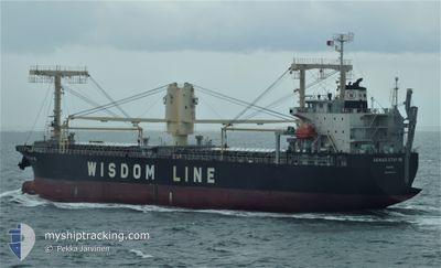
GENIUS STAR XII
Ro-Ro Cargo
Current Trip
| Time Travelled | 16 h, 54 mins |
|---|---|
| Remaining Time | 4 h, 50 mins |
| Distance Travelled | 202.78 nm |
| Remaining Distance | 147.54 nm |
| AVG Speed | 11.8 Knots |
| MAX Speed | 14.3 Knots |
| AVG Wind | 16.6 knots |
| MAX Wind | 22.2 knots |
| MIN Temp | 23.5°C / 74.3°F |
| MAX Temp | 24.4°C / 75.92°F |
| Dybgang | 8.6 m |
| Position Modtaget | 22 d siden |
Current Position
| Longitude | --- |
|---|---|
| Latitude | --- |
| Status | Under way using engine |
| Fart | 12.5 Knots |
| Kurs | 277.5° |
| Område | Singapore Strait |
| Station | T-AIS |
| Position Modtaget | 22 d siden |
Info
Information
The current position of GENIUS STAR XII is in Singapore Strait with coordinates 1.21696° / 103.48668° as reported on 2024-11-09 09:57 by AIS to our vessel tracker app. The vessel's current speed is 12.5 Knots and is heading at the port of RICHARDS BAY. The estimated time of arrival as calculated by MyShipTracking vessel tracking app is 2024-12-02 14:43 LT
The vessel GENIUS STAR XII (IMO: 9644744, MMSI: 351550000) is a Ro-Ro Cargo that was built in 2013 ( 11 år gamle ). It's sailing under the flag of [PA] Panama.
In this page you can find informations about the vessels current position, last detected port calls, and current voyage information. If the vessels is not in coverage by AIS you will find the latest position.
The current position of GENIUS STAR XII is detected by our AIS receivers and we are not responsible for the reliability of the data. The last position was recorded while the vessel was in Coverage by the Ais receivers of our vessel tracking app.
The current draught of GENIUS STAR XII as reported by AIS is 8.6 meters
Weather
| Temperature | 24.3°C / 75.74°F |
|---|---|
| Wind Speed | 17 knots |
| Direction | 19° NNE |
| Pressure | 1011.8 hPa |
| Humidity | 72.1 % |
| Cloud Coverage | 27 % |
Featured Company
Last Port Calls
| Port | Arrival | Departure | Time In Port |
|---|---|---|---|
| 2024-11-28 01:31 | 2024-12-01 16:59 | 3 d | |
| 2024-10-26 21:48 | 2024-10-29 12:12 | 2 d | |
| 2024-10-19 03:07 | 2024-10-20 11:29 | 1 d |
Last Trips
| Origin | Departure | Destination | Arrival | Distance | |
|---|---|---|---|---|---|
| 2024-10-29 20:12 | 2024-11-28 03:31 | 7881.17 nm | |||
| 2024-10-20 20:29 | 2024-10-27 05:48 | 370.04 nm | |||
| 2024-08-21 09:16 | 2024-10-19 12:07 | 9862.49 nm |
Events
| Tid | Hændelsen | Detaljer | Position / Dest | Info |
|---|---|---|---|---|
| 2024-12-01 17:08 | START Sejllads | 0.67 nm, South East of MAPUTO |
-25.98501 / 32.57471
ZA RCB
|
Fart: 7.6 kn Kurs: 131° |
| 2024-12-01 16:59 | Afsejlet fra sidste havn |
|
-25.98501 / 32.57471
ZA RCB
|
Fart: 0.1 kn Kurs: 303° |
| 2024-11-28 01:58 | STOP Sejllads |
-25.97208 / 32.56153
[MZ] MAPUTO
|
Fart: Kurs: 303° |
|
| 2024-11-28 01:31 | Skibe i havn |
|
-25.97208 / 32.56153
[MZ] MAPUTO
|
Fart: 6.2 kn Kurs: 312° |
| 2024-11-27 22:59 | START Sejllads | 15.26 nm, East of MAPUTO |
-25.96360 / 32.84843
ZA RCB
|
Fart: 3.6 kn Kurs: 337° |
| 2024-11-27 16:31 | STOP Sejllads | 15.4 nm, East of MAPUTO |
-25.96268 / 32.85105
ZA RCB
|
Fart: Kurs: 203° |
| 2024-11-27 16:07 | START Sejllads | 15.05 nm, East of MAPUTO |
-25.95592 / 32.84403
ZA RCB
|
Fart: 6.8 kn Kurs: 164° |
| 2024-11-26 11:11 | STOP Sejllads | 14.92 nm, East of MAPUTO |
-25.95604 / 32.84170
ZA RCB
|
Fart: 0.1 kn Kurs: 53° |