
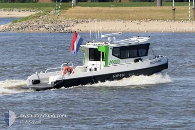
GELDERLAND
Other Type
Current Trip
SURVEY
Unknown Port
ETA*
---
| Time Travelled | 3 days |
|---|---|
| Remaining Time | --- |
| Distance Travelled | 118.15 nm |
| Remaining Distance | --- |
| AVG Speed | 9 Knots |
| MAX Speed | 16.8 Knots |
| AVG Wind | 7.5 knots |
| MAX Wind | 12 knots |
| MIN Temp | 5.4°C / 41.72°F |
| MAX Temp | 15.4°C / 59.72°F |
| Dybgang | 0 m |
| Position Modtaget | 2 m siden |
Current Position
| Longitude | --- |
|---|---|
| Latitude | --- |
| Status | Moored |
| Fart | |
| Kurs | --- |
| Område | North Sea |
| Station | T-AIS |
| Position Modtaget | 2 m siden |
Info
info
Information
The current position of GELDERLAND is in North Sea with coordinates 51.84947° / 5.86947° as reported on 2024-10-06 18:18 by AIS to our vessel tracker app. The vessel's current speed is 0 Knots
The vessel GELDERLAND (MMSI: 244150552) is a Other Type It's sailing under the flag of [NL] Netherlands.
In this page you can find informations about the vessels current position, last detected port calls, and current voyage information. If the vessels is not in coverage by AIS you will find the latest position.
The current position of GELDERLAND is detected by our AIS receivers and we are not responsible for the reliability of the data. The last position was recorded while the vessel was in Coverage by the Ais receivers of our vessel tracking app.
Weather
| Temperature | 11.9°C / 53.42°F |
|---|---|
| Wind Speed | 9 knots |
| Direction | 140° SE |
| Pressure | 1003.5 hPa |
| Humidity | 73.2 % |
| Cloud Coverage | 66 % |
Featured Company
Limited time offer - Install a base station receiver to your area and list your company on MyShipTracking Free forever!
Last Port Calls
| Port | Arrival | Departure | Time In Port |
|---|---|---|---|
| 2024-10-03 08:34 | 2024-10-03 08:38 | 3 m | |
| 2024-10-03 07:47 | 2024-10-03 07:59 | 11 m | |
| 2024-10-03 07:08 | 2024-10-03 07:36 | 28 m | |
| 2024-10-03 06:14 | 2024-10-03 06:19 | 4 m | |
| 2024-10-01 15:43 | 2024-10-02 06:19 | 14 h | |
| 2024-09-30 15:21 | 2024-10-01 05:37 | 14 h | |
| 2024-09-26 10:35 | 2024-09-30 04:55 | 3 d | |
| 2024-09-24 12:35 | 2024-09-26 05:14 | 1 d | |
| 2024-09-24 12:04 | 2024-09-24 12:08 | 4 m | |
| 2024-09-24 10:38 | 2024-09-24 10:40 | 1 m |
Last Trips
| Origin | Departure | Destination | Arrival | Distance | |
|---|---|---|---|---|---|
| 2024-10-03 09:59 | 2024-10-03 10:34 | 3.97 nm | |||
| 2024-10-03 09:36 | 2024-10-03 09:47 | 1.82 nm | |||
| 2024-10-03 08:19 | 2024-10-03 09:08 | 6.30 nm | |||
| 2024-10-03 08:19 | 2024-10-03 08:14 | 6.30 nm | |||
| 2024-10-01 07:37 | 2024-10-01 17:43 | 32.25 nm | |||
| 2024-09-30 06:55 | 2024-09-30 17:21 | 48.02 nm | |||
| 2024-09-26 07:14 | 2024-09-26 12:35 | 25.24 nm | |||
| 2024-09-24 14:08 | 2024-09-24 14:35 | 4.02 nm | |||
| 2024-09-24 12:40 | 2024-09-24 14:04 | 11.21 nm | |||
| 2024-09-24 12:40 | 2024-09-24 12:38 | 11.21 nm |
Events
| Tid | Hændelsen | Detaljer | Position / Dest | Info |
|---|---|---|---|---|
| 2024-10-04 13:49 | STOP Sejllads | 1.71 nm, East of NIJMEGEN |
51.84943 / 5.86942
SURVEY
|
Fart: 0.3 kn Kurs: 511° |
| 2024-10-04 10:38 | START Sejllads | 0.41 nm, West of LOBITH |
51.85536 / 6.08418
SURVEY
|
Fart: 7.5 kn Kurs: 315.2° |
| 2024-10-04 10:32 | STOP Sejllads | 0.32 nm, South West of LOBITH |
51.85467 / 6.08711
SURVEY
|
Fart: 0.2 kn Kurs: 511° |
| 2024-10-04 10:17 | START Sejllads | 0.54 nm, East of MILLINGEN AAN DE RIJN |
51.86390 / 6.06610
SURVEY
|
Fart: 8.6 kn Kurs: 123.8° |
| 2024-10-04 10:15 | STOP Sejllads | 0.41 nm, East of MILLINGEN AAN DE RIJN |
51.86493 / 6.06320
SURVEY
|
Fart: 0.3 kn Kurs: 511° |
| 2024-10-04 05:11 | START Sejllads | 1.78 nm, East of NIJMEGEN |
51.85109 / 5.87124
SURVEY
|
Fart: 5.9 kn Kurs: 71.3° |
| 2024-10-03 18:53 | Indenfor Dækning |
51.84944 / 5.86942
North Sea
|
Fart: Kurs: 511° |
|
| 2024-10-03 18:05 | Udenfor Dækning |
51.84945 / 5.86944
North Sea
|
Fart: 0.1 kn Kurs: 511° |
|
| 2024-10-03 14:55 | STOP Sejllads | 1.71 nm, East of NIJMEGEN |
51.84946 / 5.86946
SURVEY
|
Fart: 0.1 kn Kurs: 511° |
| 2024-10-03 11:39 | START Sejllads | 3.21 nm, South West of ANGEREN |
51.87241 / 5.93226
SURVEY
|
Fart: 9.9 kn Kurs: 113.1° |