
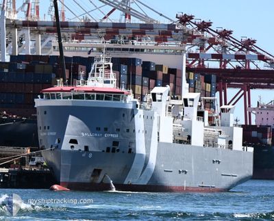
GALLOWAY EXPRESS
Livestock Carrier
Current Trip
| Time Travelled | 12 days |
|---|---|
| Remaining Time | --- |
| Distance Travelled | 3750.63 nm |
| Remaining Distance | --- |
| AVG Speed | 14.1 Knots |
| MAX Speed | 16.1 Knots |
| AVG Wind | 12.2 knots |
| MAX Wind | 27 knots |
| MIN Temp | 19.9°C / 67.82°F |
| MAX Temp | 28.4°C / 83.12°F |
| Dybgang | 7.1 m |
| Position Modtaget | 11 h, 43 m siden |
Current Position
| Longitude | --- |
|---|---|
| Latitude | --- |
| Status | Under way using engine |
| Fart | 13.9 Knots |
| Kurs | 23.7° |
| Område | North Atlantic Ocean |
| Station | T-AIS |
| Position Modtaget | 11 h, 43 m siden |
Info
Information
The current position of GALLOWAY EXPRESS is in North Atlantic Ocean with coordinates 13.80712° / -22.09526° as reported on 2026-01-05 07:13 by AIS to our vessel tracker app. The vessel's current speed is 13.9 Knots and is heading at the port of HAIFA. The estimated time of arrival as calculated by MyShipTracking vessel tracking app is 2026-01-14 19:00 LT
The vessel GALLOWAY EXPRESS (IMO: 9621194, MMSI: 255915561) is a Livestock Carrier that was built in 2013 ( 13 år gamle ). It's sailing under the flag of [PT] Portugal.
In this page you can find informations about the vessels current position, last detected port calls, and current voyage information. If the vessels is not in coverage by AIS you will find the latest position.
The current position of GALLOWAY EXPRESS is detected by our AIS receivers and we are not responsible for the reliability of the data. The last position was recorded while the vessel was in Coverage by the Ais receivers of our vessel tracking app.
The current draught of GALLOWAY EXPRESS as reported by AIS is 7.1 meters
Weather
| Temperature | 21.6°C / 70.88°F |
|---|---|
| Wind Speed | 12 knots |
| Direction | 33° NNE |
| Pressure | 1015.5 hPa |
| Humidity | 75.2 % |
| Cloud Coverage | 2 % |
Featured Company
Last Port Calls
| Port | Arrival | Departure | Time In Port |
|---|---|---|---|
| 2025-12-22 18:31 | 2025-12-24 14:03 | 1 d | |
| 2025-11-30 06:47 | 2025-12-01 06:22 | 23 h | |
| 2025-11-06 14:17 | 2025-11-08 09:45 | 1 d |
Most Visited Ports (Last year)
| Port | Arrivals | |
|---|---|---|
| 6 | ||
| 6 | ||
| 3 | ||
| 3 | ||
| 2 | ||
| 1 |
Last Trips
| Origin | Departure | Destination | Arrival | Distance | |
|---|---|---|---|---|---|
| 2025-12-01 06:22 | 2025-12-22 18:31 | 7268.36 nm | |||
| 2025-11-08 09:45 | 2025-11-30 06:47 | 7239.31 nm | |||
| 2025-10-19 06:56 | 2025-11-06 14:17 | 6233.87 nm |
Events
| Tid | Hændelsen | Detaljer | Position / Dest | Info |
|---|---|---|---|---|
| 2026-01-05 07:22 | Status er ændret | Default Under way using engine |
13.83667 / -22.07833
IL HFA
|
Fart: 13.9 kn Kurs: 23.7° |
| 2026-01-05 07:13 | Udenfor Dækning |
13.80712 / -22.09526
North Atlantic Ocean
IL HFA
|
Fart: 13.9 kn Kurs: 23.7° |
|
| 2026-01-05 07:11 | Status er ændret | Under way using engine Default |
13.79885 / -22.09915
IL HFA
|
Fart: 14 kn Kurs: 26° |
| 2026-01-05 07:04 | Indenfor Dækning |
13.80712 / -22.09526
North Atlantic Ocean
IL HFA
|
Fart: 13.9 kn Kurs: 23.7° |
|
| 2026-01-05 00:01 | Status er ændret | Default Under way using engine |
12.27383 / -22.83192
IL HFA
|
Fart: 14.3 kn Kurs: 28.4° |
| 2026-01-04 23:49 | Status er ændret | Under way using engine Default |
12.22907 / -22.85564
IL HFA
|
Fart: 14 kn Kurs: 27° |
| 2026-01-04 23:49 | Udenfor Dækning |
12.22907 / -22.85564
North Atlantic Ocean
IL HFA
|
Fart: 14.3 kn Kurs: 28.4° |
|
| 2026-01-04 22:57 | Status er ændret | Default Under way using engine |
12.04205 / -22.94185
IL HFA
|
Fart: 14.3 kn Kurs: 27.5° |
| 2026-01-04 22:53 | Status er ændret | Under way using engine Default |
12.02780 / -22.94853
IL HFA
|
Fart: 14 kn Kurs: 26° |
| 2026-01-04 22:46 | Status er ændret | Default Under way using engine |
12.00167 / -22.96167
IL HFA
|
Fart: 14.2 kn Kurs: 27.3° |