img
No Internet
SWIPE TO GO BACK
TRIP
POSITION
INFO
PORT CALLS
VISITED PORTS
LAST TRIPS
EVENTS
WEATHER
image
Upload Photo
Type
IMO 6804848
MMSI 316001834
Flag
Flag Canada
Call Sign VGNB
Størrelse 223 x 23 m
GT 17,808 Tons
DWT 26,365 Tons
Build 1968 ( 56 år gamle )
Status Active
Ejer

Current Trip

Flag CAPWE
ATD
2024-06-29 04:04 (UTC)
1 day ago
Flag USFPT
ETA*
2024-06-29 23:00 (UTC)
Time Travelled 1 day
Remaining Time ---
Distance Travelled 137.57 nm
Remaining Distance ---
AVG Speed 8.8 Knots
MAX Speed 13.4 Knots
AVG Wind 12.4 knots
MAX Wind 25.9 knots
MIN Temp 17°C / 62.6°F
MAX Temp 25.9°C / 78.62°F
Dybgang 6.7 m
Position Modtaget 23 m siden

Current Position

Longitude -81.28233°
Latitude 41.77621°
Status Under way using engine
Fart 1.8 Knots
Kurs 330°
Område Gulf of St-Lawrence
Station T-AIS
Position Modtaget 23 m siden

Info

info

Information

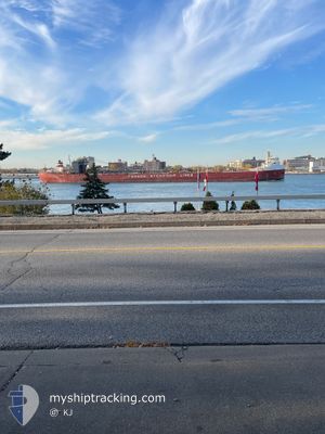
The current position of FRONTENAC is in Gulf of St-Lawrence with coordinates 41.77621° / -81.28233° as reported on 2024-06-30 12:38 by AIS to our vessel tracker app. The vessel's current speed is 1.8 Knots

The vessel FRONTENAC (IMO: 6804848, MMSI: 316001834) is a Self Discharging Bulk Carrier that was built in 1968 ( 56 år gamle ). It's sailing under the flag of [CA] Canada.

In this page you can find informations about the vessels current position, last detected port calls, and current voyage information. If the vessels is not in coverage by AIS you will find the latest position.

The current position of FRONTENAC is detected by our AIS receivers and we are not responsible for the reliability of the data. The last position was recorded while the vessel was in Coverage by the Ais receivers of our vessel tracking app.

The current draught of FRONTENAC as reported by AIS is 6.7 meters

Weather

Temperature 18.4°C / 65.12°F
Wind Speed 13 knots
Direction 344° NNW
Pressure 1016.9 hPa
Humidity 88.7 %
Cloud Coverage 24 %

Featured Company

Last Port Calls

Port Arrival Departure Time In Port
Flag PORT WELLER 2024-06-29 03:20 2024-06-29 04:04 43 m
Flag TORONTO 2024-06-28 12:58 2024-06-28 23:56 10 h
Flag PORT WELLER 2024-06-28 10:15 2024-06-28 10:56 41 m
Flag FAIRPORT HARBOR 2024-06-26 10:22 2024-06-27 14:08 1 d
Flag PORT WELLER 2024-06-25 13:26 2024-06-25 14:34 1 h
Flag TORONTO 2024-06-24 23:31 2024-06-25 10:30 10 h
Flag PORT WELLER 2024-06-24 20:41 2024-06-24 21:20 38 m
Flag FAIRPORT HARBOR 2024-06-23 03:48 2024-06-23 21:20 17 h
Flag PORT WELLER 2024-06-22 01:48 2024-06-22 02:51 1 h
Flag TORONTO 2024-06-21 10:22 2024-06-21 23:15 12 h
Show More

Most Visited Ports (Last year)

Port Arrivals
Flag PORT WELLER 62
Flag SAULT STE MARIE 33
Flag FAIRPORT HARBOR 31
Flag PORT COLBORNE 23
Flag THUNDER BAY 15
Flag JOHNSTOWN 9

Last Trips

Origin Departure Destination Arrival Distance
Flag TORONTO 2024-06-28 19:56 Flag PORT WELLER 2024-06-28 23:20 22.92 nm
Flag PORT WELLER 2024-06-28 06:56 Flag TORONTO 2024-06-28 08:58 24.22 nm
Flag FAIRPORT HARBOR 2024-06-27 10:08 Flag PORT WELLER 2024-06-28 06:15 135.76 nm
Flag PORT WELLER 2024-06-25 10:34 Flag FAIRPORT HARBOR 2024-06-26 06:22 138.13 nm
Flag TORONTO 2024-06-25 06:30 Flag PORT WELLER 2024-06-25 09:26 22.33 nm
Flag PORT WELLER 2024-06-24 17:20 Flag TORONTO 2024-06-24 19:31 24.25 nm
Flag FAIRPORT HARBOR 2024-06-23 17:20 Flag PORT WELLER 2024-06-24 16:41 136.35 nm
Flag PORT WELLER 2024-06-21 22:51 Flag FAIRPORT HARBOR 2024-06-22 23:48 139.02 nm
Flag TORONTO 2024-06-21 19:15 Flag PORT WELLER 2024-06-21 21:48 23.60 nm
Flag PORT WELLER 2024-06-21 04:10 Flag TORONTO 2024-06-21 06:22 24.16 nm

Events

Tid Hændelsen Detaljer Position / Dest Info
2024-06-30 12:33 Status er ændret Under way using engine
At anchor
41.77748 / -81.28410
FAIRPORT
Fart: 0.4 kn
Kurs: 327°
2024-06-30 11:50 Status er ændret At anchor
Default
41.77724 / -81.28391
FAIRPORT
Fart:
Kurs: 312°
2024-06-30 11:41 Indenfor Dækning
41.77724 / -81.28391
Gulf of St-Lawrence
Fart: 0.1 kn
Kurs: 108.7°
2024-06-30 09:50 Status er ændret Default
At anchor
41.77811 / -81.28337
FAIRPORT
Fart:
Kurs: 255°
2024-06-30 09:41 Udenfor Dækning
41.77804 / -81.28338
Gulf of St-Lawrence
Fart:
Kurs: 94.8°
2024-06-30 08:38 Indenfor Dækning
41.77816 / -81.28340
Gulf of St-Lawrence
Fart:
Kurs: 14°
2024-06-29 19:40 Status er ændret Default
Under way using engine
42.13083 / -80.89346
FAIRPORT
Fart: 12.4 kn
Kurs: 242.9°
2024-06-29 19:34 Udenfor Dækning
42.13937 / -80.87151
Gulf of St-Lawrence
FAIRPORT
Fart: 12.4 kn
Kurs: 242.9°
2024-06-29 12:29 START Sejllads 0.46 nm, North of PORT COLBORNE
42.88910 / -79.24839
FAIRPORT
Fart: 3.1 kn
Kurs: 188°
2024-06-29 12:05 STOP Sejllads 1.02 nm, North of PORT COLBORNE
42.89823 / -79.24621
FAIRPORT
Fart: 0.3 kn
Kurs: 189°
Show More