

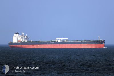
FRONT SIENA
Tanker

Current Trip
FOR ORDERS
| Time Travelled | 44 days |
|---|---|
| Remaining Time | --- |
| Distance Travelled | 10004.78 nm |
| Remaining Distance | --- |
| AVG Speed | 11.3 Knots |
| MAX Speed | 15.8 Knots |
| AVG Wind | 11.6 knots |
| MAX Wind | 35.7 knots |
| MIN Temp | 18.8°C / 65.84°F |
| MAX Temp | 31.4°C / 88.52°F |
| Dybgang | 9.3 m |
| Position Modtaget | 4 d siden |
Current Position
| Longitude | --- |
|---|---|
| Latitude | --- |
| Status | Under way using engine |
| Fart | 12.9 Knots |
| Kurs | 139.3° |
| Område | South Atlantic Ocean |
| Station | T-AIS |
| Position Modtaget | 4 d siden |
Information
The current position of FRONT SIENA is in South Atlantic Ocean with coordinates -23.32192° / -44.37065° as reported on 2025-03-24 19:13 by AIS to our vessel tracker app. The vessel's current speed is 12.9 Knots
The vessel FRONT SIENA (IMO: 9832250, MMSI: 477539900) is a Tanker It's sailing under the flag of [HK] Hong Kong.
In this page you can find informations about the vessels current position, last detected port calls, and current voyage information. If the vessels is not in coverage by AIS you will find the latest position.
The current position of FRONT SIENA is detected by our AIS receivers and we are not responsible for the reliability of the data. The last position was recorded while the vessel was in Coverage by the Ais receivers of our vessel tracking app.
The current draught of FRONT SIENA as reported by AIS is 9.3 meters
Weather
| Temperature | 27°C / 80.6°F |
|---|---|
| Wind Speed | 3 knots |
| Direction | 214° SW |
| Pressure | 1013.4 hPa |
| Humidity | 70.3 % |
| Cloud Coverage | 83 % |


Featured Company
Last Port Calls
| Port | Arrival | Departure | Time In Port |
|---|---|---|---|
| 2025-02-09 08:09 | 2025-02-13 12:01 | 4 d | |
| 2025-01-03 11:17 | 2025-01-06 14:09 | 3 d |
Most Visited Ports (Last year)
| Port | Arrivals | |
|---|---|---|
| 3 | ||
| 2 | ||
| 1 | ||
| 1 |
Last Trips
| Origin | Departure | Destination | Arrival | Distance | |
|---|---|---|---|---|---|
| 2025-01-06 14:09 | 2025-02-09 08:09 | 7723.09 nm | |||
| 2024-11-25 16:57 | 2025-01-03 11:17 | 7101.18 nm |
Events
| Tid | Hændelsen | Detaljer | Position / Dest | Info |
|---|---|---|---|---|
| 2025-03-29 11:57 | STOP Sejllads |
-21.20685 / -39.74816
FOR ORDERS
|
Fart: 0.3 kn Kurs: 109° |
|
| 2025-03-25 20:41 | START Sejllads |
-21.37266 / -39.84731
FOR ORDERS
|
Fart: 4.5 kn Kurs: 80° |
|
| 2025-03-25 20:21 | STOP Sejllads |
-21.37990 / -39.85403
FOR ORDERS
|
Fart: 0.3 kn Kurs: 29° |
|
| 2025-03-24 19:15 | Status er ændret | Default Under way using engine |
-23.32722 / -44.36630
FOR ORDERS
|
Fart: 12.9 kn Kurs: 139.3° |
| 2025-03-24 19:13 | Status er ændret | Under way using engine Default |
-23.32192 / -44.37065
FOR ORDERS
|
Fart: 13 kn Kurs: 140° |
| 2025-03-24 19:13 | Udenfor Dækning |
-23.32192 / -44.37065
South Atlantic Ocean
|
Fart: 12.9 kn Kurs: 139.3° |
|
| 2025-03-24 18:54 | Status er ændret | Default Under way using engine |
-23.27053 / -44.42033
FOR ORDERS
|
Fart: 12.7 kn Kurs: 143.3° |
| 2025-03-24 18:47 | Status er ændret | Under way using engine Default |
-23.25055 / -44.43789
FOR ORDERS
|
Fart: 12.7 kn Kurs: 157° |
| 2025-03-24 18:38 | Status er ændret | Default Under way using engine |
-23.22332 / -44.45103
FOR ORDERS
|
Fart: 12.5 kn Kurs: 156.6° |
| 2025-03-24 18:04 | Status er ændret | Under way using engine At anchor |
-23.13853 / -44.50077
FOR ORDERS
|
Fart: 3.1 kn Kurs: 149° |