
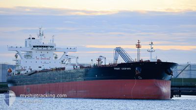
FRONT LEOPARD
Tanker
Current Trip
| Time Travelled | 26 days |
|---|---|
| Remaining Time | 3 days |
| Distance Travelled | 5667.04 nm |
| Remaining Distance | 1560.35 nm |
| AVG Speed | 11.1 Knots |
| MAX Speed | 16.4 Knots |
| AVG Wind | 10.6 knots |
| MAX Wind | 32.8 knots |
| MIN Temp | 16.7°C / 62.06°F |
| MAX Temp | 30.7°C / 87.26°F |
| Dybgang | 8.7 m |
| Position Modtaget | 1 d siden |
Current Position
| Longitude | 80.11616° |
|---|---|
| Latitude | 5.81161° |
| Status | Under way using engine |
| Fart | 11.9 Knots |
| Kurs | 250.8° |
| Område | Laccadive Sea |
| Station | T-AIS |
| Position Modtaget | 1 d siden |
Info
Information
The current position of FRONT LEOPARD is in Laccadive Sea with coordinates 5.81161° / 80.11616° as reported on 2024-06-24 15:17 by AIS to our vessel tracker app. The vessel's current speed is 11.9 Knots and is heading at the port of AL DUQM. The estimated time of arrival as calculated by MyShipTracking vessel tracking app is 2024-06-30 01:29 LT
The vessel FRONT LEOPARD (IMO: 9703320, MMSI: 538006771) is a Tanker It's sailing under the flag of [MH] Marshall Is.
In this page you can find informations about the vessels current position, last detected port calls, and current voyage information. If the vessels is not in coverage by AIS you will find the latest position.
The current position of FRONT LEOPARD is detected by our AIS receivers and we are not responsible for the reliability of the data. The last position was recorded while the vessel was in Coverage by the Ais receivers of our vessel tracking app.
The current draught of FRONT LEOPARD as reported by AIS is 8.7 meters
Weather
| Temperature | 28.2°C / 82.76°F |
|---|---|
| Wind Speed | 18 knots |
| Direction | 267° W |
| Pressure | 1004.6 hPa |
| Humidity | 79.5 % |
| Cloud Coverage | 100 % |
Featured Company
Events
| Tid | Hændelsen | Detaljer | Position / Dest | Info |
|---|---|---|---|---|
| 2024-06-24 15:26 | Status er ændret | Default Under way using engine |
5.80067 / 80.08831
OMDQM
|
Fart: 11.9 kn Kurs: 250.8° |
| 2024-06-24 15:17 | Udenfor Dækning |
5.81161 / 80.11616
Laccadive Sea
OMDQM
|
Fart: 11.9 kn Kurs: 250.8° |
|
| 2024-06-24 13:56 | Status er ændret | Under way using engine Default |
5.81551 / 80.36849
OMDQM
|
Fart: 11.9 kn Kurs: 270° |
| 2024-06-24 13:52 | Status er ændret | Default Under way using engine |
5.81553 / 80.38269
OMDQM
|
Fart: 11.6 kn Kurs: 269.7° |
| 2024-06-24 13:49 | Destination er ændret | OMDQM AEFJR |
5.81555 / 80.39391
OMDQM
|
Fart: 11.6 kn Kurs: 268.8° |
| 2024-06-24 13:41 | Fundet i havområde | Sri Lankan part of the Laccadive Sea |
5.81552 / 80.42024
Laccadive Sea
AEFJR
|
Fart: 12.2 kn Kurs: 271.4° |
| 2024-06-24 13:40 | Status er ændret | Under way using engine Default |
5.81546 / 80.42314
AEFJR
|
Fart: 12.1 kn Kurs: 268° |
| 2024-06-24 13:40 | Indenfor Dækning |
5.81552 / 80.42024
Laccadive Sea
AEFJR
|
Fart: 12.2 kn Kurs: 271.4° |
|
| 2024-06-19 17:45 | Status er ændret | Default Under way using engine |
1.22392 / 103.49685
AEFJR
|
Fart: 11.5 kn Kurs: 285.1° |
| 2024-06-19 17:40 | Udenfor Dækning |
1.21911 / 103.51429
Singapore Strait
AEFJR
|
Fart: 11.5 kn Kurs: 285.1° |