
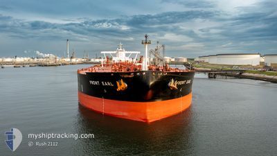
FRONT EARL
Tanker
Current Trip
CNTJN
| Time Travelled | 8 days |
|---|---|
| Remaining Time | --- |
| Distance Travelled | 2349.90 nm |
| Remaining Distance | --- |
| AVG Speed | 13.2 Knots |
| MAX Speed | 15.2 Knots |
| AVG Wind | 9.8 knots |
| MAX Wind | 26.8 knots |
| MIN Temp | 8.2°C / 46.76°F |
| MAX Temp | 30.2°C / 86.36°F |
| Dybgang | 16 m |
| Position Modtaget | 7 d siden |
Current Position
| Longitude | 118.78888° |
|---|---|
| Latitude | 38.78171° |
| Status | Under way using engine |
| Fart | 13.7 Knots |
| Kurs | 99.2° |
| Område | Yellow Sea |
| Station | T-AIS |
| Position Modtaget | 7 d siden |
Info
Information
The current position of FRONT EARL is in Yellow Sea with coordinates 38.78171° / 118.78888° as reported on 2024-04-20 04:18 by AIS to our vessel tracker app. The vessel's current speed is 13.7 Knots
The vessel FRONT EARL (IMO: 9788320, MMSI: 538007494) is a Tanker It's sailing under the flag of [MH] Marshall Is.
In this page you can find informations about the vessels current position, last detected port calls, and current voyage information. If the vessels is not in coverage by AIS you will find the latest position.
The current position of FRONT EARL is detected by our AIS receivers and we are not responsible for the reliability of the data. The last position was recorded while the vessel was in Coverage by the Ais receivers of our vessel tracking app.
The current draught of FRONT EARL as reported by AIS is 16 meters
Weather
| Temperature | 29.6°C / 85.28°F |
|---|---|
| Wind Speed | 6 knots |
| Direction | 80° E |
| Pressure | 1010.1 hPa |
| Humidity | 73.2 % |
| Cloud Coverage | 22 % |
Featured Company
Events
| Tid | Hændelsen | Detaljer | Position / Dest | Info |
|---|---|---|---|---|
| 2024-04-22 15:02 | START Sejllads |
32.04858 / 124.69480
CNTJN
|
Fart: 4.1 kn Kurs: 175° |
|
| 2024-04-22 00:13 | STOP Sejllads |
32.05500 / 124.69833
CNTJN
|
Fart: Kurs: -1° |
|
| 2024-04-20 04:23 | Status er ændret | Default Under way using engine |
38.77798 / 118.81792
CNTJN
|
Fart: 13.7 kn Kurs: 99.2° |
| 2024-04-20 04:18 | Udenfor Dækning |
38.78171 / 118.78888
Yellow Sea
|
Fart: 13.7 kn Kurs: 99.2° |
|
| 2024-04-20 04:08 | Ændre havområde | Chinese part of the Yellow Sea Japanese part of the Japan Sea |
38.79387 / 118.69007
Yellow Sea
|
Fart: 13.5 kn Kurs: 98.4° |
| 2024-04-20 04:08 | Status er ændret | Under way using engine Default |
38.79387 / 118.69007
CNTJN
|
Fart: 13.6 kn Kurs: 98° |
| 2024-04-20 04:08 | Indenfor Dækning |
38.79387 / 118.69007
Yellow Sea
|
Fart: 13.5 kn Kurs: 98.4° |
|
| 2024-04-20 00:36 | Afsejlet fra sidste havn |
|
38.95487 / 117.88928
CNTJN
|
Fart: 12 kn Kurs: 102° |
| 2024-04-20 00:04 | START Sejllads |
38.97305 / 117.76836
[CN] TIANJIN
|
Fart: 5.7 kn Kurs: 97° |
|
| 2024-04-18 02:01 | STOP Sejllads |
38.97275 / 117.75887
[CN] TIANJIN
|
Fart: Kurs: 292° |