
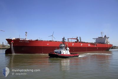
FPMC P IDEAL
Crude Oil Tanker
Current Trip
| Time Travelled | 4 days |
|---|---|
| Remaining Time | 1 day |
| Distance Travelled | 867.17 nm |
| Remaining Distance | 375.09 nm |
| AVG Speed | 11.4 Knots |
| MAX Speed | 11.4 Knots |
| AVG Wind | 7.8 knots |
| MAX Wind | 18 knots |
| MIN Temp | 21.6°C / 70.88°F |
| MAX Temp | 31°C / 87.8°F |
| Dybgang | 14.2 m |
| Position Modtaget | Nu |
Current Position
| Longitude | --- |
|---|---|
| Latitude | --- |
| Status | Under way using engine |
| Fart | 12.4 Knots |
| Kurs | 318° |
| Område | Mediterranean Sea - Eastern Basin |
| Station | T-AIS |
| Position Modtaget | Nu |
Info
Information
The current position of FPMC P IDEAL is in Mediterranean Sea - Eastern Basin with coordinates 34.58611° / 28.90888° as reported on 2024-10-16 14:14 by AIS to our vessel tracker app. The vessel's current speed is 12.4 Knots and is heading at the port of ALIAGA. The estimated time of arrival as calculated by MyShipTracking vessel tracking app is 2024-10-17 21:23 LT
The vessel FPMC P IDEAL (IMO: 9459709, MMSI: 636015457) is a Crude Oil Tanker that was built in 2012 ( 12 år gamle ). It's sailing under the flag of [LR] Liberia.
In this page you can find informations about the vessels current position, last detected port calls, and current voyage information. If the vessels is not in coverage by AIS you will find the latest position.
The current position of FPMC P IDEAL is detected by our AIS receivers and we are not responsible for the reliability of the data. The last position was recorded while the vessel was in Coverage by the Ais receivers of our vessel tracking app.
The current draught of FPMC P IDEAL as reported by AIS is 14.2 meters
Weather
| Temperature | 23.3°C / 73.94°F |
|---|---|
| Wind Speed | 16 knots |
| Direction | 305° NW |
| Pressure | 1014.4 hPa |
| Humidity | 73.1 % |
| Cloud Coverage | --- |
Featured Company
Last Port Calls
| Port | Arrival | Departure | Time In Port |
|---|---|---|---|
| 2024-10-15 06:03 | 2024-10-15 15:49 | 9 h | |
| 2024-10-10 19:45 | 2024-10-12 02:29 | 1 d | |
| 2024-10-08 10:01 | 2024-10-08 18:54 | 8 h | |
| 2024-09-28 08:00 | 2024-10-02 04:45 | 3 d | |
| 2024-09-18 04:18 | 2024-09-20 17:51 | 2 d | |
| 2024-09-15 05:28 | 2024-09-15 15:17 | 9 h | |
| 2024-09-11 13:40 | 2024-09-12 13:43 | 1 d | |
| 2024-09-07 05:17 | 2024-09-07 15:21 | 10 h | |
| 2024-08-08 23:10 | 2024-08-09 15:16 | 16 h | |
| 2024-08-05 23:47 | 2024-08-07 00:41 | 1 d |
Last Trips
| Origin | Departure | Destination | Arrival | Distance | |
|---|---|---|---|---|---|
| 2024-10-12 05:29 | 2024-10-15 08:03 | 538.31 nm | |||
| 2024-10-02 07:45 | 2024-10-10 22:45 | 1631.30 nm | |||
| 2024-10-02 07:45 | 2024-10-08 12:01 | 1031.08 nm | |||
| 2024-09-20 20:51 | 2024-09-28 11:00 | 627.71 nm | |||
| 2024-09-12 16:43 | 2024-09-18 07:18 | 1231.80 nm | |||
| 2024-09-12 16:43 | 2024-09-15 07:28 | 508.58 nm | |||
| 2024-08-07 03:41 | 2024-09-11 16:40 | 4026.73 nm | |||
| 2024-08-07 03:41 | 2024-09-07 07:17 | 3370.21 nm | |||
| 2024-08-07 03:41 | 2024-08-09 01:10 | 506.34 nm | |||
| 2024-07-27 16:58 | 2024-08-06 02:47 | 1663.74 nm |
Events
| Tid | Hændelsen | Detaljer | Position / Dest | Info |
|---|---|---|---|---|
| 2024-10-16 10:34 | Status er ændret | Under way using engine Default |
34.02059 / 29.50006
TR ALI
|
Fart: 12.5 kn Kurs: 324° |
| 2024-10-16 10:18 | Indenfor Dækning |
34.02276 / 29.49786
Mediterranean Sea - Eastern Basin
TR ALI
|
Fart: 12.5 kn Kurs: 319.7° |
|
| 2024-10-16 09:32 | Status er ændret | Default Under way using engine |
33.85944 / 29.67117
TR ALI
|
Fart: 12.6 kn Kurs: 316.1° |
| 2024-10-16 09:29 | Udenfor Dækning |
33.85062 / 29.68139
Mediterranean Sea - Eastern Basin
TR ALI
|
Fart: 12.6 kn Kurs: 316.1° |
|
| 2024-10-16 09:24 | Destination er ændret | TR ALI EG SUZ |
33.83575 / 29.69834
TR ALI
|
Fart: 12.5 kn Kurs: 317.1° |
| 2024-10-16 09:24 | ETA er ændret | 2024/10/18 00:00 2024/10/14 00:01 |
33.83575 / 29.69834
TR ALI
|
Fart: 12.5 kn Kurs: 317.1° |
| 2024-10-16 09:06 | Fundet i havområde | Greek part of the Mediterranean Sea - Eastern Basin |
33.79082 / 29.74694
Mediterranean Sea - Eastern Basin
|
Fart: 12.5 kn Kurs: 318.6° |
| 2024-10-16 09:00 | Status er ændret | Under way using engine Default |
33.77418 / 29.76432
EG SUZ
|
Fart: 12.5 kn Kurs: 318° |
| 2024-10-16 09:00 | Indenfor Dækning |
33.77588 / 29.76251
Mediterranean Sea - Eastern Basin
|
Fart: 12.5 kn Kurs: 318.9° |
|
| 2024-10-15 16:09 | Udenfor Dækning |
31.29412 / 32.36518
Mediterranean Sea - Eastern Basin
|
Fart: 10.3 kn Kurs: 14.4° |