
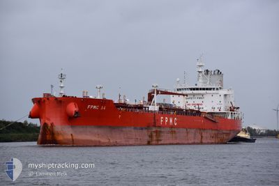
FPMC 34
Tanker
Current Trip
TRINIDAD
| Time Travelled | 14 h, 24 mins |
|---|---|
| Remaining Time | --- |
| Distance Travelled | 182.46 nm |
| Remaining Distance | --- |
| AVG Speed | 13.2 Knots |
| MAX Speed | 15.1 Knots |
| AVG Wind | 13.5 knots |
| MAX Wind | 18.9 knots |
| MIN Temp | 25.9°C / 78.62°F |
| MAX Temp | 28.2°C / 82.76°F |
| Dybgang | 7.9 m |
| Position Modtaget | 11 h, 38 m siden |
Current Position
| Longitude | -61.82053° |
|---|---|
| Latitude | 10.74183° |
| Status | Under way using engine |
| Fart | 13.8 Knots |
| Kurs | 350.6° |
| Område | Caribbean Sea |
| Station | T-AIS |
| Position Modtaget | 11 h, 38 m siden |
Info
Information
The current position of FPMC 34 is in Caribbean Sea with coordinates 10.74183° / -61.82053° as reported on 2024-07-05 08:41 by AIS to our vessel tracker app. The vessel's current speed is 13.8 Knots
The vessel FPMC 34 (IMO: 9845166, MMSI: 636018726) is a Tanker It's sailing under the flag of [LR] Liberia.
In this page you can find informations about the vessels current position, last detected port calls, and current voyage information. If the vessels is not in coverage by AIS you will find the latest position.
The current position of FPMC 34 is detected by our AIS receivers and we are not responsible for the reliability of the data. The last position was recorded while the vessel was in Coverage by the Ais receivers of our vessel tracking app.
The current draught of FPMC 34 as reported by AIS is 7.9 meters
Weather
| Temperature | 28°C / 82.4°F |
|---|---|
| Wind Speed | 17 knots |
| Direction | 107° ESE |
| Pressure | 1011 hPa |
| Humidity | 84.3 % |
| Cloud Coverage | 100 % |
Featured Company
Last Port Calls
| Port | Arrival | Departure | Time In Port |
|---|---|---|---|
| 2024-07-03 09:07 | 2024-07-05 05:55 | 1 d | |
| 2024-06-13 00:35 | 2024-06-14 22:54 | 1 d | |
| 2024-05-29 04:41 | 2024-05-31 22:53 | 2 d | |
| 2024-05-09 07:53 | 2024-05-15 00:58 | 5 d | |
| 2024-05-04 04:32 | 2024-05-06 05:50 | 2 d | |
| 2024-05-02 23:10 |
Most Visited Ports (Last year)
| Port | Arrivals | |
|---|---|---|
| 4 | ||
| 3 | ||
| 2 | ||
| 2 | ||
| 2 | ||
| 2 |
Last Trips
| Origin | Departure | Destination | Arrival | Distance | |
|---|---|---|---|---|---|
| 2024-06-14 18:54 | 2024-07-03 05:07 | 651.24 nm | |||
| 2024-05-31 18:53 | 2024-06-12 20:35 | 560.58 nm | |||
| 2024-05-15 02:58 | 2024-05-29 00:41 | 3928.92 nm | |||
| 2024-05-06 07:50 | 2024-05-09 09:53 | 321.16 nm | |||
| 2024-05-03 01:10 | 2024-05-04 06:32 | 295.44 nm |
Events
| Tid | Hændelsen | Detaljer | Position / Dest | Info |
|---|---|---|---|---|
| 2024-07-05 08:44 | Status er ændret | Default Under way using engine |
10.75310 / -61.82311
TRINIDAD
|
Fart: 13.8 kn Kurs: 350.6° |
| 2024-07-05 08:41 | Udenfor Dækning |
10.74183 / -61.82053
Caribbean Sea
|
Fart: 13.8 kn Kurs: 350.6° |
|
| 2024-07-05 08:36 | Status er ændret | Under way using engine Default |
10.72445 / -61.81917
TRINIDAD
|
Fart: 13.9 kn Kurs: 3° |
| 2024-07-05 08:29 | Status er ændret | Default Under way using engine |
10.69843 / -61.82066
TRINIDAD
|
Fart: 13.8 kn Kurs: 2.2° |
| 2024-07-05 08:07 | Fundet i havområde | Venezuelan part of the Caribbean Sea |
10.61965 / -61.80452
Caribbean Sea
|
Fart: 12.9 kn Kurs: 317.1° |
| 2024-07-05 06:25 | Status er ændret | Under way using engine Default |
10.37825 / -61.55427
TRINIDAD
|
Fart: 10.4 kn Kurs: 278° |
| 2024-07-05 06:24 | Status er ændret | Default Under way using engine |
10.37762 / -61.54985
TRINIDAD
|
Fart: 10.1 kn Kurs: 277.4° |
| 2024-07-05 05:58 | Status er ændret | Under way using engine Default |
10.39602 / -61.50292
TRINIDAD
|
Fart: 5.5 kn Kurs: 229° |
| 2024-07-05 05:56 | Status er ændret | Default Under way using engine |
10.39817 / -61.50046
TRINIDAD
|
Fart: 4.8 kn Kurs: 227° |
| 2024-07-05 05:55 | START Sejllads | 0.4 nm, North West of POINT LISAS |
10.39916 / -61.49938
TRINIDAD
|
Fart: 4.8 kn Kurs: 227° |