
FMT GUMULDUR
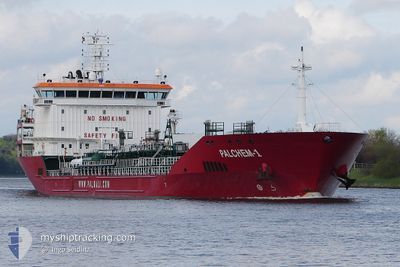
Oil/Chemical Tanker
Current Trip
| Time Travelled | 48 days |
|---|---|
| Remaining Time | 12 h, 29 mins |
| Distance Travelled | 10991.56 nm |
| Remaining Distance | 131.24 nm |
| AVG Speed | 11.2 Knots |
| MAX Speed | 15.1 Knots |
| AVG Wind | 12.5 knots |
| MAX Wind | 27 knots |
| MIN Temp | 16.6°C / 61.88°F |
| MAX Temp | 31.2°C / 88.16°F |
| Dybgang | 9 m |
| Position Modtaget | 1 d siden |
Current Position
| Longitude | -14.02769° |
|---|---|
| Latitude | 30.04151° |
| Status | Under way using engine |
| Fart | 9.6 Knots |
| Kurs | 33.3° |
| Område | North Atlantic Ocean |
| Station | T-AIS |
| Position Modtaget | 1 d siden |
Info
Information
The current position of FMT GUMULDUR is in North Atlantic Ocean with coordinates 30.04151° / -14.02769° as reported on 2024-05-14 04:41 by AIS to our vessel tracker app. The vessel's current speed is 9.6 Knots and is heading at the port of HUELVA. The estimated time of arrival as calculated by MyShipTracking vessel tracking app is 2024-05-16 15:10 LT
The vessel FMT GUMULDUR (IMO: 9427976, MMSI: 249955000) is a Oil/Chemical Tanker that was built in 2009 ( 15 år gamle ). It's sailing under the flag of [MT] Malta.
In this page you can find informations about the vessels current position, last detected port calls, and current voyage information. If the vessels is not in coverage by AIS you will find the latest position.
The current position of FMT GUMULDUR is detected by our AIS receivers and we are not responsible for the reliability of the data. The last position was recorded while the vessel was in Coverage by the Ais receivers of our vessel tracking app.
The current draught of FMT GUMULDUR as reported by AIS is 9 meters
Weather
| Temperature | 16.6°C / 61.88°F |
|---|---|
| Wind Speed | 12 knots |
| Direction | 342° NNW |
| Pressure | 1014.3 hPa |
| Humidity | 68.6 % |
| Cloud Coverage | 3 % |
Featured Company
Most Visited Ports (Last year)
| Port | Arrivals | |
|---|---|---|
| 3 | ||
| 3 | ||
| 2 | ||
| 2 | ||
| 2 | ||
| 2 |
Events
| Tid | Hændelsen | Detaljer | Position / Dest | Info |
|---|---|---|---|---|
| 2024-05-14 04:47 | Status er ændret | Default Under way using engine |
30.05446 / -14.01792
ES HUV
|
Fart: 9.6 kn Kurs: 33.3° |
| 2024-05-14 04:41 | Udenfor Dækning |
30.04151 / -14.02769
North Atlantic Ocean
ES HUV
|
Fart: 9.6 kn Kurs: 33.3° |
|
| 2024-05-14 04:40 | Status er ændret | Under way using engine Default |
30.03888 / -14.02969
ES HUV
|
Fart: 9.5 kn Kurs: 34° |
| 2024-05-14 04:28 | Status er ændret | Default Under way using engine |
30.01360 / -14.04929
ES HUV
|
Fart: 9.3 kn Kurs: 34.7° |
| 2024-05-14 04:15 | Status er ændret | Under way using engine Default |
29.98663 / -14.07031
ES HUV
|
Fart: 9.3 kn Kurs: 35° |
| 2024-05-14 04:01 | Status er ændret | Default Under way using engine |
29.95715 / -14.09319
ES HUV
|
Fart: 9 kn Kurs: 33.1° |
| 2024-05-14 03:54 | Status er ændret | Under way using engine Default |
29.94244 / -14.10452
ES HUV
|
Fart: 9 kn Kurs: 32° |
| 2024-05-14 03:10 | Status er ændret | Default Under way using engine |
29.84974 / -14.17190
ES HUV
|
Fart: 8.7 kn Kurs: 30.7° |
| 2024-05-14 01:54 | Status er ændret | Under way using engine Default |
29.69149 / -14.28083
ES HUV
|
Fart: 9 kn Kurs: 30° |
| 2024-05-14 01:43 | Status er ændret | Default Under way using engine |
29.66714 / -14.29645
ES HUV
|
Fart: 8.9 kn Kurs: 28.8° |