
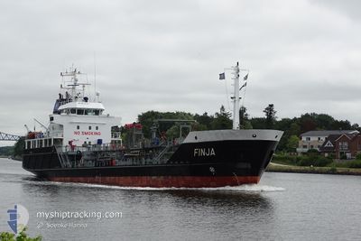
FINJA
Oil/Chemical Tanker
Current Trip
| Time Travelled | 6 h, 0 mins |
|---|---|
| Remaining Time | 2 days |
| Distance Travelled | 53.99 nm |
| Remaining Distance | 685.28 nm |
| AVG Speed | 9.8 Knots |
| MAX Speed | 11.6 Knots |
| AVG Wind | 7 knots |
| MAX Wind | 17.2 knots |
| MIN Temp | 3.8°C / 38.84°F |
| MAX Temp | 5.2°C / 41.36°F |
| Dybgang | 3.7 m |
| Position Modtaget | 17 m siden |
Current Position
| Longitude | --- |
|---|---|
| Latitude | --- |
| Status | Under way using engine |
| Fart | 10 Knots |
| Kurs | 9.9° |
| Område | North Sea |
| Station | T-AIS |
| Position Modtaget | 17 m siden |
Info
Information
The current position of FINJA is in North Sea with coordinates 52.44980° / 3.90087° as reported on 2025-01-13 17:33 by AIS to our vessel tracker app. The vessel's current speed is 10 Knots and is heading at the port of LUBMIN. The estimated time of arrival as calculated by MyShipTracking vessel tracking app is 2025-01-16 09:09 LT
The vessel FINJA (IMO: 9212345, MMSI: 211333700) is a Oil/Chemical Tanker that was built in 2000 ( 25 år gamle ). It's sailing under the flag of [DE] Germany.
In this page you can find informations about the vessels current position, last detected port calls, and current voyage information. If the vessels is not in coverage by AIS you will find the latest position.
The current position of FINJA is detected by our AIS receivers and we are not responsible for the reliability of the data. The last position was recorded while the vessel was in Coverage by the Ais receivers of our vessel tracking app.
The current draught of FINJA as reported by AIS is 3.7 meters
Weather
| Temperature | 5.2°C / 41.36°F |
|---|---|
| Wind Speed | 17 knots |
| Direction | 218° SW |
| Pressure | 1038.2 hPa |
| Humidity | 72.1 % |
| Cloud Coverage | 64 % |
Featured Company
Last Port Calls
| Port | Arrival | Departure | Time In Port |
|---|---|---|---|
| 2025-01-12 16:42 | 2025-01-13 11:51 | 19 h | |
| 2025-01-08 13:20 | 2025-01-09 20:54 | 1 d | |
| 2025-01-05 23:49 | 2025-01-07 10:16 | 1 d | |
| 2025-01-03 22:53 | 2025-01-04 14:33 | 15 h | |
| 2025-01-03 03:31 | 2025-01-03 10:49 | 7 h | |
| 2024-12-31 22:12 | 2025-01-02 15:58 | 1 d | |
| 2024-12-30 12:23 | 2024-12-30 21:41 | 9 h | |
| 2024-12-23 00:25 | 2024-12-27 18:24 | 4 d | |
| 2024-12-22 08:01 | 2024-12-22 15:57 | 7 h | |
| 2024-12-19 23:52 | 2024-12-20 10:37 | 10 h |
Most Visited Ports (Last year)
| Port | Arrivals | |
|---|---|---|
| 43 | ||
| 36 | ||
| 22 | ||
| 22 | ||
| 17 | ||
| 17 |
Last Trips
| Origin | Departure | Destination | Arrival | Distance | |
|---|---|---|---|---|---|
| 2025-01-09 21:54 | 2025-01-12 17:42 | 294.21 nm | |||
| 2025-01-07 11:16 | 2025-01-08 14:20 | 249.94 nm | |||
| 2025-01-04 15:33 | 2025-01-06 00:49 | 269.71 nm | |||
| 2025-01-03 11:49 | 2025-01-03 23:53 | 109.26 nm | |||
| 2025-01-02 16:58 | 2025-01-03 04:31 | 108.66 nm | |||
| 2024-12-30 22:41 | 2024-12-31 23:12 | 250.93 nm | |||
| 2024-12-27 19:24 | 2024-12-30 13:23 | 369.88 nm | |||
| 2024-12-22 16:57 | 2024-12-23 01:25 | 52.31 nm | |||
| 2024-12-20 11:37 | 2024-12-22 09:01 | 345.12 nm | |||
| 2024-12-18 01:51 | 2024-12-20 00:52 | 348.16 nm |
Events
| Tid | Hændelsen | Detaljer | Position / Dest | Info |
|---|---|---|---|---|
| 2025-01-13 17:39 | Status er ændret | Default Under way using engine |
52.46571 / 3.90548
DELBM
|
Fart: 10 kn Kurs: 9.9° |
| 2025-01-13 17:19 | Status er ændret | Under way using engine Default |
52.40963 / 3.88939
DELBM
|
Fart: 10.2 kn Kurs: 10° |
| 2025-01-13 17:09 | Status er ændret | Default Under way using engine |
52.38253 / 3.88186
DELBM
|
Fart: 10.3 kn Kurs: 9.5° |
| 2025-01-13 17:08 | Status er ændret | Under way using engine Default |
52.37876 / 3.88082
DELBM
|
Fart: 10.4 kn Kurs: 9° |
| 2025-01-13 16:57 | Status er ændret | Default Under way using engine |
52.34765 / 3.87228
DELBM
|
Fart: 10.3 kn Kurs: 10.3° |
| 2025-01-13 16:50 | Status er ændret | Under way using engine Default |
52.32760 / 3.86682
DELBM
|
Fart: 10.3 kn Kurs: 354° |
| 2025-01-13 16:47 | Status er ændret | Default Under way using engine |
52.31901 / 3.86641
DELBM
|
Fart: 10.4 kn Kurs: 353.8° |
| 2025-01-13 16:42 | Status er ændret | Under way using engine Default |
52.30559 / 3.86839
DELBM
|
Fart: 10.4 kn Kurs: 354° |
| 2025-01-13 16:36 | Status er ændret | Default Under way using engine |
52.28895 / 3.87133
DELBM
|
Fart: 10.4 kn Kurs: 354.4° |
| 2025-01-13 16:36 | Status er ændret | Under way using engine Default |
52.28657 / 3.87175
DELBM
|
Fart: 10.4 kn Kurs: 355° |