

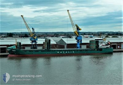
FEMBRIA
General Cargo

Current Trip
| Time Travelled | 1 day |
|---|---|
| Remaining Time | 3 days |
| Distance Travelled | 432.83 nm |
| Remaining Distance | 941.86 nm |
| AVG Speed | 10.7 Knots |
| MAX Speed | 11.3 Knots |
| AVG Wind | 8.7 knots |
| MAX Wind | 13.2 knots |
| MIN Temp | -5.7°C / 21.74°F |
| MAX Temp | 2.7°C / 36.86°F |
| Dybgang | 6 m |
| Position Modtaget | 6 m siden |
Current Position
| Longitude | --- |
|---|---|
| Latitude | --- |
| Status | Under way using engine |
| Fart | 10.7 Knots |
| Kurs | 209.1° |
| Område | Baltic Sea |
| Station | T-AIS |
| Position Modtaget | 6 m siden |
Information
The current position of FEMBRIA is in Baltic Sea with coordinates 58.31825° / 18.60615° as reported on 2025-03-22 14:47 by AIS to our vessel tracker app. The vessel's current speed is 10.7 Knots and is heading at the port of HULL. The estimated time of arrival as calculated by MyShipTracking vessel tracking app is 2025-03-26 03:03 LT
The vessel FEMBRIA (IMO: 9350771, MMSI: 255802840) is a General Cargo that was built in 2006 ( 19 år gamle ). It's sailing under the flag of [PT] Portugal.
In this page you can find informations about the vessels current position, last detected port calls, and current voyage information. If the vessels is not in coverage by AIS you will find the latest position.
The current position of FEMBRIA is detected by our AIS receivers and we are not responsible for the reliability of the data. The last position was recorded while the vessel was in Coverage by the Ais receivers of our vessel tracking app.
The current draught of FEMBRIA as reported by AIS is 6 meters
Weather
| Temperature | 2.7°C / 36.86°F |
|---|---|
| Wind Speed | 13 knots |
| Direction | 101° E |
| Pressure | 1030.9 hPa |
| Humidity | 86.1 % |
| Cloud Coverage | 5 % |


Featured Company
Last Port Calls
| Port | Arrival | Departure | Time In Port |
|---|---|---|---|
| 2025-03-20 06:45 | 2025-03-21 00:13 | 17 h | |
| 2025-03-15 16:05 | 2025-03-17 23:58 | 2 d | |
| 2025-03-13 08:53 | 2025-03-13 18:30 | 9 h | |
| 2025-03-09 21:16 | 2025-03-09 21:21 | 5 m | |
| 2025-03-06 17:30 | 2025-03-08 00:19 | 1 d | |
| 2025-03-02 05:22 | 2025-03-05 20:15 | 3 d | |
| 2025-02-18 08:09 | 2025-02-21 14:33 | 3 d | |
| 2025-02-14 19:21 | 2025-02-15 22:09 | 1 d | |
| 2025-02-12 05:10 | 2025-02-13 04:28 | 23 h | |
| 2025-02-09 19:09 | 2025-02-10 21:13 | 1 d |
Most Visited Ports (Last year)
| Port | Arrivals | |
|---|---|---|
| 5 | ||
| 5 | ||
| 5 | ||
| 4 | ||
| 4 | ||
| 4 |
Last Trips
| Origin | Departure | Destination | Arrival | Distance | |
|---|---|---|---|---|---|
| 2025-03-17 23:58 | 2025-03-20 06:45 | 120.34 nm | |||
| 2025-03-13 18:30 | 2025-03-15 16:05 | 115.33 nm | |||
| 2025-03-09 21:21 | 2025-03-13 08:53 | 917.59 nm | |||
| 2025-03-08 00:19 | 2025-03-09 21:16 | 426.94 nm | |||
| 2025-03-05 20:15 | 2025-03-06 17:30 | 237.74 nm | |||
| 2025-02-21 14:33 | 2025-03-02 05:22 | 1377.01 nm | |||
| 2025-02-15 22:09 | 2025-02-18 08:09 | 579.88 nm | |||
| 2025-02-13 04:28 | 2025-02-14 19:21 | 360.97 nm | |||
| 2025-02-10 21:13 | 2025-02-12 05:10 | 334.06 nm | |||
| 2025-02-07 22:21 | 2025-02-09 19:09 | 495.19 nm |
Events
| Tid | Hændelsen | Detaljer | Position / Dest | Info |
|---|---|---|---|---|
| 2025-03-22 14:46 | Status er ændret | Under way using engine Default |
58.32133 / 18.60958
HULL VIA NOK
|
Fart: 10.9 kn Kurs: 210° |
| 2025-03-22 14:42 | Indenfor Dækning |
58.32133 / 18.60958
Baltic Sea
HULL VIA NOK
|
Fart: 10.8 kn Kurs: 210° |
|
| 2025-03-22 13:50 | Status er ændret | Default Under way using engine |
58.47074 / 18.76611
HULL VIA NOK
|
Fart: 11.2 kn Kurs: 211.7° |
| 2025-03-22 13:43 | Status er ændret | Under way using engine Default |
58.48877 / 18.78588
HULL VIA NOK
|
Fart: 11.3 kn Kurs: 212° |
| 2025-03-22 13:43 | Udenfor Dækning |
58.48877 / 18.78588
Baltic Sea
HULL VIA NOK
|
Fart: 11.2 kn Kurs: 211.7° |
|
| 2025-03-22 13:26 | Status er ændret | Default Under way using engine |
58.53514 / 18.83868
HULL VIA NOK
|
Fart: 11.2 kn Kurs: 210.7° |
| 2025-03-22 13:18 | Status er ændret | Under way using engine Default |
58.55580 / 18.86212
HULL VIA NOK
|
Fart: 11.2 kn Kurs: 212° |
| 2025-03-22 13:06 | Status er ændret | Default Under way using engine |
58.58900 / 18.89858
HULL VIA NOK
|
Fart: 11.1 kn Kurs: 208.3° |
| 2025-03-22 12:53 | Status er ændret | Under way using engine Default |
58.62362 / 18.93660
HULL VIA NOK
|
Fart: 10.9 kn Kurs: 209° |
| 2025-03-22 12:14 | Status er ændret | Default Under way using engine |
58.72830 / 19.05107
HULL VIA NOK
|
Fart: 11.2 kn Kurs: 209.4° |