
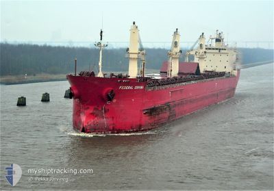
FEDERAL OSHIMA
Bulk Carrier
Current Trip
| Time Travelled | 5 days |
|---|---|
| Remaining Time | --- |
| Distance Travelled | 293.69 nm |
| Remaining Distance | --- |
| AVG Speed | 6 Knots |
| MAX Speed | 13.8 Knots |
| AVG Wind | 23.2 knots |
| MAX Wind | 37 knots |
| MIN Temp | -8.6°C / 16.52°F |
| MAX Temp | 11°C / 51.8°F |
| Dybgang | 7.9 m |
| Position Modtaget | 14 h, 2 m siden |
Current Position
| Longitude | --- |
|---|---|
| Latitude | --- |
| Status | Under way using engine |
| Fart | 13.7 Knots |
| Kurs | 62.5° |
| Område | Gulf of St-Lawrence |
| Station | T-AIS |
| Position Modtaget | 14 h, 2 m siden |
Info
Information
The current position of FEDERAL OSHIMA is in Gulf of St-Lawrence with coordinates 43.58352° / -78.89661° as reported on 2026-01-02 21:53 by AIS to our vessel tracker app. The vessel's current speed is 13.7 Knots and is heading at the port of ANTWERP. The estimated time of arrival as calculated by MyShipTracking vessel tracking app is 2026-01-15 01:00 LT
The vessel FEDERAL OSHIMA (IMO: 9200330, MMSI: 538006783) is a Bulk Carrier that was built in 1999 ( 27 år gamle ). It's sailing under the flag of [MH] Marshall Is.
In this page you can find informations about the vessels current position, last detected port calls, and current voyage information. If the vessels is not in coverage by AIS you will find the latest position.
The current position of FEDERAL OSHIMA is detected by our AIS receivers and we are not responsible for the reliability of the data. The last position was recorded while the vessel was in Coverage by the Ais receivers of our vessel tracking app.
The current draught of FEDERAL OSHIMA as reported by AIS is 7.9 meters
Weather
| Temperature | -4.4°C / 24.08°F |
|---|---|
| Wind Speed | 17 knots |
| Direction | 278° W |
| Pressure | 1010.2 hPa |
| Humidity | 76.8 % |
| Cloud Coverage | 96 % |
Featured Company
Last Port Calls
| Port | Arrival | Departure | Time In Port |
|---|---|---|---|
| 2025-12-22 11:13 | 2025-12-28 11:23 | 6 d | |
| 2025-12-22 08:03 | 2025-12-22 08:41 | 38 m | |
| 2025-12-14 10:32 | 2025-12-21 09:03 | 6 d | |
| 2025-12-11 19:10 | 2025-12-11 20:07 | 57 m | |
| 2025-12-10 05:57 | 2025-12-10 07:16 | 1 h | |
| 2025-11-10 12:16 | 2025-11-17 17:00 | 7 d | |
| 2025-11-05 14:07 |
Most Visited Ports (Last year)
| Port | Arrivals | |
|---|---|---|
| 8 | ||
| 6 | ||
| 3 | ||
| 3 | ||
| 2 | ||
| 2 |
Last Trips
| Origin | Departure | Destination | Arrival | Distance | |
|---|---|---|---|---|---|
| 2025-12-22 08:41 | 2025-12-22 11:13 | 27.63 nm | |||
| 2025-12-21 09:03 | 2025-12-22 08:03 | 232.06 nm | |||
| 2025-12-11 20:07 | 2025-12-14 10:32 | 228.69 nm | |||
| 2025-12-10 07:16 | 2025-12-11 19:10 | 296.20 nm | |||
| 2025-11-17 17:00 | 2025-12-10 05:57 | 5303.56 nm | |||
| 2025-11-05 14:07 | 2025-11-10 12:16 | 1285.15 nm |
Events
| Tid | Hændelsen | Detaljer | Position / Dest | Info |
|---|---|---|---|---|
| 2026-01-03 07:11 | STOP Sejllads | 6.95 nm, South of MARYSVILLE |
44.08482 / -76.39365
WANDELAAR
|
Fart: 0.3 kn Kurs: 258° |
| 2026-01-02 22:02 | Status er ændret | Default Under way using engine |
43.59862 / -78.85654
WANDELAAR
|
Fart: 13.7 kn Kurs: 62.5° |
| 2026-01-02 21:53 | Udenfor Dækning |
43.58352 / -78.89661
Gulf of St-Lawrence
WANDELAAR
|
Fart: 13.7 kn Kurs: 62.5° |
|
| 2026-01-02 19:01 | Destination er ændret | WANDELAAR PORT WELLER |
43.23279 / -79.30569
WANDELAAR
|
Fart: 6.9 kn Kurs: 4° |
| 2026-01-02 19:01 | ETA er ændret | 2026/01/15 00:00 2026/12/28 19:00 |
43.23279 / -79.30569
WANDELAAR
|
Fart: 6.9 kn Kurs: 4° |
| 2026-01-02 18:58 | START Sejllads | 2.45 nm, North West of DALHOUSIE |
43.22800 / -79.30601
PORT WELLER
|
Fart: 3.2 kn Kurs: 353° |
| 2026-01-02 18:53 | Status er ændret | Under way using engine At anchor |
43.22678 / -79.30339
PORT WELLER
|
Fart: 0.5 kn Kurs: 248° |
| 2026-01-02 18:48 | Status er ændret | At anchor Default |
43.22753 / -79.30304
PORT WELLER
|
Fart: 0.3 kn Kurs: 256° |
| 2026-01-02 18:45 | Status er ændret | Default At anchor |
43.22761 / -79.30262
PORT WELLER
|
Fart: 0.3 kn Kurs: 270° |
| 2026-01-02 14:03 | Status er ændret | At anchor Default |
43.22739 / -79.30118
PORT WELLER
|
Fart: Kurs: 255° |