
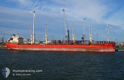
FEDERAL CEDAR
Cargo
Current Trip
| Trip Time | 5 days |
|---|---|
| Trip Distance | 839.28 nm |
| AVG Speed | 9.4 Knots |
| MAX Speed | 15.2 Knots |
| Dybgang | 6.4 m |
| AVG Wind | 7.8 knots |
| MAX Wind | 14.8 knots |
| MIN Temp | 25.9°C / 78.62°F |
| MAX Temp | 30.4°C / 86.72°F |
| Position Modtaget | 5 d siden |
Current Position
| Longitude | -85.79119° |
|---|---|
| Latitude | 30.08620° |
| Status | At anchor |
| Fart | 0.2 Knots |
| Kurs | 165° |
| Område | Gulf of Mexico |
| Station | T-AIS |
| Position Modtaget | 5 d siden |
Info
Information
The current position of FEDERAL CEDAR is in Gulf of Mexico with coordinates 30.08620° / -85.79119° as reported on 2024-09-03 01:20 by AIS to our vessel tracker app. The vessel's current speed is 0.2 Knots and is currently inside the port of PANAMA CITY.
The vessel FEDERAL CEDAR (IMO: 9671101, MMSI: 538006473) is a Cargo It's sailing under the flag of [MH] Marshall Is.
In this page you can find informations about the vessels current position, last detected port calls, and current voyage information. If the vessels is not in coverage by AIS you will find the latest position.
The current position of FEDERAL CEDAR is detected by our AIS receivers and we are not responsible for the reliability of the data. The last position was recorded while the vessel was in Coverage by the Ais receivers of our vessel tracking app.
The current draught of FEDERAL CEDAR as reported by AIS is 6.4 meters
Weather
| Temperature | 23.3°C / 73.94°F |
|---|---|
| Wind Speed | 4 knots |
| Direction | 55° NE |
| Pressure | 1012.5 hPa |
| Humidity | 90.1 % |
| Cloud Coverage | 100 % |
Featured Company
Last Port Calls
| Port | Arrival | Departure | Time In Port |
|---|---|---|---|
| 2024-09-03 11:00 | |||
| 2024-08-26 16:00 | 2024-08-28 22:30 | 2 d | |
| 2024-08-13 08:51 | 2024-08-13 23:58 | 15 h | |
| 2024-08-03 22:10 | 2024-08-11 20:36 | 7 d | |
| 2024-07-25 21:56 | 2024-08-03 19:47 | 8 d | |
| 2024-07-24 12:00 | 2024-07-24 12:50 | 49 m | |
| 2024-07-22 10:27 | 2024-07-23 22:46 | 1 d | |
| 2024-07-01 21:02 |
Most Visited Ports (Last year)
| Port | Arrivals | |
|---|---|---|
| 7 | ||
| 4 | ||
| 4 | ||
| 2 | ||
| 2 | ||
| 2 |
Last Trips
| Origin | Departure | Destination | Arrival | Distance | |
|---|---|---|---|---|---|
| 2024-08-28 17:30 | 2024-09-03 06:00 | 839.28 nm | |||
| 2024-08-13 19:58 | 2024-08-26 11:00 | 3471.43 nm | |||
| 2024-08-11 16:36 | 2024-08-13 04:51 | 320.25 nm | |||
| 2024-08-03 15:47 | 2024-08-03 18:10 | 29.00 nm | |||
| 2024-07-24 08:50 | 2024-07-25 17:56 | 293.26 nm | |||
| 2024-07-23 18:46 | 2024-07-24 08:00 | 135.58 nm | |||
| 2024-07-01 18:02 | 2024-07-22 06:27 | 5679.12 nm |
Events
| Tid | Hændelsen | Detaljer | Position / Dest | Info |
|---|---|---|---|---|
| 2024-09-03 11:00 | STOP Sejllads |
30.17606 / -85.72879
[US] PANAMA CITY
|
Fart: Kurs: 91° |
|
| 2024-09-03 11:00 | Skibe i havn |
|
30.17606 / -85.72879
[US] PANAMA CITY
|
Fart: 2.2 kn Kurs: 293° |
| 2024-09-03 08:59 | START Sejllads | 6.18 nm, South West of PANAMA CITY |
30.08534 / -85.78992
USPFN
|
Fart: 4.5 kn Kurs: 80° |
| 2024-09-03 01:26 | Status er ændret | Default At anchor |
30.08613 / -85.79150
USPFN
|
Fart: 0.2 kn Kurs: 165° |
| 2024-09-03 01:20 | Status er ændret | At anchor Default |
30.08620 / -85.79119
USPFN
|
Fart: 0.2 kn Kurs: 170° |
| 2024-09-03 01:20 | Udenfor Dækning |
30.08620 / -85.79119
Gulf of Mexico
|
Fart: 0.2 kn Kurs: 245.6° |
|
| 2024-09-03 01:17 | Status er ændret | Default At anchor |
30.08625 / -85.79104
USPFN
|
Fart: 0.2 kn Kurs: 175° |
| 2024-09-03 01:14 | Status er ændret | At anchor Default |
30.08628 / -85.79086
USPFN
|
Fart: 0.2 kn Kurs: 181° |
| 2024-09-03 01:11 | Indenfor Dækning |
30.08628 / -85.79086
Gulf of Mexico
|
Fart: 0.2 kn Kurs: 257.3° |
|
| 2024-09-03 00:50 | Status er ændret | Default At anchor |
30.08565 / -85.78929
USPFN
|
Fart: 0.2 kn Kurs: 238° |