

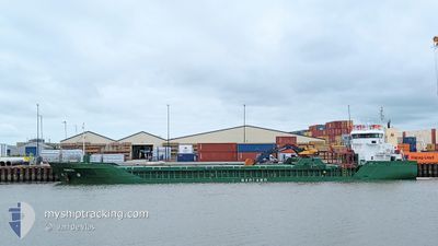
FAMITA
General Cargo

Current Trip
| Time Travelled | 2 days |
|---|---|
| Remaining Time | 3 h, 51 mins |
| Distance Travelled | 392.13 nm |
| Remaining Distance | 40.12 nm |
| AVG Speed | 10.3 Knots |
| MAX Speed | 13.6 Knots |
| AVG Wind | 22.2 knots |
| MAX Wind | 28.7 knots |
| MIN Temp | 4.6°C / 40.28°F |
| MAX Temp | 11.8°C / 53.24°F |
| Dybgang | 6.3 m |
| Position Modtaget | 1 m siden |
Current Position
| Longitude | --- |
|---|---|
| Latitude | --- |
| Status | Under way using engine |
| Fart | 9.9 Knots |
| Kurs | 161° |
| Område | North Sea |
| Station | T-AIS |
| Position Modtaget | 1 m siden |
Information
The current position of FAMITA is in North Sea with coordinates 57.30069° / 7.92300° as reported on 2025-02-26 04:46 by AIS to our vessel tracker app. The vessel's current speed is 9.9 Knots and is heading at the port of THYBORON. The estimated time of arrival as calculated by MyShipTracking vessel tracking app is 2025-02-26 09:38 LT
The vessel FAMITA (IMO: 9250438, MMSI: 311001499) is a General Cargo that was built in 2002 ( 23 år gamle ). It's sailing under the flag of [BS] Bahamas.
In this page you can find informations about the vessels current position, last detected port calls, and current voyage information. If the vessels is not in coverage by AIS you will find the latest position.
The current position of FAMITA is detected by our AIS receivers and we are not responsible for the reliability of the data. The last position was recorded while the vessel was in Coverage by the Ais receivers of our vessel tracking app.
The current draught of FAMITA as reported by AIS is 6.3 meters
Weather
| Temperature | 6.2°C / 43.16°F |
|---|---|
| Wind Speed | 12 knots |
| Direction | 230° SW |
| Pressure | 1011 hPa |
| Humidity | 76 % |
| Cloud Coverage | 35 % |


Featured Company
Last Port Calls
| Port | Arrival | Departure | Time In Port |
|---|---|---|---|
| 2025-02-22 20:45 | 2025-02-23 11:22 | 14 h | |
| 2025-02-21 10:55 | 2025-02-22 04:21 | 17 h | |
| 2025-02-13 20:04 | 2025-02-15 00:26 | 1 d | |
| 2025-02-12 11:31 | 2025-02-13 14:47 | 1 d | |
| 2025-02-06 15:11 | 2025-02-07 13:11 | 21 h | |
| 2025-02-03 09:52 | 2025-02-05 09:57 | 2 d | |
| 2025-01-30 20:27 | 2025-01-31 13:00 | 16 h | |
| 2025-01-28 07:16 | 2025-01-28 22:10 | 14 h | |
| 2025-01-22 07:57 | 2025-01-24 21:09 | 2 d | |
| 2025-01-16 03:24 | 2025-01-16 22:02 | 18 h |
Last Trips
| Origin | Departure | Destination | Arrival | Distance | |
|---|---|---|---|---|---|
| 2025-02-22 04:21 | 2025-02-22 20:45 | 181.47 nm | |||
| 2025-02-15 00:26 | 2025-02-21 10:55 | 595.78 nm | |||
| 2025-02-13 14:47 | 2025-02-13 20:04 | 60.59 nm | |||
| 2025-02-07 13:11 | 2025-02-12 11:31 | 619.96 nm | |||
| 2025-02-05 09:57 | 2025-02-06 15:11 | 165.19 nm | |||
| 2025-01-31 13:00 | 2025-02-03 09:52 | 662.74 nm | |||
| 2025-01-28 22:10 | 2025-01-30 20:27 | 366.78 nm | |||
| 2025-01-24 21:09 | 2025-01-28 07:16 | 544.58 nm | |||
| 2025-01-16 22:02 | 2025-01-22 07:57 | 818.59 nm | |||
| 2025-01-15 00:22 | 2025-01-16 03:24 | 288.84 nm |
Events
| Tid | Hændelsen | Detaljer | Position / Dest | Info |
|---|---|---|---|---|
| 2025-02-26 03:50 | Ændre havområde | Danish part of the North Sea Norwegian part of the North Sea |
57.44635 / 7.83652
North Sea
DKTHN
|
Fart: 10 kn Kurs: 168° |
| 2025-02-26 02:14 | Fundet i havområde | Norwegian part of the North Sea |
57.66481 / 7.59392
North Sea
DKTHN
|
Fart: 9.5 kn Kurs: 157° |
| 2025-02-25 23:54 | START Sejllads | 1.54 nm, South East of MANDAL |
58.01357 / 7.49770
DKTHN
|
Fart: 5.1 kn Kurs: 196° |
| 2025-02-25 23:42 | Dybgangen er ændret | 6.3 3.9 |
58.01802 / 7.50225
DKTHN
|
Fart: Kurs: 195° |
| 2025-02-25 23:42 | Destination er ændret | DKTHN NOMAN |
58.01802 / 7.50225
DKTHN
|
Fart: Kurs: 195° |
| 2025-02-25 23:42 | ETA er ændret | 2025/02/26 10:00 2025/02/25 08:00 |
58.01802 / 7.50225
DKTHN
|
Fart: Kurs: 195° |
| 2025-02-25 23:27 | Status er ændret | Under way using engine Moored |
58.01799 / 7.50228
NOMAN
|
Fart: Kurs: 193° |
| 2025-02-25 22:42 | Indenfor Dækning |
58.01803 / 7.50228
Skaggerak
|
Fart: Kurs: 308° |
|
| 2025-02-25 20:45 | Udenfor Dækning |
58.01803 / 7.50227
Skaggerak
|
Fart: 0.1 kn Kurs: 273.8° |
|
| 2025-02-25 19:39 | Indenfor Dækning |
58.01799 / 7.50229
Skaggerak
|
Fart: 0.1 kn Kurs: 110° |