
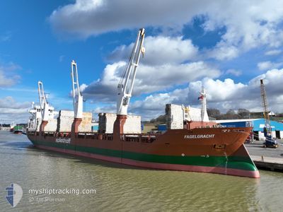
FAGELGRACHT
General Cargo
Current Trip
| Time Travelled | 3 days |
|---|---|
| Remaining Time | 1 day |
| Distance Travelled | 1042.12 nm |
| Remaining Distance | 522.77 nm |
| AVG Speed | 11.7 Knots |
| MAX Speed | 16.2 Knots |
| AVG Wind | 21.6 knots |
| MAX Wind | 29 knots |
| MIN Temp | 14.8°C / 58.64°F |
| MAX Temp | 23.6°C / 74.48°F |
| Dybgang | 7.1 m |
| Position Modtaget | 2 d siden |
Current Position
| Longitude | 118.91295° |
|---|---|
| Latitude | -35.53142° |
| Status | Under way using engine |
| Fart | 7.7 Knots |
| Kurs | 97.8° |
| Område | Indian Ocean |
| Station | T-AIS |
| Position Modtaget | 2 d siden |
Info
Information
The current position of FAGELGRACHT is in Indian Ocean with coordinates -35.53142° / 118.91295° as reported on 2024-05-01 17:41 by AIS to our vessel tracker app. The vessel's current speed is 7.7 Knots and is heading at the port of PORTLAND-AU. The estimated time of arrival as calculated by MyShipTracking vessel tracking app is 2024-05-05 19:39 LT
The vessel FAGELGRACHT (IMO: 9428425, MMSI: 246591000) is a General Cargo that was built in 2011 ( 13 år gamle ). It's sailing under the flag of [NL] Netherlands.
In this page you can find informations about the vessels current position, last detected port calls, and current voyage information. If the vessels is not in coverage by AIS you will find the latest position.
The current position of FAGELGRACHT is detected by our AIS receivers and we are not responsible for the reliability of the data. The last position was recorded while the vessel was in Coverage by the Ais receivers of our vessel tracking app.
The current draught of FAGELGRACHT as reported by AIS is 7.1 meters
Weather
| Temperature | 14.9°C / 58.82°F |
|---|---|
| Wind Speed | 12 knots |
| Direction | 30° NNE |
| Pressure | 1025 hPa |
| Humidity | 66.6 % |
| Cloud Coverage | 100 % |
Featured Company
Last Port Calls
| Port | Arrival | Departure | Time In Port |
|---|---|---|---|
| 2024-04-29 07:00 | 2024-04-30 11:48 | 1 d | |
| 2024-04-15 17:14 | 2024-04-16 02:46 | 9 h | |
| 2024-03-20 11:05 | 2024-03-27 14:24 | 7 d | |
| 2024-03-06 01:11 | 2024-03-08 21:56 | 2 d |
Last Trips
Events
| Tid | Hændelsen | Detaljer | Position / Dest | Info |
|---|---|---|---|---|
| 2024-05-01 17:44 | Status er ændret | Default Under way using engine |
-35.53252 / 118.92088
AUPTJ
|
Fart: 7.7 kn Kurs: 97.8° |
| 2024-05-01 17:41 | Udenfor Dækning |
-35.53142 / 118.91295
Indian Ocean
AUPTJ
|
Fart: 7.7 kn Kurs: 97.8° |
|
| 2024-05-01 17:33 | Status er ændret | Under way using engine Default |
-35.52842 / 118.89320
AUPTJ
|
Fart: 7.2 kn Kurs: 100° |
| 2024-05-01 17:30 | Status er ændret | Default Under way using engine |
-35.52703 / 118.88416
AUPTJ
|
Fart: 7.7 kn Kurs: 100.7° |
| 2024-05-01 17:27 | Status er ændret | Under way using engine Default |
-35.52582 / 118.87616
AUPTJ
|
Fart: 7.6 kn Kurs: 101° |
| 2024-05-01 17:22 | Status er ændret | Default Under way using engine |
-35.52421 / 118.86506
AUPTJ
|
Fart: 7.9 kn Kurs: 99.9° |
| 2024-05-01 15:55 | Status er ændret | Under way using engine Default |
-35.48793 / 118.63627
AUPTJ
|
Fart: 7 kn Kurs: 101° |
| 2024-05-01 15:50 | Status er ændret | Default Under way using engine |
-35.48500 / 118.62334
AUPTJ
|
Fart: 8.1 kn Kurs: 102.8° |
| 2024-05-01 13:20 | Status er ændret | Under way using engine Default |
-35.42617 / 118.18462
AUPTJ
|
Fart: 8.1 kn Kurs: 101° |
| 2024-05-01 13:02 | Status er ændret | Default Under way using engine |
-35.41915 / 118.13294
AUPTJ
|
Fart: 9 kn Kurs: 102.2° |