
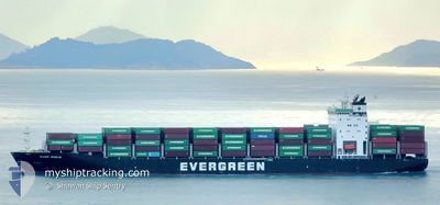
EVER BUILD
Cargo D
Current Trip
| Trip Time | 3 days |
|---|---|
| Trip Distance | 1479.03 nm |
| AVG Speed | 15.5 Knots |
| MAX Speed | 19.6 Knots |
| Dybgang | 11.2 m |
| AVG Wind | 19.7 knots |
| MAX Wind | 35 knots |
| MIN Temp | 22.3°C / 72.14°F |
| MAX Temp | 27.6°C / 81.68°F |
| Position Modtaget | 7 d siden |
Current Position
| Longitude | --- |
|---|---|
| Latitude | --- |
| Status | Under way using engine |
| Fart | 11.4 Knots |
| Kurs | 44° |
| Område | South China Sea |
| Station | T-AIS |
| Position Modtaget | 7 d siden |
Info
Information
The current position of EVER BUILD is in South China Sea with coordinates 14.45961° / 120.74254° as reported on 2026-01-01 20:29 by AIS to our vessel tracker app. The vessel's current speed is 11.4 Knots and is currently inside the port of LAEM CHABANG.
The vessel EVER BUILD (IMO: 9790062, MMSI: 370616000) is a Cargo D It's sailing under the flag of [PA] Panama.
In this page you can find informations about the vessels current position, last detected port calls, and current voyage information. If the vessels is not in coverage by AIS you will find the latest position.
The current position of EVER BUILD is detected by our AIS receivers and we are not responsible for the reliability of the data. The last position was recorded while the vessel was in Coverage by the Ais receivers of our vessel tracking app.
The current draught of EVER BUILD as reported by AIS is 11.2 meters
Weather
| Temperature | 23°C / 73.4°F |
|---|---|
| Wind Speed | 8 knots |
| Direction | 43° NE |
| Pressure | 1014.1 hPa |
| Humidity | 42.3 % |
| Cloud Coverage | 1 % |
Featured Company
Last Port Calls
| Port | Arrival | Departure | Time In Port |
|---|---|---|---|
| 2026-01-09 17:08 | |||
| 2026-01-04 16:48 | 2026-01-05 20:56 | 1 d | |
| 2025-12-31 05:27 | 2025-12-31 19:25 | 13 h | |
| 2025-12-29 20:19 | 2025-12-30 04:02 | 7 h | |
| 2025-12-29 05:07 | 2025-12-29 18:27 | 13 h | |
| 2025-12-25 13:24 | 2025-12-26 01:58 | 12 h | |
| 2025-12-21 12:12 | 2025-12-22 04:34 | 16 h | |
| 2025-12-17 13:51 | 2025-12-17 21:46 | 7 h | |
| 2025-12-15 17:37 | 2025-12-16 07:29 | 13 h | |
| 2025-12-10 07:00 | 2025-12-11 20:31 | 1 d |
Last Trips
| Origin | Departure | Destination | Arrival | Distance | |
|---|---|---|---|---|---|
| 2026-01-05 20:56 | 2026-01-09 17:08 | 1479.03 nm | |||
| 2025-12-31 19:25 | 2026-01-04 16:48 | 556.62 nm | |||
| 2025-12-30 04:02 | 2025-12-31 05:27 | 382.56 nm | |||
| 2025-12-29 18:27 | 2025-12-29 20:19 | 18.15 nm | |||
| 2025-12-26 01:58 | 2025-12-29 05:07 | 1164.63 nm | |||
| 2025-12-22 04:34 | 2025-12-25 13:24 | 456.56 nm | |||
| 2025-12-17 21:46 | 2025-12-21 12:12 | 1110.52 nm | |||
| 2025-12-16 07:29 | 2025-12-17 13:51 | 478.19 nm | |||
| 2025-12-11 20:31 | 2025-12-15 17:37 | 1474.91 nm | |||
| 2025-12-05 03:45 | 2025-12-10 07:00 | 1489.46 nm |
Events
| Tid | Hændelsen | Detaljer | Position / Dest | Info |
|---|---|---|---|---|
| 2026-01-09 10:40 | STOP Sejllads |
13.06575 / 100.89417
[TH] LAEM CHABANG
|
Fart: 0.1 kn Kurs: 240° |
|
| 2026-01-09 10:08 | Skibe i havn |
|
13.07047 / 100.86987
[TH] LAEM CHABANG
|
Fart: 8.5 kn Kurs: 106° |
| 2026-01-05 12:56 | Afsejlet fra sidste havn |
|
14.60535 / 120.90728
TW KSG > PH MNL
|
Fart: 7.7 kn Kurs: 277° |
| 2026-01-05 12:45 | START Sejllads |
14.60409 / 120.93771
[PH] MANILA
|
Fart: 7.6 kn Kurs: 278° |
|
| 2026-01-04 09:08 | STOP Sejllads |
14.59969 / 120.94741
[PH] MANILA
|
Fart: Kurs: 78° |
|
| 2026-01-04 08:48 | Skibe i havn |
|
14.60284 / 120.94118
[PH] MANILA
|
Fart: 6.2 kn Kurs: 92° |
| 2026-01-04 07:57 | START Sejllads | 4.76 nm, West of MANILA |
14.60145 / 120.86589
TW KSG > PH MNL
|
Fart: 3.7 kn Kurs: 78° |
| 2026-01-02 03:22 | STOP Sejllads | 5.1 nm, West of MANILA |
14.59815 / 120.86071
TW KSG > PH MNL
|
Fart: 0.2 kn Kurs: 357° |
| 2026-01-02 02:41 | START Sejllads | 6.19 nm, West of MANILA SOUTH HARBOR |
14.54652 / 120.87056
TW KSG > PH MNL
|
Fart: 4.2 kn Kurs: 350° |
| 2026-01-01 21:33 | STOP Sejllads | 6.29 nm, West of MANILA SOUTH HARBOR |
14.54387 / 120.86935
TW KSG > PH MNL
|
Fart: 0.2 kn Kurs: 62° |