
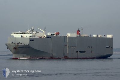
EUROPEAN HIGHWAY
Vehicles Carrier
Current Trip
| Time Travelled | 6 days |
|---|---|
| Remaining Time | 1 day |
| Distance Travelled | 2991.46 nm |
| Remaining Distance | 1051.08 nm |
| AVG Speed | 18 Knots |
| MAX Speed | 20.2 Knots |
| AVG Wind | 7.7 knots |
| MAX Wind | 20.9 knots |
| MIN Temp | 26.2°C / 79.16°F |
| MAX Temp | 31.4°C / 88.52°F |
| Dybgang | 7.9 m |
| Position Modtaget | 2 d siden |
Current Position
| Longitude | 77.38407° |
|---|---|
| Latitude | 7.51332° |
| Status | Under way using engine |
| Fart | 18.2 Knots |
| Kurs | 125° |
| Område | Laccadive Sea |
| Station | T-AIS |
| Position Modtaget | 2 d siden |
Info
Information
The current position of EUROPEAN HIGHWAY is in Laccadive Sea with coordinates 7.51332° / 77.38407° as reported on 2024-04-27 08:02 by AIS to our vessel tracker app. The vessel's current speed is 18.2 Knots and is heading at the port of JAKARTA. The estimated time of arrival as calculated by MyShipTracking vessel tracking app is 2024-05-01 21:44 LT
The vessel EUROPEAN HIGHWAY (IMO: 9206011, MMSI: 357900000) is a Vehicles Carrier that was built in 1999 ( 25 år gamle ). It's sailing under the flag of [PA] Panama.
In this page you can find informations about the vessels current position, last detected port calls, and current voyage information. If the vessels is not in coverage by AIS you will find the latest position.
The current position of EUROPEAN HIGHWAY is detected by our AIS receivers and we are not responsible for the reliability of the data. The last position was recorded while the vessel was in Coverage by the Ais receivers of our vessel tracking app.
The current draught of EUROPEAN HIGHWAY as reported by AIS is 7.9 meters
Weather
| Temperature | 29.1°C / 84.38°F |
|---|---|
| Wind Speed | 8 knots |
| Direction | 164° SSE |
| Pressure | 1008.3 hPa |
| Humidity | 78.3 % |
| Cloud Coverage | 100 % |
Featured Company
Last Port Calls
| Port | Arrival | Departure | Time In Port |
|---|---|---|---|
| 2024-04-22 06:15 | 2024-04-23 06:56 | 1 d | |
| 2024-04-17 00:56 | 2024-04-18 01:06 | 1 d | |
| 2024-04-15 10:21 | 2024-04-15 15:24 | 5 h | |
| 2024-04-10 15:24 | 2024-04-10 19:36 | 4 h | |
| 2024-04-09 02:24 | 2024-04-09 10:13 | 7 h | |
| 2024-04-04 02:21 | 2024-04-04 17:31 | 15 h | |
| 2024-03-30 12:43 | 2024-03-31 08:25 | 19 h | |
| 2024-03-24 23:00 | 2024-03-25 14:31 | 15 h | |
| 2024-03-22 05:00 | 2024-03-22 14:18 | 9 h | |
| 2024-03-21 22:19 | 2024-03-22 03:44 | 5 h |
Most Visited Ports (Last year)
| Port | Arrivals | |
|---|---|---|
| 25 | ||
| 18 | ||
| 13 | ||
| 11 | ||
| 4 | ||
| 3 |
Last Trips
| Origin | Departure | Destination | Arrival | Distance | |
|---|---|---|---|---|---|
| 2024-04-18 05:06 | 2024-04-22 10:15 | 50.20 nm | |||
| 2024-04-15 19:24 | 2024-04-17 04:56 | 329.74 nm | |||
| 2024-04-11 01:06 | 2024-04-15 14:21 | 1850.67 nm | |||
| 2024-04-09 15:43 | 2024-04-10 20:54 | 490.21 nm | |||
| 2024-04-05 01:31 | 2024-04-09 07:54 | 1600.75 nm | |||
| 2024-03-31 16:25 | 2024-04-04 10:21 | 1370.47 nm | |||
| 2024-03-25 21:31 | 2024-03-30 20:43 | 1366.68 nm | |||
| 2024-03-22 22:18 | 2024-03-25 06:00 | 796.64 nm | |||
| 2024-03-22 11:44 | 2024-03-22 13:00 | 11.15 nm | |||
| 2024-03-20 13:59 | 2024-03-22 06:19 | 546.05 nm |
Events
| Tid | Hændelsen | Detaljer | Position / Dest | Info |
|---|---|---|---|---|
| 2024-04-27 08:04 | Status er ændret | Default Under way using engine |
7.50667 / 77.39312
IDJKT
|
Fart: 18.2 kn Kurs: 125° |
| 2024-04-27 08:02 | Status er ændret | Under way using engine Default |
7.51332 / 77.38407
IDJKT
|
Fart: 18.1 kn Kurs: 125° |
| 2024-04-27 08:02 | Udenfor Dækning |
7.51332 / 77.38407
Laccadive Sea
IDJKT
|
Fart: 18.2 kn Kurs: 125° |
|
| 2024-04-27 07:55 | Status er ændret | Default Under way using engine |
7.53492 / 77.35452
IDJKT
|
Fart: 18 kn Kurs: 125° |
| 2024-04-27 04:38 | Fundet i havområde | Indian part of the Laccadive Sea |
8.08060 / 76.57403
Laccadive Sea
IDJKT
|
Fart: 17.3 kn Kurs: 120° |
| 2024-04-27 04:38 | Status er ændret | Under way using engine Default |
8.08060 / 76.57403
IDJKT
|
Fart: 16.5 kn Kurs: 125° |
| 2024-04-27 04:19 | Indenfor Dækning |
8.08060 / 76.57403
Laccadive Sea
IDJKT
|
Fart: 17.3 kn Kurs: 120° |
|
| 2024-04-23 21:00 | Status er ændret | Default Under way using engine |
24.65232 / 56.96898
IDJKT
|
Fart: 19.3 kn Kurs: 137° |
| 2024-04-23 20:55 | Udenfor Dækning |
24.67340 / 56.94787
Gulf of Oman
IDJKT
|
Fart: 19.3 kn Kurs: 137° |
|
| 2024-04-23 19:31 | Ændre havområde | Omani part of the Gulf of Oman United Arab Emirates part of the Gulf of Oman |
25.02953 / 56.68613
Gulf of Oman
IDJKT
|
Fart: 18.9 kn Kurs: 180° |