
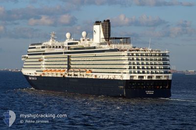
EURODAM
Passengers Ship
Current Trip
| Time Travelled | 11 h, 54 mins |
|---|---|
| Remaining Time | 1 day |
| Distance Travelled | 235.75 nm |
| Remaining Distance | 649.41 nm |
| AVG Speed | 19.5 Knots |
| MAX Speed | 23.2 Knots |
| AVG Wind | 6.2 knots |
| MAX Wind | 19.7 knots |
| MIN Temp | 9.7°C / 49.46°F |
| MAX Temp | 14.9°C / 58.82°F |
| Dybgang | 8 m |
| Position Modtaget | 1 m siden |
Current Position
| Longitude | -127.16313° |
|---|---|
| Latitude | 49.35912° |
| Status | Under way using engine |
| Fart | 19.8 Knots |
| Kurs | 307.8° |
| Område | North Pacific Ocean |
| Station | T-AIS |
| Position Modtaget | 1 m siden |
Info
Information
The current position of EURODAM is in North Pacific Ocean with coordinates 49.35912° / -127.16313° as reported on 2024-05-05 10:14 by AIS to our vessel tracker app. The vessel's current speed is 19.8 Knots and is heading at the port of JUNEAU. The estimated time of arrival as calculated by MyShipTracking vessel tracking app is 2024-05-06 17:57 LT
The vessel EURODAM (IMO: 9378448, MMSI: 245206000) is a Passengers Ship that was built in 2008 ( 16 år gamle ). It's sailing under the flag of [NL] Netherlands.
In this page you can find informations about the vessels current position, last detected port calls, and current voyage information. If the vessels is not in coverage by AIS you will find the latest position.
The current position of EURODAM is detected by our AIS receivers and we are not responsible for the reliability of the data. The last position was recorded while the vessel was in Coverage by the Ais receivers of our vessel tracking app.
The current draught of EURODAM as reported by AIS is 8 meters
Weather
| Temperature | 10.3°C / 50.54°F |
|---|---|
| Wind Speed | 16 knots |
| Direction | 293° WNW |
| Pressure | 1004 hPa |
| Humidity | 87.5 % |
| Cloud Coverage | 68 % |
Featured Company
Last Port Calls
| Port | Arrival | Departure | Time In Port |
|---|---|---|---|
| 2024-05-04 13:18 | 2024-05-04 22:22 | 9 h | |
| 2024-05-03 12:57 | 2024-05-03 23:34 | 10 h | |
| 2024-04-30 13:36 | 2024-05-01 05:49 | 16 h | |
| 2024-04-27 12:46 | 2024-04-28 00:20 | 11 h | |
| 2024-04-24 14:25 | 2024-04-24 23:04 | 8 h | |
| 2024-04-22 16:53 | 2024-04-22 23:48 | 6 h | |
| 2024-04-21 13:33 | 2024-04-21 22:09 | 8 h | |
| 2024-04-19 09:55 | 2024-04-20 00:36 | 14 h | |
| 2024-04-16 11:10 | 2024-04-16 18:25 | 7 h | |
| 2024-04-13 18:49 | 2024-04-13 20:19 | 1 h |
Most Visited Ports (Last year)
| Port | Arrivals | |
|---|---|---|
| 25 | ||
| 23 | ||
| 22 | ||
| 21 | ||
| 21 | ||
| 17 |
Last Trips
| Origin | Departure | Destination | Arrival | Distance | |
|---|---|---|---|---|---|
| 2024-05-03 16:34 | 2024-05-04 06:18 | 161.12 nm | |||
| 2024-04-30 22:49 | 2024-05-03 05:57 | 857.73 nm | |||
| 2024-04-27 17:20 | 2024-04-30 06:36 | 534.13 nm | |||
| 2024-04-24 18:04 | 2024-04-27 05:46 | 1052.94 nm | |||
| 2024-04-22 18:48 | 2024-04-24 09:25 | 698.70 nm | |||
| 2024-04-21 16:09 | 2024-04-22 11:53 | 342.17 nm | |||
| 2024-04-19 18:36 | 2024-04-21 07:33 | 478.78 nm | |||
| 2024-04-16 13:25 | 2024-04-19 03:55 | 823.74 nm | |||
| 2024-04-13 16:19 | 2024-04-16 06:10 | 1146.65 nm | |||
| 2024-04-12 08:28 | 2024-04-13 14:49 | 282.66 nm |
Events
| Tid | Hændelsen | Detaljer | Position / Dest | Info |
|---|---|---|---|---|
| 2024-05-05 05:27 | Status er ændret | Under way using engine Default |
48.51866 / -125.12980
US JNU
|
Fart: 19.5 kn Kurs: 270° |
| 2024-05-05 05:06 | Status er ændret | Default Under way using engine |
48.51825 / -124.95514
US JNU
|
Fart: 20 kn Kurs: 269.9° |
| 2024-05-05 05:00 | Status er ændret | Under way using engine Default |
48.51804 / -124.90111
US JNU
|
Fart: 20 kn Kurs: 270° |
| 2024-05-05 04:50 | Status er ændret | Default Under way using engine |
48.51799 / -124.82176
US JNU
|
Fart: 20 kn Kurs: 283° |
| 2024-05-05 04:42 | Ændre havområde | Canadian part of the North Pacific Ocean Canadian part of the The Coastal Waters of Southeast Alaska and British Columbia |
48.51551 / -124.75397
North Pacific Ocean
US JNU
|
Fart: 20 kn Kurs: 283° |
| 2024-05-05 01:58 | Ændre havområde | Canadian part of the The Coastal Waters of Southeast Alaska and British Columbia United States part of the The Coastal Waters of Southeast Alaska and British Columbia |
48.23992 / -123.48556
The Coastal Waters of Southeast Alaska and British Columbia
US JNU
|
Fart: 21.3 kn Kurs: 306.8° |
| 2024-05-05 00:20 | START Sejllads | 4.67 nm, North of PORT TOWNSEND |
48.18654 / -122.77700
US JNU
|
Fart: 22.8 kn Kurs: 302° |
| 2024-05-05 00:20 | STOP Sejllads | 4.58 nm, North of PORT TOWNSEND |
48.18538 / -122.77432
US JNU
|
Fart: Kurs: 302° |
| 2024-05-04 23:54 | START Sejllads | 5.6 nm, South East of PORT TOWNSEND |
48.06190 / -122.63505
US JNU
|
Fart: 22.1 kn Kurs: 350.1° |
| 2024-05-04 23:54 | STOP Sejllads | 5.67 nm, South East of PORT TOWNSEND |
48.06009 / -122.63460
US JNU
|
Fart: Kurs: 349° |