
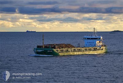
ESTLAND
General Cargo
Current Trip
| Time Travelled | 17 h, 22 mins |
|---|---|
| Remaining Time | --- |
| Distance Travelled | 137.74 nm |
| Remaining Distance | --- |
| AVG Speed | 10.3 Knots |
| MAX Speed | 11 Knots |
| AVG Wind | 6.2 knots |
| MAX Wind | 8 knots |
| MIN Temp | 5.1°C / 41.18°F |
| MAX Temp | 14.4°C / 57.92°F |
| Dybgang | 4 m |
| Position Modtaget | 3 h, 56 m siden |
Current Position
| Longitude | 23.18918° |
|---|---|
| Latitude | 59.25412° |
| Status | Under way using engine |
| Fart | 9.5 Knots |
| Kurs | 223.6° |
| Område | Baltic Sea |
| Station | T-AIS |
| Position Modtaget | 3 h, 56 m siden |
Info
Information
The current position of ESTLAND is in Baltic Sea with coordinates 59.25412° / 23.18918° as reported on 2024-05-02 01:41 by AIS to our vessel tracker app. The vessel's current speed is 9.5 Knots and is heading at the port of ROOMASSAARE. The estimated time of arrival as calculated by MyShipTracking vessel tracking app is 2024-05-02 12:30 LT
The vessel ESTLAND (IMO: 9247314, MMSI: 255802660) is a General Cargo that was built in 2002 ( 22 år gamle ). It's sailing under the flag of [PT] Portugal.
In this page you can find informations about the vessels current position, last detected port calls, and current voyage information. If the vessels is not in coverage by AIS you will find the latest position.
The current position of ESTLAND is detected by our AIS receivers and we are not responsible for the reliability of the data. The last position was recorded while the vessel was in Coverage by the Ais receivers of our vessel tracking app.
The current draught of ESTLAND as reported by AIS is 4 meters
Weather
| Temperature | 5.6°C / 42.08°F |
|---|---|
| Wind Speed | 6 knots |
| Direction | 109° ESE |
| Pressure | 1025.6 hPa |
| Humidity | 81.2 % |
| Cloud Coverage | 36 % |
Featured Company
Last Port Calls
| Port | Arrival | Departure | Time In Port |
|---|---|---|---|
| 2024-04-29 18:47 | 2024-05-01 12:15 | 1 d | |
| 2024-04-27 22:52 | 2024-04-28 18:29 | 19 h | |
| 2024-04-25 08:34 | 2024-04-26 13:05 | 1 d | |
| 2024-04-23 21:07 | 2024-04-25 01:27 | 1 d | |
| 2024-04-20 06:27 | 2024-04-21 15:08 | 1 d | |
| 2024-04-16 08:09 | 2024-04-17 17:38 | 1 d | |
| 2024-04-09 18:34 | 2024-04-12 09:40 | 2 d | |
| 2024-04-07 17:27 | 2024-04-09 01:19 | 1 d | |
| 2024-04-04 16:41 | 2024-04-05 15:13 | 22 h | |
| 2024-03-30 11:51 | 2024-03-31 09:53 | 22 h |
Last Trips
| Origin | Departure | Destination | Arrival | Distance | |
|---|---|---|---|---|---|
| 2024-04-28 21:29 | 2024-04-29 21:47 | 244.25 nm | |||
| 2024-04-26 16:05 | 2024-04-28 01:52 | 241.60 nm | |||
| 2024-04-25 04:27 | 2024-04-25 11:34 | 66.52 nm | |||
| 2024-04-21 18:08 | 2024-04-24 00:07 | 214.18 nm | |||
| 2024-04-17 20:38 | 2024-04-20 09:27 | 328.41 nm | |||
| 2024-04-12 12:40 | 2024-04-16 11:09 | 491.98 nm | |||
| 2024-04-09 04:19 | 2024-04-09 21:34 | 184.84 nm | |||
| 2024-04-05 18:13 | 2024-04-07 20:27 | 352.72 nm | |||
| 2024-03-31 12:53 | 2024-04-04 19:41 | 640.24 nm | |||
| 2024-03-26 18:35 | 2024-03-30 13:51 | 418.97 nm |
Events
| Tid | Hændelsen | Detaljer | Position / Dest | Info |
|---|---|---|---|---|
| 2024-05-02 01:48 | Status er ændret | Default Under way using engine |
59.23978 / 23.16256
EERMS
|
Fart: 9.5 kn Kurs: 223.6° |
| 2024-05-02 01:41 | Udenfor Dækning |
59.25412 / 23.18918
Baltic Sea
EERMS
|
Fart: 9.5 kn Kurs: 223.6° |
|
| 2024-05-02 00:59 | Ændre havområde | Estonian part of the Baltic Sea Estonian part of the Gulf of Finland |
59.33463 / 23.34130
Baltic Sea
EERMS
|
Fart: 9.8 kn Kurs: 232.1° |
| 2024-05-02 00:08 | Status er ændret | Under way using engine Default |
59.40701 / 23.57178
EERMS
|
Fart: 9.8 kn Kurs: 240° |
| 2024-05-02 00:01 | Status er ændret | Default Under way using engine |
59.41732 / 23.60654
EERMS
|
Fart: 9.8 kn Kurs: 240.8° |
| 2024-05-01 23:54 | Status er ændret | Under way using engine Default |
59.42593 / 23.63607
EERMS
|
Fart: 9.9 kn Kurs: 240° |
| 2024-05-01 23:54 | Indenfor Dækning |
59.42593 / 23.63607
Gulf of Finland
EERMS
|
Fart: 9.8 kn Kurs: 240.8° |
|
| 2024-05-01 22:30 | Status er ændret | Default Under way using engine |
59.54101 / 24.02365
EERMS
|
Fart: 9.8 kn Kurs: 240.2° |
| 2024-05-01 22:25 | Udenfor Dækning |
59.54857 / 24.04923
Gulf of Finland
EERMS
|
Fart: 9.8 kn Kurs: 240.2° |
|
| 2024-05-01 18:13 | Ændre havområde | Estonian part of the Gulf of Finland Finnish part of the Gulf of Finland |
59.88370 / 25.27754
Gulf of Finland
EERMS
|
Fart: 10.5 kn Kurs: 252.4° |