
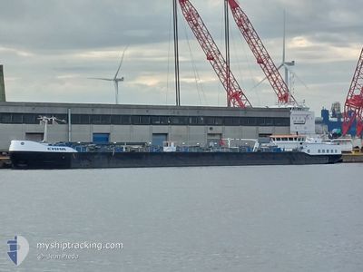
EMMA
Tanker
Current Trip
| Trip Time | 1 h, 33 mins |
|---|---|
| Trip Distance | 19.18 nm |
| AVG Speed | 11.6 Knots |
| MAX Speed | 12.9 Knots |
| Dybgang | 4.8 m |
| AVG Wind | 18.6 knots |
| MAX Wind | 20.2 knots |
| MIN Temp | 11.8°C / 53.24°F |
| MAX Temp | 12.7°C / 54.86°F |
| Position Modtaget | 1 m siden |
Current Position
| Longitude | 3.71378° |
|---|---|
| Latitude | 51.47028° |
| Status | Under way using engine |
| Fart | |
| Kurs | 205° |
| Område | North Sea |
| Station | T-AIS |
| Position Modtaget | 1 m siden |
Info
Information
The current position of EMMA is in North Sea with coordinates 51.47028° / 3.71378° as reported on 2024-04-28 11:24 by AIS to our vessel tracker app. The vessel's current speed is 0 Knots and is currently inside the port of VLISSINGEN.
The vessel EMMA (MMSI: 244044538) is a Tanker It's sailing under the flag of [NL] Netherlands.
In this page you can find informations about the vessels current position, last detected port calls, and current voyage information. If the vessels is not in coverage by AIS you will find the latest position.
The current position of EMMA is detected by our AIS receivers and we are not responsible for the reliability of the data. The last position was recorded while the vessel was in Coverage by the Ais receivers of our vessel tracking app.
The current draught of EMMA as reported by AIS is 4.8 meters
Weather
| Temperature | 13.9°C / 57.02°F |
|---|---|
| Wind Speed | 21 knots |
| Direction | 196° SSW |
| Pressure | 1004.5 hPa |
| Humidity | 66.1 % |
| Cloud Coverage | 79 % |
Featured Company
Last Port Calls
| Port | Arrival | Departure | Time In Port |
|---|---|---|---|
| 2024-04-28 09:46 | |||
| 2024-04-28 07:53 | 2024-04-28 08:13 | 19 m | |
| 2024-04-27 04:56 | 2024-04-27 15:24 | 10 h | |
| 2024-04-26 19:58 | 2024-04-27 04:54 | 8 h | |
| 2024-04-26 11:28 | 2024-04-26 11:45 | 17 m | |
| 2024-04-25 07:24 | 2024-04-26 07:21 | 23 h | |
| 2024-04-23 16:48 | 2024-04-25 04:24 | 1 d | |
| 2024-04-20 11:24 | 2024-04-23 05:49 | 2 d | |
| 2024-04-19 13:11 | 2024-04-20 09:42 | 20 h | |
| 2024-04-18 08:02 | 2024-04-19 05:47 | 21 h |
Last Trips
| Origin | Departure | Destination | Arrival | Distance | |
|---|---|---|---|---|---|
| 2024-04-28 10:13 | 2024-04-28 11:46 | 19.18 nm | |||
| 2024-04-27 17:24 | 2024-04-28 09:53 | 59.60 nm | |||
| 2024-04-27 06:54 | 2024-04-27 06:56 | 0.57 nm | |||
| 2024-04-26 13:45 | 2024-04-26 21:58 | 59.11 nm | |||
| 2024-04-26 09:21 | 2024-04-26 13:28 | 36.97 nm | |||
| 2024-04-25 06:24 | 2024-04-25 09:24 | 36.43 nm | |||
| 2024-04-23 07:49 | 2024-04-23 18:48 | 57.20 nm | |||
| 2024-04-20 11:42 | 2024-04-20 13:24 | 10.51 nm | |||
| 2024-04-19 07:47 | 2024-04-19 15:11 | 56.25 nm | |||
| 2024-04-18 07:16 | 2024-04-18 10:02 | 31.67 nm |
Events
| Tid | Hændelsen | Detaljer | Position / Dest | Info |
|---|---|---|---|---|
| 2024-04-28 10:05 | STOP Sejllads |
51.46840 / 3.71249
[NL] VLISSINGEN
|
Fart: 0.2 kn Kurs: 183° |
|
| 2024-04-28 09:46 | Skibe i havn |
|
51.44793 / 3.67271
[NL] VLISSINGEN
|
Fart: 8.8 kn Kurs: 19.9° |
| 2024-04-28 08:13 | Afsejlet fra sidste havn |
|
51.43914 / 4.00766
NLVLI
|
Fart: 8 kn Kurs: 224° |
| 2024-04-28 08:04 | START Sejllads |
51.45354 / 4.01148
[NL] HANSWEERT
|
Fart: 4.1 kn Kurs: 171° |
|
| 2024-04-28 07:53 | STOP Sejllads |
51.45557 / 4.01072
[NL] HANSWEERT
|
Fart: Kurs: 167° |
|
| 2024-04-28 07:53 | Skibe i havn |
|
51.45557 / 4.01072
[NL] HANSWEERT
|
Fart: 2.2 kn Kurs: 169° |
| 2024-04-28 05:36 | START Sejllads | 2.52 nm, East of BRUINISSE |
51.66094 / 4.15678
NLVLI
|
Fart: 4.1 kn Kurs: 269° |
| 2024-04-28 05:07 | STOP Sejllads | 2.68 nm, East of BRUINISSE |
51.66114 / 4.16117
NLVLI
|
Fart: 0.2 kn Kurs: 267° |
| 2024-04-28 04:58 | START Sejllads | 2.78 nm, North of SINT PHILIPSLAND |
51.66115 / 4.17572
NLVLI
|
Fart: 4.8 kn Kurs: 279° |
| 2024-04-27 21:17 | Dybgangen er ændret | 4.8 2.7 |
51.66088 / 4.17875
NLVLI
|
Fart: Kurs: 267° |