
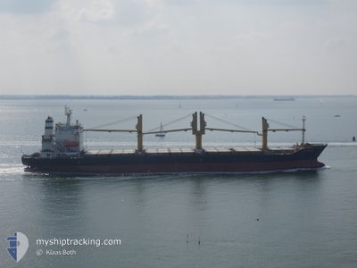
ELYANA
General Cargo
Current Trip
| Trip Time | 12 days |
|---|---|
| Trip Distance | 2740.41 nm |
| AVG Speed | 11.1 Knots |
| MAX Speed | 13.8 Knots |
| Dybgang | 9.6 m |
| AVG Wind | 10 knots |
| MAX Wind | 21 knots |
| MIN Temp | 22.6°C / 72.68°F |
| MAX Temp | 30°C / 86°F |
| Position Modtaget | 15 d siden |
Current Position
| Longitude | --- |
|---|---|
| Latitude | --- |
| Status | Under way using engine |
| Fart | 11.2 Knots |
| Kurs | 144.9° |
| Område | Gulf of Oman |
| Station | T-AIS |
| Position Modtaget | 15 d siden |
Info
Information
The current position of ELYANA is in Gulf of Oman with coordinates 25.72348° / 57.11021° as reported on 2025-02-18 07:59 by AIS to our vessel tracker app. The vessel's current speed is 11.2 Knots and is currently inside the port of MOMBASA.
The vessel ELYANA (IMO: 9165827, MMSI: 422038600) is a General Cargo that was built in 1998 ( 27 år gamle ). It's sailing under the flag of [IR] Iran.
In this page you can find informations about the vessels current position, last detected port calls, and current voyage information. If the vessels is not in coverage by AIS you will find the latest position.
The current position of ELYANA is detected by our AIS receivers and we are not responsible for the reliability of the data. The last position was recorded while the vessel was in Coverage by the Ais receivers of our vessel tracking app.
The current draught of ELYANA as reported by AIS is 9.6 meters
Weather
| Temperature | 29.5°C / 85.1°F |
|---|---|
| Wind Speed | 10 knots |
| Direction | 95° E |
| Pressure | 1008.6 hPa |
| Humidity | 60.9 % |
| Cloud Coverage | 15 % |
Featured Company
Last Port Calls
| Port | Arrival | Departure | Time In Port |
|---|---|---|---|
| 2025-03-02 23:16 | |||
| 2025-02-14 08:00 | 2025-02-18 02:24 | 3 d | |
| 2025-02-04 14:14 | 2025-02-06 23:39 | 2 d | |
| 2025-01-23 06:05 | 2025-01-23 15:13 | 9 h | |
| 2025-01-14 16:50 | 2025-01-20 16:41 | 5 d | |
| 2025-01-09 14:15 | 2025-01-12 19:58 | 3 d |
Most Visited Ports (Last year)
| Port | Arrivals | |
|---|---|---|
| 7 | ||
| 6 | ||
| 3 | ||
| 3 | ||
| 2 | ||
| 2 |
Last Trips
| Origin | Departure | Destination | Arrival | Distance | |
|---|---|---|---|---|---|
| 2025-02-18 02:24 | 2025-03-02 23:16 | 2740.41 nm | |||
| 2025-02-06 23:39 | 2025-02-14 08:00 | 211.98 nm | |||
| 2025-01-20 16:41 | 2025-02-04 14:14 | 3519.43 nm | |||
| 2025-01-20 16:41 | 2025-01-23 06:05 | 486.94 nm | |||
| 2025-01-12 19:58 | 2025-01-14 16:50 | 280.42 nm | |||
| 2024-12-26 23:44 | 2025-01-09 14:15 | 263.67 nm |
Events
| Tid | Hændelsen | Detaljer | Position / Dest | Info |
|---|---|---|---|---|
| 2025-03-02 20:16 | Skibe i havn |
|
-4.05183 / 39.64540
[KE] MOMBASA
|
Fart: 1 kn Kurs: 157° |
| 2025-02-28 06:49 | STOP Sejllads | 0.78 nm, South of MOMBASA |
-4.06003 / 39.64334
KEMBA
|
Fart: 0.3 kn Kurs: 337° |
| 2025-02-28 05:05 | START Sejllads | 9.79 nm, East of MOMBASA |
-4.10027 / 39.79485
KEMBA
|
Fart: 3.5 kn Kurs: 135° |
| 2025-02-28 03:45 | STOP Sejllads | 9.83 nm, East of MOMBASA |
-4.10688 / 39.79312
KEMBA
|
Fart: 0.3 kn Kurs: 73° |
| 2025-02-28 01:45 | START Sejllads | 16.78 nm, East of MOMBASA |
-4.05341 / 39.92018
KEMBA
|
Fart: 4.9 kn Kurs: 323° |
| 2025-02-27 20:45 | STOP Sejllads | 18.45 nm, East of MOMBASA |
-4.07953 / 39.94638
KEMBA
|
Fart: 0.2 kn Kurs: 21° |
| 2025-02-27 11:37 | START Sejllads | 14.89 nm, East of MOMBASA |
-4.01153 / 39.88605
KEMBA
|
Fart: 3.7 kn Kurs: 165° |
| 2025-02-27 11:00 | STOP Sejllads | 15.07 nm, East of MOMBASA |
-4.00846 / 39.88871
KEMBA
|
Fart: 0.3 kn Kurs: 58° |