
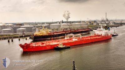
ELLIE LADY
Oil Products Tanker
Current Trip
| Time Travelled | 5 days |
|---|---|
| Remaining Time | --- |
| Distance Travelled | 881.96 nm |
| Remaining Distance | --- |
| AVG Speed | 11.8 Knots |
| MAX Speed | 13.6 Knots |
| AVG Wind | 7 knots |
| MAX Wind | 18.6 knots |
| MIN Temp | 29.2°C / 84.56°F |
| MAX Temp | 35.2°C / 95.36°F |
| Dybgang | 12.3 m |
| Position Modtaget | 18 h, 25 m siden |
Current Position
| Longitude | 57.36162° |
|---|---|
| Latitude | 25.16508° |
| Status | Under way using engine |
| Fart | 12.9 Knots |
| Kurs | 127° |
| Område | Gulf of Oman |
| Station | T-AIS |
| Position Modtaget | 18 h, 25 m siden |
Info
Information
The current position of ELLIE LADY is in Gulf of Oman with coordinates 25.16508° / 57.36162° as reported on 2024-05-27 23:39 by AIS to our vessel tracker app. The vessel's current speed is 12.9 Knots and is heading at the port of CHIBA. The estimated time of arrival as calculated by MyShipTracking vessel tracking app is 2024-06-18 06:00 LT
The vessel ELLIE LADY (IMO: 9390173, MMSI: 636014423) is a Oil Products Tanker that was built in 2009 ( 15 år gamle ). It's sailing under the flag of [LR] Liberia.
In this page you can find informations about the vessels current position, last detected port calls, and current voyage information. If the vessels is not in coverage by AIS you will find the latest position.
The current position of ELLIE LADY is detected by our AIS receivers and we are not responsible for the reliability of the data. The last position was recorded while the vessel was in Coverage by the Ais receivers of our vessel tracking app.
The current draught of ELLIE LADY as reported by AIS is 12.3 meters
Weather
| Temperature | 29.3°C / 84.74°F |
|---|---|
| Wind Speed | 23 knots |
| Direction | 207° SSW |
| Pressure | 1001.3 hPa |
| Humidity | 85.4 % |
| Cloud Coverage | --- |
Featured Company
Last Port Calls
| Port | Arrival | Departure | Time In Port |
|---|---|---|---|
| 2024-05-21 22:02 | 2024-05-23 00:31 | 1 d | |
| 2024-04-23 01:26 | 2024-04-23 23:13 | 21 h | |
| 2024-04-22 08:42 | 2024-04-23 00:56 | 16 h | |
| 2024-04-21 04:52 | 2024-04-22 07:48 | 1 d | |
| 2024-03-28 06:18 | 2024-03-29 13:14 | 1 d | |
| 2024-03-27 21:39 |
Most Visited Ports (Last year)
| Port | Arrivals | |
|---|---|---|
| 7 | ||
| 2 | ||
| 2 | ||
| 2 | ||
| 1 | ||
| 1 |
Last Trips
| Origin | Departure | Destination | Arrival | Distance | |
|---|---|---|---|---|---|
| 2024-04-24 08:13 | 2024-05-22 01:02 | 7241.14 nm | |||
| 2024-04-23 09:56 | 2024-04-23 10:26 | 1.94 nm | |||
| 2024-04-22 16:48 | 2024-04-22 17:42 | 3.91 nm | |||
| 2024-03-29 16:14 | 2024-04-21 13:52 | 6651.93 nm | |||
| 2024-03-28 00:39 | 2024-03-28 09:18 | 90.32 nm |
Events
| Tid | Hændelsen | Detaljer | Position / Dest | Info |
|---|---|---|---|---|
| 2024-05-27 23:46 | Status er ændret | Default Under way using engine |
25.14982 / 57.38215
JP CHB
|
Fart: 12.9 kn Kurs: 127° |
| 2024-05-27 23:39 | Udenfor Dækning |
25.16508 / 57.36162
Gulf of Oman
JP CHB
|
Fart: 12.9 kn Kurs: 127° |
|
| 2024-05-27 19:47 | Ændre havområde | Iranian part of the Gulf of Oman Omani part of the Gulf of Oman |
25.76855 / 56.85687
Gulf of Oman
JP CHB
|
Fart: 12.2 kn Kurs: 163° |
| 2024-05-27 19:05 | Ændre havområde | Omani part of the Gulf of Oman Omani part of the Persian Gulf |
25.90092 / 56.80920
Gulf of Oman
JP CHB
|
Fart: 11.4 kn Kurs: 163° |
| 2024-05-27 19:04 | Status er ændret | Under way using engine Default |
25.90303 / 56.80852
JP CHB
|
Fart: 11.4 kn Kurs: 163° |
| 2024-05-27 18:56 | Indenfor Dækning |
25.90092 / 56.80920
Gulf of Oman
JP CHB
|
Fart: 11.4 kn Kurs: 163° |
|
| 2024-05-27 12:13 | Status er ændret | Default Under way using engine |
26.30523 / 55.93100
JP CHB
|
Fart: 11.5 kn Kurs: 71° |
| 2024-05-27 12:08 | Udenfor Dækning |
26.29930 / 55.91428
Persian Gulf
JP CHB
|
Fart: 11.5 kn Kurs: 71° |
|
| 2024-05-27 11:25 | Ændre havområde | Omani part of the Persian Gulf United Arab Emirates part of the Persian Gulf |
26.26355 / 55.77045
Persian Gulf
JP CHB
|
Fart: 11.2 kn Kurs: 78° |
| 2024-05-27 11:19 | Ændre havområde | United Arab Emirates part of the Persian Gulf Iranian part of the Persian Gulf |
26.25873 / 55.74948
Persian Gulf
JP CHB
|
Fart: 11.4 kn Kurs: 74° |