

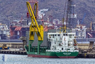
ELENE
General Cargo

Current Trip
| Trip Time | 1 day |
|---|---|
| Trip Distance | 248.80 nm |
| AVG Speed | 10 Knots |
| MAX Speed | 12.1 Knots |
| Dybgang | 5.5 m |
| AVG Wind | 17.5 knots |
| MAX Wind | 24 knots |
| MIN Temp | 23.7°C / 74.66°F |
| MAX Temp | 26.7°C / 80.06°F |
| Position Modtaget | 23 h, 13 m siden |
Current Position
| Longitude | --- |
|---|---|
| Latitude | --- |
| Status | Moored |
| Fart | 10.2 Knots |
| Kurs | 140.6° |
| Område | Caribbean Sea |
| Station | T-AIS |
| Position Modtaget | 23 h, 13 m siden |
Information
The current position of ELENE is in Caribbean Sea with coordinates 10.57266° / -61.73522° as reported on 2025-02-14 00:06 by AIS to our vessel tracker app. The vessel's current speed is 10.2 Knots and is currently inside the port of POINT LISAS.
The vessel ELENE (IMO: 9347073, MMSI: 218861000) is a General Cargo that was built in 2007 ( 18 år gamle ). It's sailing under the flag of [DE] Germany.
In this page you can find informations about the vessels current position, last detected port calls, and current voyage information. If the vessels is not in coverage by AIS you will find the latest position.
The current position of ELENE is detected by our AIS receivers and we are not responsible for the reliability of the data. The last position was recorded while the vessel was in Coverage by the Ais receivers of our vessel tracking app.
The current draught of ELENE as reported by AIS is 5.5 meters
Weather
| Temperature | 25.2°C / 77.36°F |
|---|---|
| Wind Speed | 9 knots |
| Direction | 56° NE |
| Pressure | 1013.2 hPa |
| Humidity | 71.6 % |
| Cloud Coverage | 100 % |


Featured Company
Last Port Calls
| Port | Arrival | Departure | Time In Port |
|---|---|---|---|
| 2025-02-13 22:34 | |||
| 2025-02-07 07:11 | 2025-02-12 21:27 | 5 d | |
| 2025-02-05 14:55 | 2025-02-06 17:43 | 1 d | |
| 2025-01-28 09:13 | 2025-01-29 17:50 | 1 d | |
| 2025-01-23 14:55 | 2025-01-25 15:15 | 2 d | |
| 2025-01-17 09:02 | 2025-01-19 08:12 | 1 d | |
| 2025-01-10 10:36 | 2025-01-11 22:38 | 1 d | |
| 2025-01-08 17:27 | 2025-01-10 07:51 | 1 d | |
| 2024-12-27 03:47 | 2024-12-30 03:22 | 2 d | |
| 2024-12-23 13:10 | 2024-12-23 22:24 | 9 h |
Most Visited Ports (Last year)
| Port | Arrivals | |
|---|---|---|
| 8 | ||
| 6 | ||
| 4 | ||
| 3 | ||
| 2 | ||
| 2 |
Last Trips
| Origin | Departure | Destination | Arrival | Distance | |
|---|---|---|---|---|---|
| 2025-02-12 21:27 | 2025-02-13 22:34 | 248.80 nm | |||
| 2025-02-06 17:43 | 2025-02-07 07:11 | 28.21 nm | |||
| 2025-01-29 17:50 | 2025-02-05 14:55 | 1035.46 nm | |||
| 2025-01-25 15:15 | 2025-01-28 09:13 | 488.57 nm | |||
| 2025-01-19 08:12 | 2025-01-23 14:55 | 1038.08 nm | |||
| 2025-01-11 22:38 | 2025-01-17 09:02 | 977.05 nm | |||
| 2025-01-10 07:51 | 2025-01-10 10:36 | 20.83 nm | |||
| 2024-12-30 03:22 | 2025-01-08 17:27 | 1877.06 nm | |||
| 2024-12-23 22:24 | 2024-12-27 03:47 | 25.56 nm | |||
| 2024-12-20 20:02 | 2024-12-23 13:10 | 400.16 nm |
Events
| Tid | Hændelsen | Detaljer | Position / Dest | Info |
|---|---|---|---|---|
| 2025-02-14 02:34 | STOP Sejllads |
10.40425 / -61.49391
[TT] POINT LISAS
|
Fart: Kurs: 239° |
|
| 2025-02-14 02:34 | Skibe i havn |
|
10.40425 / -61.49391
[TT] POINT LISAS
|
Fart: 1.5 kn Kurs: 304° |
| 2025-02-14 00:11 | Status er ændret | Default Moored |
10.56166 / -61.72631
LCCAS
|
Fart: 10.2 kn Kurs: 140.6° |
| 2025-02-14 00:06 | Status er ændret | Moored Default |
10.57266 / -61.73522
LCCAS
|
Fart: 10.1 kn Kurs: 141° |
| 2025-02-14 00:06 | Udenfor Dækning |
10.57266 / -61.73522
Caribbean Sea
|
Fart: 10.2 kn Kurs: 140.6° |
|
| 2025-02-14 00:03 | Status er ændret | Default Moored |
10.57842 / -61.74008
LCCAS
|
Fart: 9.8 kn Kurs: 139.3° |
| 2025-02-13 23:54 | Status er ændret | Moored Default |
10.59758 / -61.75694
LCCAS
|
Fart: 10.4 kn Kurs: 137° |
| 2025-02-13 23:35 | Status er ændret | Default Moored |
10.63906 / -61.79378
LCCAS
|
Fart: 8.9 kn Kurs: 199.1° |
| 2025-02-13 23:20 | Ændre havområde | Trinidad and Tobago part of the Caribbean Sea Grenadian part of the Caribbean Sea |
10.67569 / -61.80242
Caribbean Sea
|
Fart: 8.9 kn Kurs: 199.1° |
| 2025-02-13 23:20 | Status er ændret | Moored Default |
10.67569 / -61.80242
LCCAS
|
Fart: 9.9 kn Kurs: 195° |