

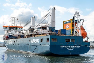
EEMSLIFT HENDRIKA
Cargo

Current Trip
| Time Travelled | 36 mins |
|---|---|
| Remaining Time | 2 days |
| Distance Travelled | 3.50 nm |
| Remaining Distance | 363.51 nm |
| AVG Speed | 6.6 Knots |
| MAX Speed | 7 Knots |
| AVG Wind | 3.8 knots |
| MAX Wind | 4 knots |
| MIN Temp | -6.1°C / 21.02°F |
| MAX Temp | -5.1°C / 22.82°F |
| Dybgang | 5.5 m |
| Position Modtaget | 1 m siden |
Current Position
| Longitude | --- |
|---|---|
| Latitude | --- |
| Status | Under way using engine |
| Fart | 6.1 Knots |
| Kurs | 268.3° |
| Område | Baltic Sea |
| Station | T-AIS |
| Position Modtaget | 1 m siden |
Information
The current position of EEMSLIFT HENDRIKA is in Baltic Sea with coordinates 54.36078° / 10.03069° as reported on 2025-02-18 19:23 by AIS to our vessel tracker app. The vessel's current speed is 6.1 Knots and is heading at the port of ROTTERDAM. The estimated time of arrival as calculated by MyShipTracking vessel tracking app is 2025-02-21 03:14 LT
The vessel EEMSLIFT HENDRIKA (IMO: 9671486, MMSI: 244790047) is a Cargo It's sailing under the flag of [NL] Netherlands.
In this page you can find informations about the vessels current position, last detected port calls, and current voyage information. If the vessels is not in coverage by AIS you will find the latest position.
The current position of EEMSLIFT HENDRIKA is detected by our AIS receivers and we are not responsible for the reliability of the data. The last position was recorded while the vessel was in Coverage by the Ais receivers of our vessel tracking app.
The current draught of EEMSLIFT HENDRIKA as reported by AIS is 5.5 meters
Weather
| Temperature | -5.1°C / 22.82°F |
|---|---|
| Wind Speed | 4 knots |
| Direction | 126° SE |
| Pressure | 1030.8 hPa |
| Humidity | 86.6 % |
| Cloud Coverage | 5 % |


Featured Company
Last Port Calls
| Port | Arrival | Departure | Time In Port |
|---|---|---|---|
| 2025-02-18 18:15 | 2025-02-18 18:48 | 32 m | |
| 2025-02-16 09:21 | 2025-02-17 17:41 | 1 d | |
| 2025-02-15 14:28 | 2025-02-15 21:11 | 6 h | |
| 2025-02-12 10:05 | 2025-02-12 20:31 | 10 h | |
| 2025-02-11 10:44 | 2025-02-11 20:48 | 10 h | |
| 2025-02-09 19:10 | 2025-02-10 16:10 | 21 h | |
| 2025-02-02 09:06 | 2025-02-03 13:56 | 1 d | |
| 2025-01-30 05:11 | 2025-01-30 11:49 | 6 h | |
| 2025-01-29 07:02 | 2025-01-29 10:22 | 3 h | |
| 2025-01-28 05:43 | 2025-01-28 13:21 | 7 h |
Most Visited Ports (Last year)
| Port | Arrivals | |
|---|---|---|
| 12 | ||
| 8 | ||
| 8 | ||
| 8 | ||
| 7 | ||
| 6 |
Last Trips
| Origin | Departure | Destination | Arrival | Distance | |
|---|---|---|---|---|---|
| 2025-02-17 18:41 | 2025-02-18 19:15 | 341.36 nm | |||
| 2025-02-15 23:11 | 2025-02-16 10:21 | 133.56 nm | |||
| 2025-02-12 21:31 | 2025-02-15 16:28 | 534.99 nm | |||
| 2025-02-11 21:48 | 2025-02-12 11:05 | 128.66 nm | |||
| 2025-02-10 17:10 | 2025-02-11 11:44 | 206.37 nm | |||
| 2025-02-03 14:56 | 2025-02-09 20:10 | 2182.67 nm | |||
| 2025-01-30 12:49 | 2025-02-02 10:06 | 991.20 nm | |||
| 2025-01-29 11:22 | 2025-01-30 06:11 | 131.98 nm | |||
| 2025-01-28 14:21 | 2025-01-29 08:02 | 239.48 nm | |||
| 2025-01-24 17:52 | 2025-01-28 06:43 | 1188.80 nm |
Events
| Tid | Hændelsen | Detaljer | Position / Dest | Info |
|---|---|---|---|---|
| 2025-02-18 18:48 | Afsejlet fra sidste havn |
|
54.36673 / 10.13438
ROTTERDAM
|
Fart: 5.4 kn Kurs: 284° |
| 2025-02-18 18:47 | START Sejllads |
54.36629 / 10.13678
[DE] KIEL
|
Fart: 4.6 kn Kurs: 285° |
|
| 2025-02-18 18:28 | STOP Sejllads |
54.36594 / 10.14019
[DE] KIEL
|
Fart: 0.3 kn Kurs: 282° |
|
| 2025-02-18 18:15 | Skibe i havn |
|
54.36369 / 10.15619
[DE] KIEL
|
Fart: 5.5 kn Kurs: 271.3° |
| 2025-02-18 16:41 | Ændre havområde | German part of the Baltic Sea Danish part of the Baltic Sea |
54.56370 / 10.55800
Baltic Sea
ROTTERDAM
|
Fart: 14.5 kn Kurs: 249.5° |
| 2025-02-18 16:06 | Ændre havområde | Danish part of the Baltic Sea German part of the Baltic Sea |
54.58468 / 10.79317
Baltic Sea
ROTTERDAM
|
Fart: 14.2 kn Kurs: 263.7° |
| 2025-02-18 14:50 | Ændre havområde | German part of the Baltic Sea Danish part of the Baltic Sea |
54.57285 / 11.30595
Baltic Sea
ROTTERDAM
|
Fart: 14.3 kn Kurs: 290.1° |
| 2025-02-18 12:14 | Ændre havområde | Danish part of the Baltic Sea German part of the Baltic Sea |
54.53630 / 12.24697
Baltic Sea
ROTTERDAM
|
Fart: 14.2 kn Kurs: 246.4° |
| 2025-02-18 06:50 | Ændre havområde | German part of the Baltic Sea Danish part of the Kattegat |
54.71791 / 14.39644
Baltic Sea
ROTTERDAM
|
Fart: 13.9 kn Kurs: 268.4° |
| 2025-02-18 04:56 | Ændre havområde | Danish part of the Kattegat Polish part of the Baltic Sea |
54.77094 / 15.16239
Kattegat
ROTTERDAM
|
Fart: 14.1 kn Kurs: 264.1° |