

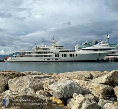
ECSTASEA
Yacht

Current Trip
| Trip Time | 6 h, 14 mins |
|---|---|
| Trip Distance | 68.58 nm |
| AVG Speed | 10 Knots |
| MAX Speed | 12.5 Knots |
| Dybgang | 3.8 m |
| AVG Wind | 13 knots |
| MAX Wind | 16 knots |
| MIN Temp | 23.3°C / 73.94°F |
| MAX Temp | 26.1°C / 78.98°F |
| Position Modtaget | 2 m siden |
Current Position
| Longitude | --- |
|---|---|
| Latitude | --- |
| Status | Moored |
| Fart | |
| Kurs | 177° |
| Område | North Atlantic Ocean |
| Station | T-AIS |
| Position Modtaget | 2 m siden |
Information
The current position of ECSTASEA is in North Atlantic Ocean with coordinates 25.78589° / -80.18029° as reported on 2025-03-27 22:46 by AIS to our vessel tracker app. The vessel's current speed is 0 Knots and is currently inside the port of MIAMI.
The vessel ECSTASEA (IMO: 1008102, MMSI: 319009900) is a Yacht that was built in 2004 ( 21 år gamle ). It's sailing under the flag of [KY] Cayman Is.
In this page you can find informations about the vessels current position, last detected port calls, and current voyage information. If the vessels is not in coverage by AIS you will find the latest position.
The current position of ECSTASEA is detected by our AIS receivers and we are not responsible for the reliability of the data. The last position was recorded while the vessel was in Coverage by the Ais receivers of our vessel tracking app.
The current draught of ECSTASEA as reported by AIS is 3.8 meters
Weather
| Temperature | 25.6°C / 78.08°F |
|---|---|
| Wind Speed | 14 knots |
| Direction | 64° ENE |
| Pressure | 1021.6 hPa |
| Humidity | 46.5 % |
| Cloud Coverage | --- |


Featured Company
Last Port Calls
| Port | Arrival | Departure | Time In Port |
|---|---|---|---|
| 2025-03-27 13:01 | |||
| 2025-03-12 21:46 | 2025-03-27 06:47 | 14 d | |
| 2025-02-23 15:57 | 2025-03-08 13:48 | 12 d | |
| 2025-02-20 07:14 | 2025-02-23 11:05 | 3 d | |
| 2025-01-15 09:35 | 2025-01-16 16:38 | 1 d |
Most Visited Ports (Last year)
| Port | Arrivals | |
|---|---|---|
| 5 | ||
| 4 | ||
| 3 | ||
| 3 | ||
| 3 | ||
| 2 |
Last Trips
| Origin | Departure | Destination | Arrival | Distance | |
|---|---|---|---|---|---|
| 2025-03-27 06:47 | 2025-03-27 13:01 | 68.58 nm | |||
| 2025-03-08 13:48 | 2025-03-12 21:46 | 381.88 nm | |||
| 2025-02-23 11:05 | 2025-02-23 15:57 | 67.41 nm | |||
| 2025-01-16 16:38 | 2025-02-20 07:14 | 1059.12 nm | |||
| 2024-12-30 18:33 | 2025-01-15 09:35 | 1614.98 nm |
Events
| Tid | Hændelsen | Detaljer | Position / Dest | Info |
|---|---|---|---|---|
| 2025-03-27 17:51 | Status er ændret | Moored Under way using engine |
25.78590 / -80.18028
[US] MIAMI
|
Fart: Kurs: 177° |
| 2025-03-27 17:29 | STOP Sejllads |
25.78396 / -80.18165
[US] MIAMI
|
Fart: 0.3 kn Kurs: 212° |
|
| 2025-03-27 17:01 | Skibe i havn |
|
25.76238 / -80.13027
[US] MIAMI
|
Fart: 8.6 kn Kurs: 294.8° |
| 2025-03-27 15:04 | Dybgangen er ændret | 3.8 3 |
26.02716 / -79.97222
US MIA
|
Fart: 10.9 kn Kurs: 198.3° |
| 2025-03-27 15:04 | ETA er ændret | 2025/03/27 17:30 |
26.02716 / -79.97222
US MIA
|
Fart: 10.9 kn Kurs: 198.3° |
| 2025-03-27 14:13 | Indenfor Dækning |
26.17709 / -79.94506
North Atlantic Ocean
|
Fart: 11 kn Kurs: 182.7° |
|
| 2025-03-27 12:13 | Udenfor Dækning |
26.56451 / -79.93277
North Atlantic Ocean
|
Fart: 12 kn Kurs: 180° |
|
| 2025-03-27 10:49 | Ændre havområde | United States part of the North Atlantic Ocean Bahamas part of the North Atlantic Ocean |
26.77225 / -80.02851
North Atlantic Ocean
|
Fart: 9.2 kn Kurs: 93° |
| 2025-03-27 10:47 | Afsejlet fra sidste havn |
|
26.77227 / -80.03379
US MIA
|
Fart: 7.8 kn Kurs: 90° |
| 2025-03-27 10:39 | START Sejllads |
26.76827 / -80.04791
[US] PALM BEACH
|
Fart: 3.1 kn Kurs: 80° |