

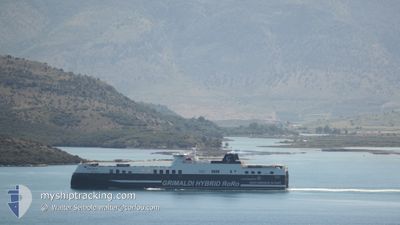
ECO ITALIA
Cargo D

Current Trip
| Time Travelled | 18 h, 54 mins |
|---|---|
| Remaining Time | 1 h, 33 mins |
| Distance Travelled | 315.29 nm |
| Remaining Distance | 19.13 nm |
| AVG Speed | 16.6 Knots |
| MAX Speed | 19.9 Knots |
| AVG Wind | 10.7 knots |
| MAX Wind | 21.7 knots |
| MIN Temp | 11.1°C / 51.98°F |
| MAX Temp | 13.5°C / 56.3°F |
| Dybgang | 6.5 m |
| Position Modtaget | 1 m siden |
Current Position
| Longitude | --- |
|---|---|
| Latitude | --- |
| Status | Under way using engine |
| Fart | 9.2 Knots |
| Kurs | 308.4° |
| Område | Adriatic Sea |
| Station | T-AIS |
| Position Modtaget | 1 m siden |
Information
The current position of ECO ITALIA is in Adriatic Sea with coordinates 45.26853° / 12.53770° as reported on 2025-03-28 19:14 by AIS to our vessel tracker app. The vessel's current speed is 9.2 Knots and is heading at the port of VENEZIA. The estimated time of arrival as calculated by MyShipTracking vessel tracking app is 2025-03-28 21:48 LT
The vessel ECO ITALIA (IMO: 9859612, MMSI: 247384200) is a Cargo D It's sailing under the flag of [IT] Italy.
In this page you can find informations about the vessels current position, last detected port calls, and current voyage information. If the vessels is not in coverage by AIS you will find the latest position.
The current position of ECO ITALIA is detected by our AIS receivers and we are not responsible for the reliability of the data. The last position was recorded while the vessel was in Coverage by the Ais receivers of our vessel tracking app.
The current draught of ECO ITALIA as reported by AIS is 6.5 meters
Weather
| Temperature | 11.1°C / 51.98°F |
|---|---|
| Wind Speed | 11 knots |
| Direction | 36° NE |
| Pressure | 1005.2 hPa |
| Humidity | 89.6 % |
| Cloud Coverage | 100 % |


Featured Company
Last Port Calls
| Port | Arrival | Departure | Time In Port |
|---|---|---|---|
| 2025-03-27 20:45 | 2025-03-28 01:21 | 4 h | |
| 2025-03-27 08:15 | 2025-03-27 11:06 | 2 h | |
| 2025-03-26 12:06 | 2025-03-27 00:38 | 12 h | |
| 2025-03-25 13:59 | 2025-03-25 20:51 | 6 h | |
| 2025-03-24 08:03 | 2025-03-24 20:37 | 12 h | |
| 2025-03-23 14:07 | 2025-03-23 14:16 | 9 m | |
| 2025-03-23 06:45 | 2025-03-23 14:06 | 7 h | |
| 2025-03-22 03:53 | 2025-03-22 16:00 | 12 h | |
| 2025-03-21 18:03 | 2025-03-21 22:00 | 3 h | |
| 2025-03-21 01:25 | 2025-03-21 07:29 | 6 h |
Most Visited Ports (Last year)
| Port | Arrivals | |
|---|---|---|
| 155 | ||
| 79 | ||
| 72 | ||
| 61 |
Last Trips
| Origin | Departure | Destination | Arrival | Distance | |
|---|---|---|---|---|---|
| 2025-03-27 11:06 | 2025-03-27 20:45 | 191.74 nm | |||
| 2025-03-27 00:38 | 2025-03-27 08:15 | 123.84 nm | |||
| 2025-03-25 20:51 | 2025-03-26 12:06 | 298.66 nm | |||
| 2025-03-24 20:37 | 2025-03-25 13:59 | 332.90 nm | |||
| 2025-03-23 14:16 | 2025-03-24 08:03 | 331.51 nm | |||
| 2025-03-23 14:06 | 2025-03-23 14:07 | 0.38 nm | |||
| 2025-03-22 16:00 | 2025-03-23 06:45 | 302.52 nm | |||
| 2025-03-21 22:00 | 2025-03-22 03:53 | 122.49 nm | |||
| 2025-03-21 07:29 | 2025-03-21 18:03 | 188.27 nm | |||
| 2025-03-20 08:17 | 2025-03-21 01:25 | 333.68 nm |
Events
| Tid | Hændelsen | Detaljer | Position / Dest | Info |
|---|---|---|---|---|
| 2025-03-28 15:16 | ETA er ændret | 2025/03/28 19:30 2025/03/28 18:00 |
44.54383 / 13.12054
ITBRI>ITPMA
|
Fart: 16.6 kn Kurs: 340.3° |
| 2025-03-28 15:14 | Ændre havområde | Italian part of the Adriatic Sea Croatian part of the Adriatic Sea |
44.53515 / 13.12485
Adriatic Sea
ITBRI>ITPMA
|
Fart: 16.6 kn Kurs: 340.3° |
| 2025-03-28 15:05 | Ændre havområde | Croatian part of the Adriatic Sea Italian part of the Adriatic Sea |
44.49609 / 13.14442
Adriatic Sea
ITBRI>ITPMA
|
Fart: 16.6 kn Kurs: 339.9° |
| 2025-03-28 14:17 | Status er ændret | Under way using engine Default |
44.29179 / 13.25470
ITBRI>ITPMA
|
Fart: 16.3 kn Kurs: 312° |
| 2025-03-28 14:04 | Status er ændret | Default Under way using engine |
44.24902 / 13.30665
ITBRI>ITPMA
|
Fart: 16.4 kn Kurs: 308° |
| 2025-03-28 13:31 | Status er ændret | Under way using engine Default |
44.15844 / 13.47534
ITBRI>ITPMA
|
Fart: 16.2 kn Kurs: 305° |
| 2025-03-28 13:10 | Status er ændret | Default Under way using engine |
44.10421 / 13.58437
ITBRI>ITPMA
|
Fart: 16.3 kn Kurs: 304.8° |
| 2025-03-28 13:04 | Ændre havområde | Italian part of the Adriatic Sea Croatian part of the Adriatic Sea |
44.08943 / 13.61367
Adriatic Sea
ITBRI>ITPMA
|
Fart: 16.3 kn Kurs: 304.8° |
| 2025-03-28 13:04 | Status er ændret | Under way using engine Default |
44.08866 / 13.61522
ITBRI>ITPMA
|
Fart: 16.3 kn Kurs: 305° |
| 2025-03-28 13:04 | Indenfor Dækning |
44.08943 / 13.61367
Adriatic Sea
ITBRI>ITPMA
|
Fart: 16.3 kn Kurs: 304.8° |