
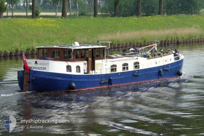
EBENHAEZER
Not available
Current Trip
| Time Travelled | 11 days |
|---|---|
| Remaining Time | --- |
| Distance Travelled | 63.05 nm |
| Remaining Distance | --- |
| AVG Speed | 5.4 Knots |
| MAX Speed | 6.3 Knots |
| AVG Wind | 8.8 knots |
| MAX Wind | 11.6 knots |
| MIN Temp | 12.1°C / 53.78°F |
| MAX Temp | 17.1°C / 62.78°F |
| Dybgang | 1.2 m |
| Position Modtaget | 2 d siden |
Current Position
| Longitude | 6.10213° |
|---|---|
| Latitude | 52.66054° |
| Status | Under way using engine |
| Fart | 5.7 Knots |
| Kurs | 5.2° |
| Område | North Sea |
| Station | T-AIS |
| Position Modtaget | 2 d siden |
Info
Information
The current position of EBENHAEZER is in North Sea with coordinates 52.66054° / 6.10213° as reported on 2024-06-05 09:31 by AIS to our vessel tracker app. The vessel's current speed is 5.7 Knots
The vessel EBENHAEZER (MMSI: 205421670) is a Not available It's sailing under the flag of [BE] Belgium.
In this page you can find informations about the vessels current position, last detected port calls, and current voyage information. If the vessels is not in coverage by AIS you will find the latest position.
The current position of EBENHAEZER is detected by our AIS receivers and we are not responsible for the reliability of the data. The last position was recorded while the vessel was in Coverage by the Ais receivers of our vessel tracking app.
The current draught of EBENHAEZER as reported by AIS is 1.2 meters
Weather
| Temperature | 13.8°C / 56.84°F |
|---|---|
| Wind Speed | 11 knots |
| Direction | 263° W |
| Pressure | 1011.9 hPa |
| Humidity | 60 % |
| Cloud Coverage | 48 % |
Featured Company
Last Port Calls
| Port | Arrival | Departure | Time In Port |
|---|---|---|---|
| 2024-05-27 08:12 | 2024-05-27 08:39 | 27 m | |
| 2024-05-27 07:24 | 2024-05-27 08:01 | 37 m | |
| 2024-05-23 10:04 | 2024-05-23 10:10 | 6 m | |
| 2024-05-04 11:19 | 2024-05-11 07:46 | 6 d | |
| 2024-05-04 06:02 | |||
| 2024-05-02 09:39 | 2024-05-02 10:18 | 39 m | |
| 2024-04-11 06:13 |
Most Visited Ports (Last year)
| Port | Arrivals | |
|---|---|---|
| 2 | ||
| 1 | ||
| 1 | ||
| 1 | ||
| 1 |
Last Trips
| Origin | Departure | Destination | Arrival | Distance | |
|---|---|---|---|---|---|
| 2024-05-27 10:01 | 2024-05-27 10:12 | 0.48 nm | |||
| 2024-05-23 12:10 | 2024-05-27 09:24 | 7.06 nm | |||
| 2024-05-11 09:46 | 2024-05-23 12:04 | 47.07 nm | |||
| 2024-05-04 08:02 | 2024-05-04 13:19 | 22.67 nm | |||
| 2024-04-11 08:13 | 2024-05-02 11:39 | 124.35 nm |
Events
| Tid | Hændelsen | Detaljer | Position / Dest | Info |
|---|---|---|---|---|
| 2024-06-05 09:31 | Udenfor Dækning |
52.66054 / 6.10213
North Sea
MUNSTER
|
Fart: 5.7 kn Kurs: 5.2° |
|
| 2024-06-05 06:39 | START Sejllads | 0.08 nm, South West of KETELHAVEN |
52.57998 / 5.75853
MUNSTER
|
Fart: 3.3 kn Kurs: 21.3° |
| 2024-06-05 06:03 | Dybgangen er ændret | 1.2 1 |
52.57704 / 5.75717
MUNSTER
|
Fart: Kurs: 511° |
| 2024-06-05 06:03 | ETA er ændret | 2024/06/13 17:30 |
52.57704 / 5.75717
MUNSTER
|
Fart: Kurs: 511° |
| 2024-06-05 05:57 | STOP Sejllads | 0.25 nm, South West of KETELHAVEN |
52.57696 / 5.75714
MUNSTER
|
Fart: Kurs: 511° |
| 2024-06-05 05:56 | Indenfor Dækning |
52.57622 / 5.75690
North Sea
|
Fart: 2 kn Kurs: 6.7° |
|
| 2024-06-02 11:13 | Udenfor Dækning |
52.58008 / 5.75851
North Sea
|
Fart: 1.3 kn Kurs: 221.2° |
|
| 2024-06-02 09:14 | Indenfor Dækning |
52.48316 / 5.83962
North Sea
|
Fart: 5.5 kn Kurs: 29.5° |
|
| 2024-05-31 08:45 | Udenfor Dækning |
52.35119 / 5.58103
North Sea
|
Fart: 5.3 kn Kurs: 63.7° |
|
| 2024-05-31 08:40 | Indenfor Dækning |
52.34603 / 5.57304
North Sea
|
Fart: 5.3 kn Kurs: 21.8° |