
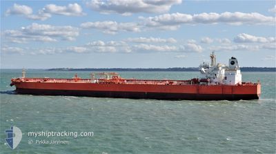
EAGLE LYON
Tanker
Current Trip
| Trip Time | 28 days |
|---|---|
| Trip Distance | 7202.36 nm |
| AVG Speed | 11.5 Knots |
| MAX Speed | 15.9 Knots |
| Dybgang | 9 m |
| AVG Wind | 12.1 knots |
| MAX Wind | 43 knots |
| MIN Temp | 12.6°C / 54.68°F |
| MAX Temp | 28.5°C / 83.3°F |
| Position Modtaget | 5 d siden |
Current Position
| Longitude | --- |
|---|---|
| Latitude | --- |
| Status | Under way using engine |
| Fart | 10.4 Knots |
| Kurs | 297.4° |
| Område | Persian Gulf |
| Station | T-AIS |
| Position Modtaget | 5 d siden |
Info
Information
The current position of EAGLE LYON is in Persian Gulf with coordinates 30.00130° / 47.96755° as reported on 2026-01-02 10:09 by AIS to our vessel tracker app. The vessel's current speed is 10.4 Knots and is currently inside the port of KHOR AL ZUBAIR.
The vessel EAGLE LYON (IMO: 9795115, MMSI: 563027100) is a Tanker It's sailing under the flag of [SG] Singapore.
In this page you can find informations about the vessels current position, last detected port calls, and current voyage information. If the vessels is not in coverage by AIS you will find the latest position.
The current position of EAGLE LYON is detected by our AIS receivers and we are not responsible for the reliability of the data. The last position was recorded while the vessel was in Coverage by the Ais receivers of our vessel tracking app.
The current draught of EAGLE LYON as reported by AIS is 9 meters
Weather
| Temperature | 18.1°C / 64.58°F |
|---|---|
| Wind Speed | 6 knots |
| Direction | 315° NW |
| Pressure | 1022.2 hPa |
| Humidity | 20.2 % |
| Cloud Coverage | --- |
Featured Company
Last Port Calls
| Port | Arrival | Departure | Time In Port |
|---|---|---|---|
| 2026-01-02 15:16 | |||
| 2025-12-01 21:15 | 2025-12-05 11:00 | 3 d | |
| 2025-11-15 05:08 | 2025-11-17 23:24 | 2 d | |
| 2025-11-10 09:10 | 2025-11-11 10:10 | 1 d |
Most Visited Ports (Last year)
| Port | Arrivals | |
|---|---|---|
| 2 | ||
| 2 | ||
| 2 | ||
| 2 | ||
| 1 | ||
| 1 |
Last Trips
| Origin | Departure | Destination | Arrival | Distance | |
|---|---|---|---|---|---|
| 2025-12-05 11:00 | 2026-01-02 15:16 | 7202.36 nm | |||
| 2025-11-17 23:24 | 2025-12-01 21:15 | 3953.55 nm | |||
| 2025-11-11 10:10 | 2025-11-15 05:08 | 43.12 nm | |||
| 2025-10-31 11:38 | 2025-11-10 09:10 | 2386.32 nm |
Events
| Tid | Hændelsen | Detaljer | Position / Dest | Info |
|---|---|---|---|---|
| 2026-01-02 12:16 | Skibe i havn |
|
30.19824 / 47.88251
[IQ] KHOR AL ZUBAIR
|
Fart: 1.2 kn Kurs: 324° |
| 2026-01-02 10:17 | Status er ændret | Default Under way using engine |
30.02002 / 47.95566
IQ KAZ
|
Fart: 10.4 kn Kurs: 297.4° |
| 2026-01-02 10:09 | Udenfor Dækning |
30.00130 / 47.96755
Persian Gulf
|
Fart: 10.4 kn Kurs: 297.4° |
|
| 2026-01-02 09:58 | Ændre havområde | Iraqi part of the Persian Gulf Kuwaiti part of the Persian Gulf |
29.99496 / 48.00267
Persian Gulf
|
Fart: 10.3 kn Kurs: 279° |
| 2026-01-02 09:42 | Ændre havområde | Kuwaiti part of the Persian Gulf Iraqi part of the Persian Gulf |
30.01887 / 48.04390
Persian Gulf
IQ KAZ
|
Fart: 10.7 kn Kurs: 222.2° |
| 2026-01-02 09:42 | Status er ændret | Under way using engine Default |
30.02066 / 48.04579
IQ KAZ
|
Fart: 10.6 kn Kurs: 226° |
| 2026-01-02 09:33 | Status er ændret | Default Under way using engine |
30.03167 / 48.07340
IQ KAZ
|
Fart: 11.2 kn Kurs: 274° |
| 2026-01-02 09:06 | Ændre havområde | Iraqi part of the Persian Gulf Kuwaiti part of the Persian Gulf |
30.02267 / 48.16515
Persian Gulf
IQ KAZ
|
Fart: 11.5 kn Kurs: 301.7° |
| 2026-01-02 09:04 | Ændre havområde | Kuwaiti part of the Persian Gulf Iraqi part of the Persian Gulf |
30.01935 / 48.17152
Persian Gulf
IQ KAZ
|
Fart: 11.5 kn Kurs: 299.9° |
| 2026-01-02 08:49 | Ændre havområde | Iraqi part of the Persian Gulf Kuwaiti part of the Persian Gulf |
29.99243 / 48.21671
Persian Gulf
IQ KAZ
|
Fart: 11.8 kn Kurs: 316.3° |