
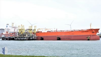
EAGLE HALIFAX
Crude Oil Tanker
Current Trip
CCLZ
| Time Travelled | 6 days |
|---|---|
| Remaining Time | --- |
| Distance Travelled | 277.33 nm |
| Remaining Distance | --- |
| AVG Speed | 7.7 Knots |
| MAX Speed | 13.6 Knots |
| AVG Wind | 11.7 knots |
| MAX Wind | 24.8 knots |
| MIN Temp | 23.6°C / 74.48°F |
| MAX Temp | 32.4°C / 90.32°F |
| Dybgang | 8.5 m |
| Position Modtaget | 3 d siden |
Current Position
| Longitude | -96.92228° |
|---|---|
| Latitude | 27.72247° |
| Status | At anchor |
| Fart | |
| Kurs | 66° |
| Område | Gulf of Mexico |
| Station | T-AIS |
| Position Modtaget | 3 d siden |
Info
Information
The current position of EAGLE HALIFAX is in Gulf of Mexico with coordinates 27.72247° / -96.92228° as reported on 2024-05-16 00:15 by AIS to our vessel tracker app. The vessel's current speed is 0 Knots
The vessel EAGLE HALIFAX (IMO: 9453987, MMSI: 235076282) is a Crude Oil Tanker that was built in 2010 ( 14 år gamle ). It's sailing under the flag of [GB] United Kingdom.
In this page you can find informations about the vessels current position, last detected port calls, and current voyage information. If the vessels is not in coverage by AIS you will find the latest position.
The current position of EAGLE HALIFAX is detected by our AIS receivers and we are not responsible for the reliability of the data. The last position was recorded while the vessel was in Coverage by the Ais receivers of our vessel tracking app.
The current draught of EAGLE HALIFAX as reported by AIS is 8.5 meters
Weather
| Temperature | 26.7°C / 80.06°F |
|---|---|
| Wind Speed | 11 knots |
| Direction | 83° E |
| Pressure | 1012.4 hPa |
| Humidity | 84.6 % |
| Cloud Coverage | 51 % |
Featured Company
Last Port Calls
| Port | Arrival | Departure | Time In Port |
|---|---|---|---|
| 2024-05-11 11:34 | 2024-05-13 07:54 | 1 d | |
| 2024-05-08 10:26 | 2024-05-10 07:13 | 1 d | |
| 2024-04-24 20:44 | 2024-04-26 13:10 | 1 d | |
| 2024-04-17 10:19 | 2024-04-17 11:16 | 57 m | |
| 2024-04-15 17:28 | 2024-04-17 07:40 | 1 d | |
| 2024-04-08 11:09 | 2024-04-10 12:23 | 2 d | |
| 2024-03-30 11:07 | 2024-04-01 01:55 | 1 d | |
| 2024-03-21 00:09 | 2024-03-22 06:32 | 1 d | |
| 2024-03-07 15:54 | 2024-03-07 16:38 | 43 m | |
| 2024-03-01 08:04 |
Most Visited Ports (Last year)
| Port | Arrivals | |
|---|---|---|
| 7 | ||
| 5 | ||
| 5 | ||
| 3 | ||
| 2 | ||
| 2 |
Last Trips
| Origin | Departure | Destination | Arrival | Distance | |
|---|---|---|---|---|---|
| 2024-05-10 07:13 | 2024-05-11 11:34 | 324.83 nm | |||
| 2024-04-26 13:10 | 2024-05-08 10:26 | 652.91 nm | |||
| 2024-04-17 11:16 | 2024-04-24 20:44 | 1215.15 nm | |||
| 2024-04-17 07:40 | 2024-04-17 10:19 | 19.23 nm | |||
| 2024-04-10 12:23 | 2024-04-15 17:28 | 257.85 nm | |||
| 2024-04-01 01:55 | 2024-04-08 11:09 | 628.83 nm | |||
| 2024-03-22 06:32 | 2024-03-30 11:07 | 1923.46 nm | |||
| 2024-03-07 16:38 | 2024-03-21 00:09 | 2153.99 nm | |||
| 2024-03-01 08:04 | 2024-03-07 15:54 | 296.46 nm |
Events
| Tid | Hændelsen | Detaljer | Position / Dest | Info |
|---|---|---|---|---|
| 2024-05-19 06:46 | STOP Sejllads |
27.70802 / -96.23618
CCLZ
|
Fart: 0.2 kn Kurs: 205° |
|
| 2024-05-18 17:43 | START Sejllads | 4.25 nm, West of CORPUS CHRISTI |
27.81633 / -97.46298
CCLZ
|
Fart: 3.6 kn Kurs: 88° |
| 2024-05-16 14:27 | STOP Sejllads | 4.67 nm, West of CORPUS CHRISTI |
27.81745 / -97.47073
CCLZ
|
Fart: 0.1 kn Kurs: 108° |
| 2024-05-16 09:10 | START Sejllads | 10.51 nm, South East of PORT ARANSAS |
27.72635 / -96.91779
CCLZ
|
Fart: 3.3 kn Kurs: 56° |
| 2024-05-16 00:21 | Status er ændret | Default At anchor |
27.72246 / -96.92227
CCLZ
|
Fart: Kurs: 66° |
| 2024-05-16 00:15 | Status er ændret | At anchor Default |
27.72247 / -96.92228
CCLZ
|
Fart: Kurs: 66° |
| 2024-05-16 00:15 | Udenfor Dækning |
27.72247 / -96.92228
Gulf of Mexico
|
Fart: Kurs: 312.3° |
|
| 2024-05-16 00:12 | Status er ændret | Default At anchor |
27.72249 / -96.92230
CCLZ
|
Fart: Kurs: 63° |
| 2024-05-16 00:06 | Status er ændret | At anchor Default |
27.72241 / -96.92223
CCLZ
|
Fart: Kurs: 67° |
| 2024-05-15 23:52 | Indenfor Dækning |
27.72241 / -96.92223
Gulf of Mexico
|
Fart: Kurs: 93.7° |