

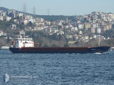
DREMORA 1
General Cargo

Current Trip
Current Position
| Longitude | --- |
|---|---|
| Latitude | --- |
| Status | At anchor |
| Fart | |
| Kurs | 340° |
| Område | Adriatic Sea |
| Station | T-AIS |
| Position Modtaget | 1 m siden |
Information
The current position of DREMORA 1 is in Adriatic Sea with coordinates 45.66013° / 13.76203° as reported on 2025-03-27 23:54 by AIS to our vessel tracker app. The vessel's current speed is 0 Knots and is currently inside the port of TRIESTE.
The vessel DREMORA 1 (IMO: 9407029, MMSI: 341654000) is a General Cargo that was built in 2008 ( 17 år gamle ). It's sailing under the flag of [KN] St Kitts Nevis.
In this page you can find informations about the vessels current position, last detected port calls, and current voyage information. If the vessels is not in coverage by AIS you will find the latest position.
The current position of DREMORA 1 is detected by our AIS receivers and we are not responsible for the reliability of the data. The last position was recorded while the vessel was in Coverage by the Ais receivers of our vessel tracking app.
The current draught of DREMORA 1 as reported by AIS is 4.5 meters
Weather
| Temperature | 11.4°C / 52.52°F |
|---|---|
| Wind Speed | 5 knots |
| Direction | 19° NNE |
| Pressure | 1010 hPa |
| Humidity | 66.3 % |
| Cloud Coverage | 100 % |


Featured Company
Most Visited Ports (Last year)
| Port | Arrivals | |
|---|---|---|
| 4 | ||
| 2 | ||
| 2 | ||
| 1 | ||
| 1 | ||
| 1 |
Events
| Tid | Hændelsen | Detaljer | Position / Dest | Info |
|---|---|---|---|---|
| 2025-03-27 23:07 | Dybgangen er ændret | 4.5 4 |
45.66011 / 13.76203
[IT] TRIESTE
|
Fart: Kurs: 340° |
| 2025-03-27 23:07 | ETA er ændret | 2025/03/22 15:00 |
45.66011 / 13.76203
[IT] TRIESTE
|
Fart: Kurs: 340° |
| 2025-03-27 23:01 | Dybgangen er ændret | 4 4.5 |
45.66011 / 13.76203
[IT] TRIESTE
|
Fart: Kurs: 340° |
| 2025-03-27 21:37 | Dybgangen er ændret | 4.5 4 |
45.66012 / 13.76203
[IT] TRIESTE
|
Fart: Kurs: 340° |
| 2025-03-27 21:37 | ETA er ændret | 2025/03/22 15:00 |
45.66012 / 13.76203
[IT] TRIESTE
|
Fart: Kurs: 340° |
| 2025-03-27 21:31 | Dybgangen er ændret | 4 4.5 |
45.66011 / 13.76203
[IT] TRIESTE
|
Fart: Kurs: 340° |
| 2025-03-27 18:55 | Dybgangen er ændret | 4.5 4 |
45.66013 / 13.76206
[IT] TRIESTE
|
Fart: Kurs: 340° |
| 2025-03-27 18:55 | ETA er ændret | 2025/03/22 15:00 |
45.66013 / 13.76206
[IT] TRIESTE
|
Fart: Kurs: 340° |
| 2025-03-27 18:49 | Dybgangen er ændret | 4 4.5 |
45.66013 / 13.76206
[IT] TRIESTE
|
Fart: Kurs: 340° |
| 2025-03-27 18:43 | Dybgangen er ændret | 4.5 4 |
45.66013 / 13.76204
[IT] TRIESTE
|
Fart: Kurs: 340° |