

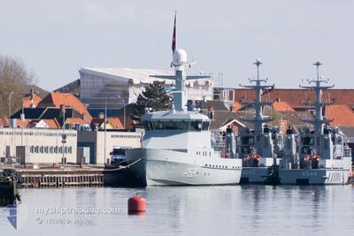
DNK NAVY PATROL P521
Military ops

Current Trip
Current Position
| Longitude | --- |
|---|---|
| Latitude | --- |
| Status | Moored |
| Fart | |
| Kurs | 335° |
| Område | Kattegat |
| Station | T-AIS |
| Position Modtaget | Nu |
Information
The current position of DNK NAVY PATROL P521 is in Kattegat with coordinates 55.33017° / 11.12915° as reported on 2025-03-30 10:16 by AIS to our vessel tracker app. The vessel's current speed is 0 Knots and is currently inside the port of KORSOR.
The vessel DNK NAVY PATROL P521 (MMSI: 220432000) is a Military ops It's sailing under the flag of [DK] Denmark.
In this page you can find informations about the vessels current position, last detected port calls, and current voyage information. If the vessels is not in coverage by AIS you will find the latest position.
The current position of DNK NAVY PATROL P521 is detected by our AIS receivers and we are not responsible for the reliability of the data. The last position was recorded while the vessel was in Coverage by the Ais receivers of our vessel tracking app.
The current draught of DNK NAVY PATROL P521 as reported by AIS is 2.7 meters
Weather
| Temperature | 7.2°C / 44.96°F |
|---|---|
| Wind Speed | 11 knots |
| Direction | 257° WSW |
| Pressure | 1001.3 hPa |
| Humidity | 84 % |
| Cloud Coverage | 86 % |


Featured Company
Last Port Calls
| Port | Arrival | Departure | Time In Port |
|---|---|---|---|
| 2025-03-26 08:03 | |||
| 2025-03-23 15:34 | 2025-03-24 06:03 | 14 h | |
| 2025-03-22 16:50 | 2025-03-23 09:06 | 16 h | |
| 2025-03-20 09:40 | 2025-03-22 09:10 | 1 d | |
| 2025-03-18 18:05 | 2025-03-19 12:40 | 18 h | |
| 2025-03-17 22:49 | 2025-03-18 12:42 | 13 h | |
| 2025-03-15 19:28 | 2025-03-17 06:06 | 1 d | |
| 2025-03-14 21:12 | 2025-03-15 12:38 | 15 h | |
| 2025-03-13 07:02 | 2025-03-14 07:08 | 1 d | |
| 2025-03-11 00:29 | 2025-03-12 21:48 | 1 d |
Last Trips
| Origin | Departure | Destination | Arrival | Distance | |
|---|---|---|---|---|---|
| 2025-03-24 06:03 | 2025-03-26 08:03 | 628.12 nm | |||
| 2025-03-23 09:06 | 2025-03-23 15:34 | 74.34 nm | |||
| 2025-03-22 09:10 | 2025-03-22 16:50 | 99.91 nm | |||
| 2025-03-19 12:40 | 2025-03-20 09:40 | 314.94 nm | |||
| 2025-03-18 12:42 | 2025-03-18 18:05 | 74.41 nm | |||
| 2025-03-17 06:06 | 2025-03-17 22:49 | 204.59 nm | |||
| 2025-03-15 12:38 | 2025-03-15 19:28 | 77.07 nm | |||
| 2025-03-14 07:08 | 2025-03-14 21:12 | 94.66 nm | |||
| 2025-03-12 21:48 | 2025-03-13 07:02 | 129.79 nm | |||
| 2025-03-10 12:43 | 2025-03-11 00:29 | 169.63 nm |
Events
| Tid | Hændelsen | Detaljer | Position / Dest | Info |
|---|---|---|---|---|
| 2025-03-26 11:16 | Status er ændret | Moored Under way using engine |
55.33016 / 11.12918
[DK] KORSOR
|
Fart: 0.1 kn Kurs: 335° |
| 2025-03-26 11:02 | Status er ændret | Under way using engine Moored |
55.33045 / 11.12819
[DK] KORSOR
|
Fart: Kurs: 336° |
| 2025-03-26 07:20 | Status er ændret | Moored Under way using engine |
55.33054 / 11.12823
[DK] KORSOR
|
Fart: 0.1 kn Kurs: 343° |
| 2025-03-26 07:11 | STOP Sejllads |
55.33031 / 11.12778
[DK] KORSOR
|
Fart: 0.3 kn Kurs: 91° |
|
| 2025-03-26 07:03 | Skibe i havn |
|
55.33296 / 11.11988
[DK] KORSOR
|
Fart: 8.7 kn Kurs: 75.7° |
| 2025-03-25 07:10 | START Sejllads | 2.77 nm, South West of KORSOR |
55.31431 / 11.06518
UNKNOWN
|
Fart: 8.8 kn Kurs: 184.6° |
| 2025-03-25 07:07 | STOP Sejllads | 2.66 nm, South West of KORSOR |
55.31562 / 11.06763
UNKNOWN
|
Fart: 0.2 kn Kurs: 279° |
| 2025-03-25 03:02 | Ændre havområde | Danish part of the Kattegat Danish part of the Baltic Sea |
54.74988 / 10.91342
Kattegat
|
Fart: 10.1 kn Kurs: 359.9° |
| 2025-03-24 17:34 | Fundet i havområde | Danish part of the Baltic Sea |
54.86010 / 12.95776
Baltic Sea
|
Fart: 10 kn Kurs: 247.9° |
| 2025-03-24 11:43 | Ændre havområde | German part of the Baltic Sea Danish part of the Baltic Sea |
54.91317 / 13.05358
Baltic Sea
|
Fart: 18.4 kn Kurs: 81.4° |