
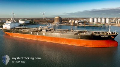
DIMITRIS P
Crude Oil Tanker
Current Trip
| Time Travelled | 8 h, 56 mins |
|---|---|
| Remaining Time | 1 day |
| Distance Travelled | 35.58 nm |
| Remaining Distance | 373.97 nm |
| AVG Speed | 12.4 Knots |
| MAX Speed | 13.1 Knots |
| AVG Wind | 17.2 knots |
| MAX Wind | 19.4 knots |
| MIN Temp | 4.5°C / 40.1°F |
| MAX Temp | 5.5°C / 41.9°F |
| Dybgang | 9.3 m |
| Position Modtaget | 6 h, 3 m siden |
Current Position
| Longitude | --- |
|---|---|
| Latitude | --- |
| Status | Under way using engine |
| Fart | 12.9 Knots |
| Kurs | 62.9° |
| Område | Black Sea |
| Station | T-AIS |
| Position Modtaget | 6 h, 3 m siden |
Info
Information
The current position of DIMITRIS P is in Black Sea with coordinates 41.49104° / 29.79880° as reported on 2025-02-18 12:15 by AIS to our vessel tracker app. The vessel's current speed is 12.9 Knots and is heading at the port of NOVOROSSIYSK. The estimated time of arrival as calculated by MyShipTracking vessel tracking app is 2025-02-19 20:12 LT
The vessel DIMITRIS P (IMO: 9565950, MMSI: 636015302) is a Crude Oil Tanker that was built in 2011 ( 14 år gamle ). It's sailing under the flag of [LR] Liberia.
In this page you can find informations about the vessels current position, last detected port calls, and current voyage information. If the vessels is not in coverage by AIS you will find the latest position.
The current position of DIMITRIS P is detected by our AIS receivers and we are not responsible for the reliability of the data. The last position was recorded while the vessel was in Coverage by the Ais receivers of our vessel tracking app.
The current draught of DIMITRIS P as reported by AIS is 9.3 meters
Weather
| Temperature | 5.2°C / 41.36°F |
|---|---|
| Wind Speed | 22 knots |
| Direction | 63° ENE |
| Pressure | 1022.2 hPa |
| Humidity | 66.9 % |
| Cloud Coverage | 100 % |
Featured Company
Last Port Calls
Most Visited Ports (Last year)
| Port | Arrivals | |
|---|---|---|
| 4 | ||
| 3 | ||
| 3 | ||
| 3 | ||
| 2 | ||
| 2 |
Last Trips
| Origin | Departure | Destination | Arrival | Distance | |
|---|---|---|---|---|---|
| 2025-02-05 08:48 | 2025-02-18 10:50 | 1683.49 nm | |||
| 2025-01-12 19:39 | 2025-02-03 02:16 | 5690.90 nm | |||
| 2024-12-24 14:28 | 2025-01-10 14:03 | 5262.20 nm | |||
| 2024-12-20 10:49 | 2024-12-21 12:28 | 301.57 nm | |||
| 2024-11-30 12:59 | 2024-12-18 12:05 | 5057.75 nm |
Events
| Tid | Hændelsen | Detaljer | Position / Dest | Info |
|---|---|---|---|---|
| 2025-02-18 12:18 | Status er ændret | Default Under way using engine |
41.49554 / 29.80994
RUNVS
|
Fart: 12.9 kn Kurs: 62.9° |
| 2025-02-18 12:15 | Udenfor Dækning |
41.49104 / 29.79880
Black Sea
RUNVS
|
Fart: 12.9 kn Kurs: 62.9° |
|
| 2025-02-18 09:38 | Ændre havområde | Turkish part of the Black Sea Turkish part of the Sea of Marmara |
41.23865 / 29.15512
Black Sea
RUNVS
|
Fart: 11.4 kn Kurs: 45.9° |
| 2025-02-18 09:23 | Afsejlet fra sidste havn |
|
41.20432 / 29.11633
RUNVS
|
Fart: 7.9 kn Kurs: 41° |
| 2025-02-18 08:06 | START Sejllads |
41.03988 / 29.02514
[TR] ISTANBUL
|
Fart: 9.3 kn Kurs: 58° |
|
| 2025-02-18 07:50 | STOP Sejllads |
41.01009 / 28.99716
[TR] ISTANBUL
|
Fart: 0.1 kn Kurs: 2° |
|
| 2025-02-18 07:50 | Skibe i havn |
|
41.01009 / 28.99716
[TR] ISTANBUL
|
Fart: 9 kn Kurs: 1.9° |
| 2025-02-18 02:50 | START Sejllads | 9.16 nm, South of BAKIRKOY |
40.82682 / 28.93598
RUNVS
|
Fart: 3.1 kn Kurs: 90° |
| 2025-02-17 21:25 | STOP Sejllads | 8.14 nm, South West of MALTEPE |
40.81172 / 29.01273
RUNVS
|
Fart: 0.3 kn Kurs: 5° |
| 2025-02-17 19:37 | START Sejllads | 9.19 nm, South East of YESILKOY |
40.82061 / 28.92171
RUNVS
|
Fart: 3.1 kn Kurs: 40° |