
DIDE
General Cargo
Current Trip
| Trip Time | 5 h, 30 mins |
|---|---|
| Trip Distance | 35.85 nm |
| AVG Speed | 5.4 Knots |
| MAX Speed | 7.9 Knots |
| Dybgang | 1.5 m |
| AVG Wind | 19.4 knots |
| MAX Wind | 24.9 knots |
| MIN Temp | 2.4°C / 36.32°F |
| MAX Temp | 3.2°C / 37.76°F |
| Position Modtaget | 22 h, 37 m siden |
Current Position
| Longitude | --- |
|---|---|
| Latitude | --- |
| Status | Under way using engine |
| Fart | 6.3 Knots |
| Kurs | 307.3° |
| Område | North Sea |
| Station | T-AIS |
| Position Modtaget | 22 h, 37 m siden |
Information
The current position of DIDE is in North Sea with coordinates 54.02773° / 8.49820° as reported on 2025-02-19 14:46 by AIS to our vessel tracker app. The vessel's current speed is 6.3 Knots and is currently inside the port of HELGOLAND.
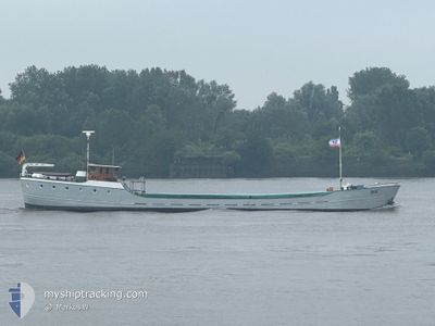
The vessel DIDE (IMO: 6613586, MMSI: 211254620) is a General Cargo that was built in 1901 ( 124 år gamle ). It's sailing under the flag of [DE] Germany.
In this page you can find informations about the vessels current position, last detected port calls, and current voyage information. If the vessels is not in coverage by AIS you will find the latest position.
The current position of DIDE is detected by our AIS receivers and we are not responsible for the reliability of the data. The last position was recorded while the vessel was in Coverage by the Ais receivers of our vessel tracking app.
The current draught of DIDE as reported by AIS is 1.5 meters
Weather
| Temperature | 3.9°C / 39.02°F |
|---|---|
| Wind Speed | 18 knots |
| Direction | 154° SSE |
| Pressure | 1019.7 hPa |
| Humidity | 78.9 % |
| Cloud Coverage | 100 % |
Featured Company
Last Port Calls
| Port | Arrival | Departure | Time In Port |
|---|---|---|---|
| 2025-02-19 18:02 | |||
| 2025-02-18 13:53 | 2025-02-19 12:32 | 22 h | |
| 2025-02-17 23:32 | 2025-02-18 09:32 | 9 h | |
| 2025-02-17 15:30 |
Events
| Tid | Hændelsen | Detaljer | Position / Dest | Info |
|---|---|---|---|---|
| 2025-02-19 18:05 | STOP Sejllads |
54.17878 / 7.88944
[DE] HELGOLAND
|
Fart: 0.1 kn Kurs: -1° |
|
| 2025-02-19 18:02 | Skibe i havn |
|
54.17871 / 7.88947
[DE] HELGOLAND
|
Fart: 6.9 kn Kurs: 328° |
| 2025-02-19 14:53 | Status er ændret | Default Under way using engine |
54.03306 / 8.47988
HELGOLAND
|
Fart: 6.3 kn Kurs: 307.3° |
| 2025-02-19 14:46 | Udenfor Dækning |
54.02773 / 8.49820
North Sea
HELGOLAND
|
Fart: 6.3 kn Kurs: 307.3° |
|
| 2025-02-19 12:32 | Afsejlet fra sidste havn |
|
53.87261 / 8.71470
HELGOLAND
|
Fart: 5.6 kn Kurs: 26.8° |
| 2025-02-19 12:29 | START Sejllads |
53.86852 / 8.71115
[DE] CUXHAVEN
|
Fart: 3.9 kn Kurs: 17.9° |
|
| 2025-02-19 12:15 | STOP Sejllads |
53.86662 / 8.71035
[DE] CUXHAVEN
|
Fart: 0.2 kn Kurs: 511° |
|
| 2025-02-19 12:01 | START Sejllads |
53.85639 / 8.72103
[DE] CUXHAVEN
|
Fart: 3.2 kn Kurs: 315.5° |
|
| 2025-02-18 14:42 | Destination er ændret | HELGOLAND CUXHAVEN |
53.85561 / 8.72391
[DE] CUXHAVEN
|
Fart: Kurs: 511° |
| 2025-02-18 14:42 | ETA er ændret | 2025/02/19 17:00 2025/02/18 16:00 |
53.85561 / 8.72391
[DE] CUXHAVEN
|
Fart: Kurs: 511° |