
DEVON
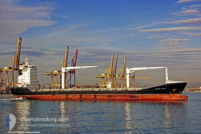
Cargo/Container Ship
Current Trip
| Time Travelled | 7 days |
|---|---|
| Remaining Time | --- |
| Distance Travelled | 1330.14 nm |
| Remaining Distance | 5.98 nm |
| AVG Speed | 13.2 Knots |
| MAX Speed | 15.5 Knots |
| AVG Wind | 10.9 knots |
| MAX Wind | 21.5 knots |
| MIN Temp | 17.7°C / 63.86°F |
| MAX Temp | 27°C / 80.6°F |
| Dybgang | 8.8 m |
| Position Modtaget | 7 d siden |
Current Position
| Longitude | --- |
|---|---|
| Latitude | --- |
| Status | Under way using engine |
| Fart | 14.9 Knots |
| Kurs | 162.4° |
| Område | Laccadive Sea |
| Station | T-AIS |
| Position Modtaget | 7 d siden |
Info
Information
The current position of DEVON is in Laccadive Sea with coordinates 6.25183° / 79.91761° as reported on 2026-02-10 04:02 by AIS to our vessel tracker app. The vessel's current speed is 14.9 Knots and is heading at the port of CHITTAGONG. The estimated time of arrival as calculated by MyShipTracking vessel tracking app is 2026-02-14 10:00 LT
The vessel DEVON (IMO: 9406843, MMSI: 255805599) is a Cargo/Container Ship that was built in 2008 ( 18 år gamle ). It's sailing under the flag of [PT] Portugal.
In this page you can find informations about the vessels current position, last detected port calls, and current voyage information. If the vessels is not in coverage by AIS you will find the latest position.
The current position of DEVON is detected by our AIS receivers and we are not responsible for the reliability of the data. The last position was recorded while the vessel was in Coverage by the Ais receivers of our vessel tracking app.
The current draught of DEVON as reported by AIS is 8.8 meters
Weather
| Temperature | 24.2°C / 75.56°F |
|---|---|
| Wind Speed | 9 knots |
| Direction | 289° WNW |
| Pressure | 1009.8 hPa |
| Humidity | 57.8 % |
| Cloud Coverage | --- |
Featured Company
Last Port Calls
| Port | Arrival | Departure | Time In Port |
|---|---|---|---|
| 2026-02-09 13:06 | 2026-02-10 05:27 | 16 h | |
| 2026-02-01 09:17 | 2026-02-05 15:45 | 4 d | |
| 2026-01-27 05:53 | 2026-01-28 03:59 | 22 h | |
| 2026-01-17 10:13 | 2026-01-20 13:05 | 3 d | |
| 2026-01-11 21:49 | 2026-01-12 10:06 | 12 h | |
| 2026-01-10 00:15 | 2026-01-10 13:46 | 13 h | |
| 2025-12-10 12:45 | 2025-12-11 02:52 | 14 h |
Most Visited Ports (Last year)
| Port | Arrivals | |
|---|---|---|
| 8 | ||
| 6 | ||
| 3 | ||
| 3 | ||
| 3 | ||
| 2 |
Last Trips
| Origin | Departure | Destination | Arrival | Distance | |
|---|---|---|---|---|---|
| 2026-02-05 15:45 | 2026-02-09 13:06 | 1310.60 nm | |||
| 2026-01-28 03:59 | 2026-02-01 09:17 | 1311.54 nm | |||
| 2026-01-20 13:05 | 2026-01-27 05:53 | 1460.63 nm | |||
| 2026-01-12 10:06 | 2026-01-17 10:13 | 1525.37 nm | |||
| 2026-01-10 13:46 | 2026-01-11 21:49 | 189.02 nm | |||
| 2025-12-11 02:52 | 2026-01-10 00:15 | 4542.04 nm | |||
| 2025-11-22 08:57 | 2025-12-10 12:45 | 913.73 nm |
Events
| Tid | Hændelsen | Detaljer | Position / Dest | Info |
|---|---|---|---|---|
| 2026-02-14 04:03 | STOP Sejllads | --- |
22.23490 / 91.71865
BDCGP
|
Fart: 0.3 kn Kurs: 163° |
| 2026-02-10 04:08 | Status er ændret | Default Under way using engine |
6.22833 / 79.92500
BDCGP
|
Fart: 14.9 kn Kurs: 162.4° |
| 2026-02-10 04:02 | Udenfor Dækning |
6.25183 / 79.91761
Laccadive Sea
BDCGP
|
Fart: 14.9 kn Kurs: 162.4° |
|
| 2026-02-10 03:52 | Status er ændret | Under way using engine Default |
6.29259 / 79.90668
BDCGP
|
Fart: 14.7 kn Kurs: 163° |
| 2026-02-10 03:41 | Status er ændret | Default Under way using engine |
6.33708 / 79.89537
BDCGP
|
Fart: 14.6 kn Kurs: 162.3° |
| 2026-02-10 00:00 | Dybgangen er ændret | 8.8 7.4 |
6.97041 / 79.83472
BDCGP
|
Fart: 5.4 kn Kurs: 333.8° |
| 2026-02-10 00:00 | ETA er ændret | 2026/02/14 04:00 2026/02/09 07:00 |
6.97041 / 79.83472
BDCGP
|
Fart: 5.4 kn Kurs: 333.8° |
| 2026-02-09 23:57 | Afsejlet fra sidste havn |
|
6.96767 / 79.83593
BDCGP
|
Fart: 4.9 kn Kurs: 338° |
| 2026-02-09 23:44 | START Sejllads |
6.94934 / 79.82905
[LK] COLOMBO
|
Fart: 3.4 kn Kurs: 24° |
|
| 2026-02-09 23:36 | Status er ændret | Under way using engine Default |
6.94715 / 79.82725
[LK] COLOMBO
|
Fart: Kurs: -1° |