
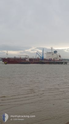
DESERT OAK
Oil/Chemical Tanker
Current Trip
| Time Travelled | 7 days |
|---|---|
| Remaining Time | --- |
| Distance Travelled | 810.49 nm |
| Remaining Distance | --- |
| AVG Speed | 11.5 Knots |
| MAX Speed | 13.3 Knots |
| AVG Wind | 12.2 knots |
| MAX Wind | 15 knots |
| MIN Temp | 27.4°C / 81.32°F |
| MAX Temp | 30.2°C / 86.36°F |
| Dybgang | 5.1 m |
| Position Modtaget | 3 d siden |
Current Position
| Longitude | -63.46402° |
|---|---|
| Latitude | 17.12998° |
| Status | Under way using engine |
| Fart | 12.5 Knots |
| Kurs | 247° |
| Område | Caribbean Sea |
| Station | T-AIS |
| Position Modtaget | 3 d siden |
Info
Information
The current position of DESERT OAK is in Caribbean Sea with coordinates 17.12998° / -63.46402° as reported on 2024-05-18 11:42 by AIS to our vessel tracker app. The vessel's current speed is 12.5 Knots and is heading at the port of ST EUSTATIUS. The estimated time of arrival as calculated by MyShipTracking vessel tracking app is 2024-05-18 01:30 LT
The vessel DESERT OAK (IMO: 9445667, MMSI: 538005560) is a Oil/Chemical Tanker that was built in 2008 ( 16 år gamle ). It's sailing under the flag of [MH] Marshall Is.
In this page you can find informations about the vessels current position, last detected port calls, and current voyage information. If the vessels is not in coverage by AIS you will find the latest position.
The current position of DESERT OAK is detected by our AIS receivers and we are not responsible for the reliability of the data. The last position was recorded while the vessel was in Coverage by the Ais receivers of our vessel tracking app.
The current draught of DESERT OAK as reported by AIS is 5.1 meters
Weather
| Temperature | 28.3°C / 82.94°F |
|---|---|
| Wind Speed | 14 knots |
| Direction | 118° ESE |
| Pressure | 1013.2 hPa |
| Humidity | 79.4 % |
| Cloud Coverage | 100 % |
Featured Company
Last Port Calls
| Port | Arrival | Departure | Time In Port |
|---|---|---|---|
| 2024-05-12 15:53 | 2024-05-14 19:24 | 2 d | |
| 2024-05-07 21:18 | 2024-05-10 17:33 | 2 d | |
| 2024-05-07 16:01 | 2024-05-07 20:10 | 4 h | |
| 2024-04-27 23:03 | 2024-05-03 00:31 | 5 d | |
| 2024-04-24 16:24 | 2024-04-26 15:04 | 1 d | |
| 2024-04-19 05:00 | 2024-04-23 06:56 | 4 d | |
| 2024-04-08 19:17 | 2024-04-10 02:10 | 1 d | |
| 2024-04-05 22:13 | 2024-04-07 05:03 | 1 d | |
| 2024-03-30 15:11 | 2024-03-31 21:02 | 1 d | |
| 2024-03-27 22:34 | 2024-03-29 00:14 | 1 d |
Most Visited Ports (Last year)
| Port | Arrivals | |
|---|---|---|
| 9 | ||
| 8 | ||
| 4 | ||
| 4 | ||
| 3 | ||
| 2 |
Last Trips
| Origin | Departure | Destination | Arrival | Distance | |
|---|---|---|---|---|---|
| 2024-05-10 13:33 | 2024-05-12 11:53 | 523.68 nm | |||
| 2024-05-07 16:10 | 2024-05-07 17:18 | 1.63 nm | |||
| 2024-05-02 20:31 | 2024-05-07 12:01 | 909.06 nm | |||
| 2024-04-26 11:04 | 2024-04-27 19:03 | 368.31 nm | |||
| 2024-04-23 02:56 | 2024-04-24 12:24 | 373.78 nm | |||
| 2024-04-09 22:10 | 2024-04-19 01:00 | 861.26 nm | |||
| 2024-04-07 01:03 | 2024-04-08 15:17 | 408.90 nm | |||
| 2024-03-31 17:02 | 2024-04-05 18:13 | 457.27 nm | |||
| 2024-03-28 20:14 | 2024-03-30 11:11 | 410.78 nm | |||
| 2024-03-21 21:28 | 2024-03-27 18:34 | 498.92 nm |
Events
| Tid | Hændelsen | Detaljer | Position / Dest | Info |
|---|---|---|---|---|
| 2024-05-21 18:58 | START Sejllads |
16.73042 / -65.03307
BQEUX
|
Fart: 5.1 kn Kurs: 146° |
|
| 2024-05-20 21:41 | STOP Sejllads |
16.44187 / -64.83162
BQEUX
|
Fart: 0.2 kn Kurs: 110° |
|
| 2024-05-18 11:49 | Status er ændret | Default Under way using engine |
17.12122 / -63.48700
BQEUX
|
Fart: 12.5 kn Kurs: 247° |
| 2024-05-18 11:42 | Udenfor Dækning |
17.12998 / -63.46402
Caribbean Sea
|
Fart: 12.5 kn Kurs: 247° |
|
| 2024-05-18 11:24 | Ændre havområde | Saba part of the Caribbean Sea Sint-Eustasius part of the Caribbean Sea |
17.15437 / -63.40398
Caribbean Sea
|
Fart: 12.6 kn Kurs: 245° |
| 2024-05-18 11:24 | Status er ændret | Under way using engine Default |
17.15437 / -63.40398
BQEUX
|
Fart: 12.7 kn Kurs: 245° |
| 2024-05-18 11:24 | Indenfor Dækning |
17.15437 / -63.40398
Caribbean Sea
|
Fart: 12.6 kn Kurs: 245° |
|
| 2024-05-18 09:18 | Status er ændret | Default Under way using engine |
17.43555 / -63.04946
BQEUX
|
Fart: 10.6 kn Kurs: 215° |
| 2024-05-18 09:12 | Status er ændret | Under way using engine Default |
17.45295 / -63.03630
BQEUX
|
Fart: 10.4 kn Kurs: 219° |
| 2024-05-18 09:12 | Udenfor Dækning |
17.45295 / -63.03630
Caribbean Sea
|
Fart: 10.6 kn Kurs: 215° |