
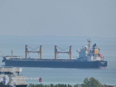
DESERT MOON
Bulk Carrier
Current Trip
| Time Travelled | 1 day |
|---|---|
| Remaining Time | 23 h, 43 mins |
| Distance Travelled | 85.98 nm |
| Remaining Distance | 212.29 nm |
| AVG Speed | 7.4 Knots |
| MAX Speed | 14 Knots |
| AVG Wind | 12.8 knots |
| MAX Wind | 20 knots |
| MIN Temp | 13.6°C / 56.48°F |
| MAX Temp | 16°C / 60.8°F |
| Dybgang | 6.4 m |
| Position Modtaget | Nu |
Current Position
| Longitude | 28.59536° |
|---|---|
| Latitude | 40.72364° |
| Status | Under way using engine |
| Fart | 0.3 Knots |
| Kurs | 110° |
| Område | Sea of Marmara |
| Station | T-AIS |
| Position Modtaget | Nu |
Info
Information
The current position of DESERT MOON is in Sea of Marmara with coordinates 40.72364° / 28.59536° as reported on 2024-04-30 19:58 by AIS to our vessel tracker app. The vessel's current speed is 0.3 Knots and is heading at the port of CONSTANTA. The estimated time of arrival as calculated by MyShipTracking vessel tracking app is 2024-05-01 19:41 LT
The vessel DESERT MOON (IMO: 9543770, MMSI: 538004585) is a Bulk Carrier that was built in 2012 ( 12 år gamle ). It's sailing under the flag of [MH] Marshall Is.
In this page you can find informations about the vessels current position, last detected port calls, and current voyage information. If the vessels is not in coverage by AIS you will find the latest position.
The current position of DESERT MOON is detected by our AIS receivers and we are not responsible for the reliability of the data. The last position was recorded while the vessel was in Coverage by the Ais receivers of our vessel tracking app.
The current draught of DESERT MOON as reported by AIS is 6.4 meters
Weather
| Temperature | 14.2°C / 57.56°F |
|---|---|
| Wind Speed | 18 knots |
| Direction | 36° NE |
| Pressure | 1017.8 hPa |
| Humidity | 93.8 % |
| Cloud Coverage | 100 % |
Featured Company
Most Visited Ports (Last year)
| Port | Arrivals | |
|---|---|---|
| 3 | ||
| 2 | ||
| 1 | ||
| 1 | ||
| 1 | ||
| 1 |
Events
| Tid | Hændelsen | Detaljer | Position / Dest | Info |
|---|---|---|---|---|
| 2024-04-30 15:09 | Status er ændret | Under way using engine Default |
40.72055 / 28.64132
ROCND WAITING 4LYCAN
|
Fart: 0.5 kn Kurs: 109° |
| 2024-04-30 14:30 | Status er ændret | Default Under way using engine |
40.72154 / 28.65226
ROCND WAITING 4LYCAN
|
Fart: 0.7 kn Kurs: 90° |
| 2024-04-30 06:53 | Status er ændret | Under way using engine Default |
40.73412 / 28.73620
ROCND WAITING 4LYCAN
|
Fart: 0.3 kn Kurs: 113° |
| 2024-04-30 06:52 | Status er ændret | Default Under way using engine |
40.73365 / 28.73566
ROCND WAITING 4LYCAN
|
Fart: 0.2 kn Kurs: 115° |
| 2024-04-30 06:39 | STOP Sejllads | 13.78 nm, South of AMBARLI |
40.73476 / 28.73663
ROCND WAITING 4LYCAN
|
Fart: 0.2 kn Kurs: 115° |
| 2024-04-30 05:35 | START Sejllads | 10.64 nm, South of AMBARLI |
40.78292 / 28.65508
ROCND WAITING 4LYCAN
|
Fart: 3.1 kn Kurs: 133° |
| 2024-04-30 00:08 | STOP Sejllads | 13.57 nm, South of AMBARLI |
40.73389 / 28.69316
ROCND WAITING 4LYCAN
|
Fart: 0.3 kn Kurs: 148° |
| 2024-04-29 23:12 | START Sejllads | 10.11 nm, South of AMBARLI |
40.79606 / 28.72830
ROCND WAITING 4LYCAN
|
Fart: 3.2 kn Kurs: 192° |
| 2024-04-29 18:14 | STOP Sejllads | 12.21 nm, South of YESILKOY |
40.75475 / 28.78049
ROCND WAITING 4LYCAN
|
Fart: 0.3 kn Kurs: 89° |
| 2024-04-29 12:10 | START Sejllads | 14.05 nm, South of AMBARLI |
40.72582 / 28.65718
ROCND WAITING 4LYCAN
|
Fart: 3.2 kn Kurs: 255° |