
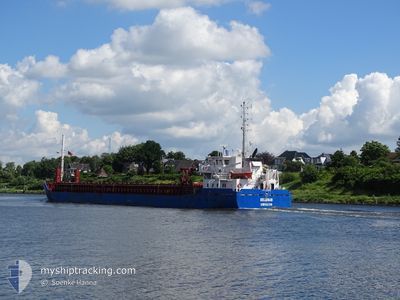
DELAMAR
General Cargo
Current Trip
| Time Travelled | 23 h, 18 mins |
|---|---|
| Remaining Time | 3 h, 50 mins |
| Distance Travelled | 242.43 nm |
| Remaining Distance | 66.71 nm |
| AVG Speed | 11.2 Knots |
| MAX Speed | 13 Knots |
| AVG Wind | 19.5 knots |
| MAX Wind | 24.8 knots |
| MIN Temp | -3.8°C / 25.16°F |
| MAX Temp | 6.9°C / 44.42°F |
| Dybgang | 4.6 m |
| Position Modtaget | 2 h, 47 m siden |
Current Position
| Longitude | --- |
|---|---|
| Latitude | --- |
| Status | Under way using engine |
| Fart | 11.2 Knots |
| Kurs | 149.5° |
| Område | Baltic Sea |
| Station | T-AIS |
| Position Modtaget | 2 h, 47 m siden |
Info
Information
The current position of DELAMAR is in Baltic Sea with coordinates 54.56303° / 13.73521° as reported on 2024-11-23 13:21 by AIS to our vessel tracker app. The vessel's current speed is 11.2 Knots and is heading at the port of SZCZECIN. The estimated time of arrival as calculated by MyShipTracking vessel tracking app is 2024-11-23 19:59 LT
The vessel DELAMAR (IMO: 9528500, MMSI: 209731000) is a General Cargo that was built in 2011 ( 13 år gamle ). It's sailing under the flag of [CY] Cyprus.
In this page you can find informations about the vessels current position, last detected port calls, and current voyage information. If the vessels is not in coverage by AIS you will find the latest position.
The current position of DELAMAR is detected by our AIS receivers and we are not responsible for the reliability of the data. The last position was recorded while the vessel was in Coverage by the Ais receivers of our vessel tracking app.
The current draught of DELAMAR as reported by AIS is 4.6 meters
Weather
| Temperature | 4.5°C / 40.1°F |
|---|---|
| Wind Speed | 19 knots |
| Direction | 241° WSW |
| Pressure | 1015.5 hPa |
| Humidity | 84.6 % |
| Cloud Coverage | 100 % |
Featured Company
Last Port Calls
| Port | Arrival | Departure | Time In Port |
|---|---|---|---|
| 2024-11-19 12:12 | 2024-11-22 16:51 | 3 d | |
| 2024-11-10 17:32 | 2024-11-15 10:05 | 4 d | |
| 2024-11-08 06:47 | 2024-11-08 18:31 | 11 h | |
| 2024-11-05 14:32 | 2024-11-06 11:20 | 20 h | |
| 2024-11-04 21:26 | |||
| 2024-10-25 15:32 | 2024-10-29 14:46 | 3 d | |
| 2024-10-23 15:50 | 2024-10-24 18:44 | 1 d | |
| 2024-10-21 09:18 | 2024-10-22 12:17 | 1 d | |
| 2024-10-16 04:31 | 2024-10-17 15:17 | 1 d | |
| 2024-10-15 04:29 | 2024-10-15 21:45 | 17 h |
Last Trips
| Origin | Departure | Destination | Arrival | Distance | |
|---|---|---|---|---|---|
| 2024-11-15 12:05 | 2024-11-19 13:12 | 927.00 nm | |||
| 2024-11-08 19:31 | 2024-11-10 19:32 | 496.96 nm | |||
| 2024-11-06 13:20 | 2024-11-08 07:47 | 490.18 nm | |||
| 2024-11-04 23:26 | 2024-11-05 16:32 | 172.69 nm | |||
| 2024-10-24 20:44 | 2024-10-25 17:32 | 171.25 nm | |||
| 2024-10-22 14:17 | 2024-10-23 17:50 | 305.46 nm | |||
| 2024-10-17 18:17 | 2024-10-21 11:18 | 930.52 nm | |||
| 2024-10-15 23:45 | 2024-10-16 07:31 | 80.93 nm | |||
| 2024-10-10 00:03 | 2024-10-15 06:29 | 1199.39 nm | |||
| 2024-10-08 08:57 | 2024-10-09 06:54 | 210.48 nm |
Events
| Tid | Hændelsen | Detaljer | Position / Dest | Info |
|---|---|---|---|---|
| 2024-11-23 13:25 | Status er ændret | Default Under way using engine |
54.55316 / 13.74533
PLSZZ
|
Fart: 11.2 kn Kurs: 149.5° |
| 2024-11-23 13:21 | Udenfor Dækning |
54.56303 / 13.73521
Baltic Sea
PLSZZ
|
Fart: 11.2 kn Kurs: 149.5° |
|
| 2024-11-23 10:26 | Ændre havområde | German part of the Baltic Sea Swedish part of the Baltic Sea |
55.00641 / 13.29083
Baltic Sea
PLSZZ
|
Fart: 11.5 kn Kurs: 121.1° |
| 2024-11-23 08:44 | Ændre havområde | Swedish part of the Baltic Sea Danish part of the Baltic Sea |
55.16440 / 12.80415
Baltic Sea
PLSZZ
|
Fart: 11.6 kn Kurs: 117.9° |
| 2024-11-23 07:35 | Ændre havområde | Danish part of the Baltic Sea Danish part of the Kattegat |
55.32467 / 12.63640
Baltic Sea
PLSZZ
|
Fart: 11.4 kn Kurs: 187.8° |
| 2024-11-23 07:32 | Ændre havområde | Danish part of the Kattegat Swedish part of the Kattegat |
55.33411 / 12.63859
Kattegat
PLSZZ
|
Fart: 11.4 kn Kurs: 191.2° |
| 2024-11-23 06:50 | Ændre havområde | Swedish part of the Kattegat Danish part of the Kattegat |
55.46623 / 12.67971
Kattegat
PLSZZ
|
Fart: 11.7 kn Kurs: 188.1° |
| 2024-11-22 18:30 | ETA er ændret | 2024/11/23 21:00 2024/11/23 22:00 |
55.66492 / 10.02693
PLSZZ
|
Fart: 10.9 kn Kurs: 85.8° |
| 2024-11-22 18:29 | ETA er ændret | 2024/11/23 22:00 2024/11/23 21:00 |
55.66462 / 10.02070
PLSZZ
|
Fart: 10.9 kn Kurs: 84.4° |
| 2024-11-22 18:25 | ETA er ændret | 2024/11/23 21:00 2024/11/23 19:00 |
55.66347 / 10.00032
PLSZZ
|
Fart: 10.9 kn Kurs: 83.2° |