

DEEP BELUGA
High speed craft

Current Trip
| Time Travelled | 9 mins |
|---|---|
| Remaining Time | --- |
| Distance Travelled | 0.40 nm |
| Remaining Distance | --- |
| AVG Speed | --- |
| MAX Speed | --- |
| AVG Wind | 9.9 knots |
| MAX Wind | 9.9 knots |
| MIN Temp | 7°C / 44.6°F |
| MAX Temp | 7°C / 44.6°F |
| Dybgang | 0.8 m |
| Position Modtaget | 1 m siden |
Current Position
| Longitude | --- |
|---|---|
| Latitude | --- |
| Status | Under way using engine |
| Fart | 7.8 Knots |
| Kurs | 118.1° |
| Område | North Sea |
| Station | T-AIS |
| Position Modtaget | 1 m siden |
Information
The current position of DEEP BELUGA is in North Sea with coordinates 53.31670° / 6.98245° as reported on 2025-02-20 13:17 by AIS to our vessel tracker app. The vessel's current speed is 7.8 Knots
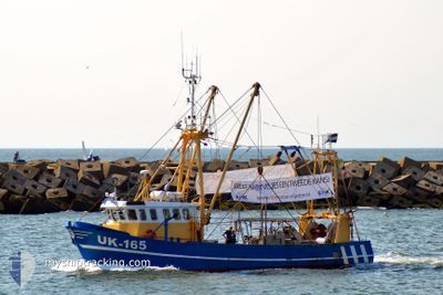
The vessel DEEP BELUGA (MMSI: 244038000) is a High speed craft It's sailing under the flag of [NL] Netherlands.
In this page you can find informations about the vessels current position, last detected port calls, and current voyage information. If the vessels is not in coverage by AIS you will find the latest position.
The current position of DEEP BELUGA is detected by our AIS receivers and we are not responsible for the reliability of the data. The last position was recorded while the vessel was in Coverage by the Ais receivers of our vessel tracking app.
The current draught of DEEP BELUGA as reported by AIS is 0.8 meters
Weather
| Temperature | 7.1°C / 44.78°F |
|---|---|
| Wind Speed | 10 knots |
| Direction | 171° S |
| Pressure | 1019.3 hPa |
| Humidity | 85.3 % |
| Cloud Coverage | 100 % |


Featured Company
Last Port Calls
| Port | Arrival | Departure | Time In Port |
|---|---|---|---|
| 2025-02-19 15:58 | 2025-02-20 14:10 | 22 h | |
| 2025-02-18 17:42 | 2025-02-19 11:03 | 17 h | |
| 2025-02-18 12:39 | 2025-02-18 12:52 | 13 m | |
| 2025-02-17 20:07 | 2025-02-18 07:11 | 11 h | |
| 2025-02-17 10:32 | 2025-02-17 18:10 | 7 h | |
| 2025-02-15 01:36 | 2025-02-17 09:47 | 2 d | |
| 2025-02-13 19:03 | |||
| 2025-01-30 11:52 | 2025-02-04 10:17 | 4 d | |
| 2025-01-28 15:15 | 2025-01-30 11:03 | 1 d | |
| 2025-01-28 10:10 | 2025-01-28 14:43 | 4 h |
Most Visited Ports (Last year)
| Port | Arrivals | |
|---|---|---|
| 4 | ||
| 3 | ||
| 3 | ||
| 1 |
Last Trips
| Origin | Departure | Destination | Arrival | Distance | |
|---|---|---|---|---|---|
| 2025-02-19 11:03 | 2025-02-19 15:58 | 23.72 nm | |||
| 2025-02-18 12:52 | 2025-02-18 17:42 | 25.53 nm | |||
| 2025-02-18 07:11 | 2025-02-18 12:39 | 83.08 nm | |||
| 2025-02-17 18:10 | 2025-02-17 20:07 | 26.86 nm | |||
| 2025-02-17 09:47 | 2025-02-17 10:32 | 4.97 nm | |||
| 2025-02-13 19:03 | 2025-02-15 01:36 | 51.30 nm | |||
| 2025-01-30 11:03 | 2025-01-30 11:52 | 15.86 nm | |||
| 2025-01-28 14:43 | 2025-01-28 15:15 | 6.57 nm | |||
| 2025-01-28 09:01 | 2025-01-28 10:10 | 8.10 nm | |||
| 2025-01-27 14:57 | 2025-01-27 15:26 | 2.97 nm |
Events
| Tid | Hændelsen | Detaljer | Position / Dest | Info |
|---|---|---|---|---|
| 2025-02-20 13:10 | Afsejlet fra sidste havn |
|
53.32131 / 6.96140
SURVEY
|
Fart: 7.7 kn Kurs: 101° |
| 2025-02-20 13:02 | START Sejllads |
53.32870 / 6.93412
[NL] DELFZIJL
|
Fart: 7.4 kn Kurs: 123° |
|
| 2025-02-19 15:07 | STOP Sejllads |
53.32937 / 6.93130
[NL] DELFZIJL
|
Fart: 0.3 kn Kurs: 15° |
|
| 2025-02-19 14:58 | Skibe i havn |
|
53.32260 / 6.95517
[NL] DELFZIJL
|
Fart: 9.2 kn Kurs: 286.3° |
| 2025-02-19 14:40 | Ændre havområde | Dutch part of the North Sea German part of the North Sea |
53.31689 / 7.03578
North Sea
|
Fart: 11.2 kn Kurs: 275.3° |
| 2025-02-19 13:56 | Ændre havområde | German part of the North Sea Dutch part of the North Sea |
53.31517 / 7.15331
North Sea
|
Fart: 6.3 kn Kurs: 308.1° |
| 2025-02-19 13:53 | Indenfor Dækning |
53.31517 / 7.15331
North Sea
|
Fart: 6.3 kn Kurs: 308.1° |
|
| 2025-02-19 12:20 | Udenfor Dækning |
53.25556 / 7.17437
North Sea
|
Fart: 5.9 kn Kurs: 322.4° |
|
| 2025-02-19 12:20 | Fundet i havområde | Dutch part of the North Sea |
53.25556 / 7.17437
North Sea
|
Fart: 5.9 kn Kurs: 322.4° |
| 2025-02-19 10:27 | Ændre havområde | German part of the North Sea Dutch part of the North Sea |
53.31695 / 7.04973
North Sea
|
Fart: 10.1 kn Kurs: 91.5° |