
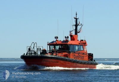
DANPILOT NOVEMBER
Pilot Vessel
Current Trip
UDBYHOJ
| Time Travelled | 3 days |
|---|---|
| Remaining Time | --- |
| Distance Travelled | 184.76 nm |
| Remaining Distance | --- |
| AVG Speed | 15.3 Knots |
| MAX Speed | 21.4 Knots |
| AVG Wind | 16 knots |
| MAX Wind | 28.5 knots |
| MIN Temp | 0.9°C / 33.62°F |
| MAX Temp | 7°C / 44.6°F |
| Dybgang | 1.5 m |
| Position Modtaget | 1 m siden |
Current Position
| Longitude | --- |
|---|---|
| Latitude | --- |
| Status | Under way using engine |
| Fart | |
| Kurs | 314° |
| Område | Kattegat |
| Station | T-AIS |
| Position Modtaget | 1 m siden |
Info
Information
The current position of DANPILOT NOVEMBER is in Kattegat with coordinates 56.61037° / 10.30551° as reported on 2025-01-24 18:43 by AIS to our vessel tracker app. The vessel's current speed is 0 Knots
The vessel DANPILOT NOVEMBER (IMO: 9878436, MMSI: 219026147) is a Pilot Vessel It's sailing under the flag of [DK] Denmark.
In this page you can find informations about the vessels current position, last detected port calls, and current voyage information. If the vessels is not in coverage by AIS you will find the latest position.
The current position of DANPILOT NOVEMBER is detected by our AIS receivers and we are not responsible for the reliability of the data. The last position was recorded while the vessel was in Coverage by the Ais receivers of our vessel tracking app.
The current draught of DANPILOT NOVEMBER as reported by AIS is 1.5 meters
Weather
| Temperature | 7.4°C / 45.32°F |
|---|---|
| Wind Speed | 22 knots |
| Direction | 221° SW |
| Pressure | 992 hPa |
| Humidity | 78.2 % |
| Cloud Coverage | 100 % |
Featured Company
Last Port Calls
| Port | Arrival | Departure | Time In Port |
|---|---|---|---|
| 2025-01-21 11:48 | 2025-01-21 12:25 | 36 m | |
| 2025-01-21 10:15 | 2025-01-21 10:47 | 31 m | |
| 2025-01-21 08:56 | 2025-01-21 09:18 | 22 m | |
| 2025-01-21 07:37 | 2025-01-21 08:09 | 32 m | |
| 2024-12-09 14:25 | 2024-12-09 15:56 | 1 h | |
| 2024-12-09 12:10 | 2024-12-09 13:32 | 1 h | |
| 2024-11-26 08:29 | 2024-11-29 08:51 | 3 d |
Last Trips
| Origin | Departure | Destination | Arrival | Distance | |
|---|---|---|---|---|---|
| 2025-01-21 11:47 | 2025-01-21 12:48 | 15.37 nm | |||
| 2025-01-21 10:18 | 2025-01-21 11:15 | 14.42 nm | |||
| 2025-01-21 09:09 | 2025-01-21 09:56 | 13.05 nm | |||
| 2024-12-09 16:56 | 2025-01-21 08:37 | 1191.59 nm | |||
| 2024-12-09 14:32 | 2024-12-09 15:25 | 14.24 nm | |||
| 2024-11-29 09:51 | 2024-12-09 13:10 | 316.98 nm | |||
| 2024-09-18 09:31 | 2024-11-26 09:29 | 1445.19 nm |
Events
| Tid | Hændelsen | Detaljer | Position / Dest | Info |
|---|---|---|---|---|
| 2025-01-24 16:38 | STOP Sejllads | 12.29 nm, North East of RANDERS |
56.61039 / 10.30553
UDBYHOJ
|
Fart: Kurs: 315° |
| 2025-01-24 15:29 | START Sejllads | 12.3 nm, North East of RANDERS |
56.60909 / 10.30830
UDBYHOJ
|
Fart: 9.7 kn Kurs: 130.8° |
| 2025-01-24 13:55 | STOP Sejllads | 12.29 nm, North East of RANDERS |
56.61040 / 10.30550
UDBYHOJ
|
Fart: 0.1 kn Kurs: 315° |
| 2025-01-24 13:19 | START Sejllads | 12.29 nm, North East of RANDERS |
56.60909 / 10.30783
UDBYHOJ
|
Fart: 9.3 kn Kurs: 136.9° |
| 2025-01-24 11:07 | STOP Sejllads | 12.29 nm, North East of RANDERS |
56.61038 / 10.30552
UDBYHOJ
|
Fart: 0.3 kn Kurs: 315° |
| 2025-01-24 10:17 | START Sejllads | 12.3 nm, North East of RANDERS |
56.60917 / 10.30822
UDBYHOJ
|
Fart: 8.6 kn Kurs: 128.4° |
| 2025-01-24 02:18 | STOP Sejllads | 12.29 nm, North East of RANDERS |
56.61040 / 10.30548
UDBYHOJ
|
Fart: 0.3 kn Kurs: 315° |
| 2025-01-24 01:38 | START Sejllads | 12.29 nm, North East of RANDERS |
56.60918 / 10.30791
UDBYHOJ
|
Fart: 6.7 kn Kurs: 131.1° |
| 2025-01-23 18:55 | STOP Sejllads | 12.29 nm, North East of RANDERS |
56.61037 / 10.30546
UDBYHOJ
|
Fart: 0.2 kn Kurs: 320° |
| 2025-01-23 17:53 | START Sejllads | 12.28 nm, North East of RANDERS |
56.60895 / 10.30787
UDBYHOJ
|
Fart: 10.7 kn Kurs: 138.3° |