

DANIEL A
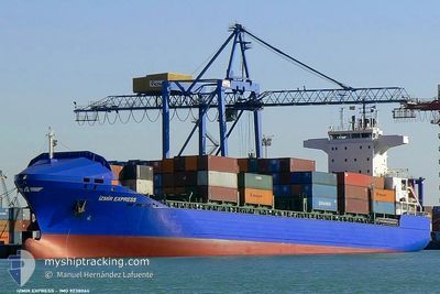
Container Ship

Current Trip
| Time Travelled | 4 days |
|---|---|
| Remaining Time | --- |
| Distance Travelled | 624.91 nm |
| Remaining Distance | --- |
| AVG Speed | 10.9 Knots |
| MAX Speed | 16.9 Knots |
| AVG Wind | 6.3 knots |
| MAX Wind | 18 knots |
| MIN Temp | 8.5°C / 47.3°F |
| MAX Temp | 16.6°C / 61.88°F |
| Dybgang | 8.1 m |
| Position Modtaget | 3 d siden |
Current Position
| Longitude | --- |
|---|---|
| Latitude | --- |
| Status | Under way using engine |
| Fart | 11.8 Knots |
| Kurs | 66.3° |
| Område | Black Sea |
| Station | T-AIS |
| Position Modtaget | 3 d siden |
Information
The current position of DANIEL A is in Black Sea with coordinates 41.99543° / 32.80791° as reported on 2025-03-24 03:49 by AIS to our vessel tracker app. The vessel's current speed is 11.8 Knots
The vessel DANIEL A (IMO: 9238064, MMSI: 271000647) is a Container Ship that was built in 2001 ( 24 år gamle ). It's sailing under the flag of [TR] Turkey.
In this page you can find informations about the vessels current position, last detected port calls, and current voyage information. If the vessels is not in coverage by AIS you will find the latest position.
The current position of DANIEL A is detected by our AIS receivers and we are not responsible for the reliability of the data. The last position was recorded while the vessel was in Coverage by the Ais receivers of our vessel tracking app.
The current draught of DANIEL A as reported by AIS is 8.1 meters
Weather
| Temperature | 14.6°C / 58.28°F |
|---|---|
| Wind Speed | 7 knots |
| Direction | 55° NE |
| Pressure | 1014.2 hPa |
| Humidity | 71.2 % |
| Cloud Coverage | 87 % |


Featured Company
Last Port Calls
| Port | Arrival | Departure | Time In Port |
|---|---|---|---|
| 2025-03-22 09:26 | 2025-03-23 02:24 | 16 h | |
| 2025-03-20 12:44 | 2025-03-21 01:34 | 12 h | |
| 2025-03-18 14:02 | 2025-03-19 09:28 | 19 h | |
| 2025-03-15 08:10 | 2025-03-16 10:33 | 1 d | |
| 2025-03-10 21:19 | 2025-03-11 08:19 | 10 h | |
| 2025-03-09 09:44 | 2025-03-10 13:24 | 1 d | |
| 2025-03-05 21:57 | 2025-03-06 17:05 | 19 h | |
| 2025-03-02 15:13 | 2025-03-03 08:20 | 17 h | |
| 2025-02-28 14:42 | 2025-03-01 05:22 | 14 h | |
| 2025-02-27 01:42 | 2025-02-27 20:18 | 18 h |
Most Visited Ports (Last year)
| Port | Arrivals | |
|---|---|---|
| 36 | ||
| 29 | ||
| 10 | ||
| 8 | ||
| 7 | ||
| 4 |
Last Trips
| Origin | Departure | Destination | Arrival | Distance | |
|---|---|---|---|---|---|
| 2025-03-21 01:34 | 2025-03-22 09:26 | 11.05 nm | |||
| 2025-03-19 09:28 | 2025-03-20 12:44 | 211.97 nm | |||
| 2025-03-16 10:33 | 2025-03-18 14:02 | 588.36 nm | |||
| 2025-03-11 08:19 | 2025-03-15 08:10 | 621.10 nm | |||
| 2025-03-10 13:24 | 2025-03-10 21:19 | 10.83 nm | |||
| 2025-03-06 17:05 | 2025-03-09 09:44 | 642.31 nm | |||
| 2025-03-03 08:20 | 2025-03-05 21:57 | 597.50 nm | |||
| 2025-03-01 05:22 | 2025-03-02 15:13 | 226.58 nm | |||
| 2025-02-27 20:18 | 2025-02-28 14:42 | 9.85 nm | |||
| 2025-02-25 03:09 | 2025-02-27 01:42 | 488.63 nm |
Events
| Tid | Hændelsen | Detaljer | Position / Dest | Info |
|---|---|---|---|---|
| 2025-03-25 10:18 | STOP Sejllads | 2.15 nm, West of POTI |
42.15391 / 41.60138
GEPTI
|
Fart: 0.3 kn Kurs: 147° |
| 2025-03-24 03:49 | Status er ændret | Default Under way using engine |
41.99635 / 32.81069
GEPTI
|
Fart: 11.8 kn Kurs: 66.3° |
| 2025-03-24 03:49 | Udenfor Dækning |
41.99543 / 32.80791
Black Sea
GEPTI
|
Fart: 11.8 kn Kurs: 66.3° |
|
| 2025-03-24 02:03 | Status er ændret | Under way using engine Default |
41.85203 / 32.38582
GEPTI
|
Fart: 11.7 kn Kurs: 63° |
| 2025-03-24 01:36 | Status er ændret | Default Under way using engine |
41.81327 / 32.28160
GEPTI
|
Fart: 11.8 kn Kurs: 66.3° |
| 2025-03-23 21:51 | ETA er ændret | 2025/03/25 13:30 2025/03/25 03:00 |
41.63983 / 31.32385
GEPTI
|
Fart: 11.7 kn Kurs: 72.8° |
| 2025-03-23 21:43 | Status er ændret | Under way using engine Default |
41.63281 / 31.29188
GEPTI
|
Fart: 11.6 kn Kurs: 74° |
| 2025-03-23 21:26 | Indenfor Dækning |
41.63281 / 31.29188
Black Sea
GEPTI
|
Fart: 11.7 kn Kurs: 73.6° |
|
| 2025-03-23 18:55 | Status er ændret | Default Under way using engine |
41.51005 / 30.57637
GEPTI
|
Fart: 11.8 kn Kurs: 76.6° |
| 2025-03-23 18:38 | Udenfor Dækning |
41.49638 / 30.50263
Black Sea
GEPTI
|
Fart: 11.8 kn Kurs: 76.6° |