
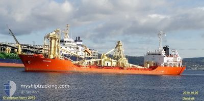
DANAVIK
Cement Carrier
Current Trip
| Time Travelled | 6 h, 12 mins |
|---|---|
| Remaining Time | 2 days |
| Distance Travelled | 64.49 nm |
| Remaining Distance | 602.31 nm |
| AVG Speed | 10.9 Knots |
| MAX Speed | 11.5 Knots |
| AVG Wind | 13 knots |
| MAX Wind | 16.5 knots |
| MIN Temp | 23.2°C / 73.76°F |
| MAX Temp | 24.2°C / 75.56°F |
| Dybgang | 6.5 m |
| Position Modtaget | 1 m siden |
Current Position
| Longitude | 14.63988° |
|---|---|
| Latitude | 36.68038° |
| Status | Under way using engine |
| Fart | 10.2 Knots |
| Kurs | 289.9° |
| Område | Mediterranean Sea - Eastern Basin |
| Station | T-AIS |
| Position Modtaget | 1 m siden |
Info
Information
The current position of DANAVIK is in Mediterranean Sea - Eastern Basin with coordinates 36.68038° / 14.63988° as reported on 2024-06-23 01:28 by AIS to our vessel tracker app. The vessel's current speed is 10.2 Knots and is heading at the port of ALCUDIA. The estimated time of arrival as calculated by MyShipTracking vessel tracking app is 2024-06-25 11:36 LT
The vessel DANAVIK (IMO: 8221363, MMSI: 210131000) is a Cement Carrier that was built in 1983 ( 41 år gamle ). It's sailing under the flag of [CY] Cyprus.
In this page you can find informations about the vessels current position, last detected port calls, and current voyage information. If the vessels is not in coverage by AIS you will find the latest position.
The current position of DANAVIK is detected by our AIS receivers and we are not responsible for the reliability of the data. The last position was recorded while the vessel was in Coverage by the Ais receivers of our vessel tracking app.
The current draught of DANAVIK as reported by AIS is 6.5 meters
Weather
| Temperature | 23.4°C / 74.12°F |
|---|---|
| Wind Speed | 8 knots |
| Direction | 288° WNW |
| Pressure | 1010 hPa |
| Humidity | 61.5 % |
| Cloud Coverage | --- |
Featured Company
Last Port Calls
| Port | Arrival | Departure | Time In Port |
|---|---|---|---|
| 2024-06-21 09:33 | 2024-06-22 19:17 | 1 d | |
| 2024-06-17 04:11 | 2024-06-18 08:35 | 1 d | |
| 2024-06-10 16:39 | 2024-06-13 06:31 | 2 d | |
| 2024-06-06 05:16 | 2024-06-07 14:45 | 1 d | |
| 2024-05-31 14:19 | 2024-06-02 11:52 | 1 d | |
| 2024-05-27 04:46 | 2024-05-30 07:49 | 3 d | |
| 2024-05-21 12:56 | 2024-05-23 17:16 | 2 d | |
| 2024-05-17 04:18 | 2024-05-18 08:07 | 1 d | |
| 2024-05-13 11:57 | |||
| 2024-05-08 07:20 |
Last Trips
| Origin | Departure | Destination | Arrival | Distance | |
|---|---|---|---|---|---|
| 2024-06-18 10:35 | 2024-06-21 11:33 | 829.53 nm | |||
| 2024-06-13 07:31 | 2024-06-17 06:11 | 850.75 nm | |||
| 2024-06-07 16:45 | 2024-06-10 17:39 | 723.49 nm | |||
| 2024-06-02 13:52 | 2024-06-06 07:16 | 859.51 nm | |||
| 2024-05-30 09:49 | 2024-05-31 16:19 | 322.30 nm | |||
| 2024-05-23 19:16 | 2024-05-27 06:46 | 675.84 nm | |||
| 2024-05-18 10:07 | 2024-05-21 14:56 | 833.19 nm | |||
| 2024-05-13 12:57 | 2024-05-17 06:18 | 876.34 nm | |||
| 2024-04-30 00:38 | 2024-05-03 05:44 | 833.68 nm | |||
| 2024-04-25 13:59 | 2024-04-29 03:30 | 843.84 nm |
Events
| Tid | Hændelsen | Detaljer | Position / Dest | Info |
|---|---|---|---|---|
| 2024-06-23 01:08 | Status er ændret | Under way using engine Default |
36.66287 / 14.70773
ALCUDIA SP
|
Fart: 10.1 kn Kurs: 282° |
| 2024-06-23 00:37 | Status er ændret | Default Under way using engine |
36.64547 / 14.81354
ALCUDIA SP
|
Fart: 10.2 kn Kurs: 282.1° |
| 2024-06-22 23:13 | Status er ændret | Under way using engine Default |
36.60739 / 15.11252
ALCUDIA SP
|
Fart: 10.3 kn Kurs: 257° |
| 2024-06-22 23:09 | Status er ændret | Default Under way using engine |
36.60820 / 15.12851
ALCUDIA SP
|
Fart: 10.2 kn Kurs: 233.8° |
| 2024-06-22 22:49 | Fundet i havområde | Italian part of the Mediterranean Sea - Eastern Basin |
36.64134 / 15.18256
Mediterranean Sea - Eastern Basin
ALCUDIA SP
|
Fart: 10.4 kn Kurs: 213.1° |
| 2024-06-22 20:15 | Dybgangen er ændret | 6.5 4.3 |
37.05894 / 15.36050
ALCUDIA SP
|
Fart: 10.8 kn Kurs: 149.3° |
| 2024-06-22 20:15 | Destination er ændret | ALCUDIA SP AUGUSTA IT |
37.05894 / 15.36050
ALCUDIA SP
|
Fart: 10.8 kn Kurs: 149.3° |
| 2024-06-22 20:15 | ETA er ændret | 2024/06/25 06:00 2024/06/21 11:00 |
37.05894 / 15.36050
ALCUDIA SP
|
Fart: 10.8 kn Kurs: 149.3° |
| 2024-06-22 20:13 | Status er ændret | Under way using engine Default |
37.06425 / 15.35670
AUGUSTA IT
|
Fart: 11.1 kn Kurs: 151° |
| 2024-06-22 20:05 | Status er ændret | Default Under way using engine |
37.08450 / 15.34228
AUGUSTA IT
|
Fart: 11.2 kn Kurs: 149.4° |