
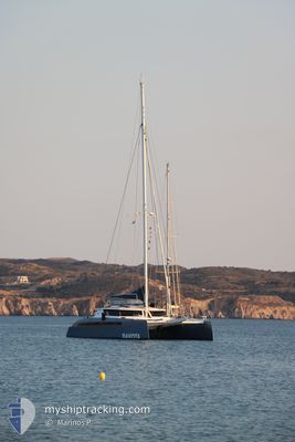
DAKOTA
Pleasure Craft
Current Trip
Unknown
| Time Travelled | 5 days |
|---|---|
| Remaining Time | --- |
| Distance Travelled | 263.01 nm |
| Remaining Distance | --- |
| AVG Speed | 6.4 Knots |
| MAX Speed | 9.4 Knots |
| AVG Wind | 7.9 knots |
| MAX Wind | 13.8 knots |
| MIN Temp | 24.2°C / 75.56°F |
| MAX Temp | 27.9°C / 82.22°F |
| Dybgang | 0 m |
| Position Modtaget | 3 d siden |
Current Position
| Longitude | 4.11982° |
|---|---|
| Latitude | 43.51047° |
| Status | Default |
| Fart | 0.1 Knots |
| Kurs | 182° |
| Område | Mediterranean Sea - Western Basin |
| Station | T-AIS |
| Position Modtaget | 3 d siden |
Info
Information
The current position of DAKOTA is in Mediterranean Sea - Western Basin with coordinates 43.51047° / 4.11982° as reported on 2024-09-02 20:44 by AIS to our vessel tracker app. The vessel's current speed is 0.1 Knots
The vessel DAKOTA (MMSI: 376497000) is a Pleasure Craft It's sailing under the flag of [VC] St Vincent Grenadines.
In this page you can find informations about the vessels current position, last detected port calls, and current voyage information. If the vessels is not in coverage by AIS you will find the latest position.
The current position of DAKOTA is detected by our AIS receivers and we are not responsible for the reliability of the data. The last position was recorded while the vessel was in Coverage by the Ais receivers of our vessel tracking app.
Weather
| Temperature | 24.4°C / 75.92°F |
|---|---|
| Wind Speed | 7 knots |
| Direction | 230° SW |
| Pressure | 1012.4 hPa |
| Humidity | 70.1 % |
| Cloud Coverage | 7 % |
Featured Company
Last Port Calls
| Port | Arrival | Departure | Time In Port |
|---|---|---|---|
| 2024-08-29 20:06 | 2024-09-01 04:07 | 2 d | |
| 2024-08-24 16:25 | 2024-08-24 16:53 | 28 m | |
| 2024-08-22 14:23 | 2024-08-23 06:38 | 16 h | |
| 2024-08-18 04:28 | 2024-08-21 06:46 | 3 d | |
| 2024-08-16 17:23 | 2024-08-17 11:35 | 18 h | |
| 2024-08-11 11:56 | 2024-08-12 11:39 | 23 h | |
| 2024-08-11 10:21 | 2024-08-11 11:13 | 52 m | |
| 2024-08-10 15:12 | 2024-08-10 16:16 | 1 h | |
| 2024-08-10 07:43 | 2024-08-10 09:17 | 1 h | |
| 2024-08-09 10:33 | 2024-08-09 17:54 | 7 h |
Last Trips
| Origin | Departure | Destination | Arrival | Distance | |
|---|---|---|---|---|---|
| 2024-08-24 18:53 | 2024-08-29 22:06 | 473.53 nm | |||
| 2024-08-23 08:38 | 2024-08-24 18:25 | 126.41 nm | |||
| 2024-08-21 08:46 | 2024-08-22 16:23 | 144.13 nm | |||
| 2024-08-17 13:35 | 2024-08-18 06:28 | 121.45 nm | |||
| 2024-08-12 13:39 | 2024-08-16 19:23 | 65.20 nm | |||
| 2024-08-11 13:13 | 2024-08-11 13:56 | 1.87 nm | |||
| 2024-08-10 18:16 | 2024-08-11 12:21 | 11.40 nm | |||
| 2024-08-10 11:17 | 2024-08-10 17:12 | 36.36 nm | |||
| 2024-08-09 19:54 | 2024-08-10 09:43 | 9.96 nm | |||
| 2024-08-04 11:54 | 2024-08-09 12:33 | 54.32 nm |
Events
| Tid | Hændelsen | Detaljer | Position / Dest | Info |
|---|---|---|---|---|
| 2024-09-02 20:44 | Udenfor Dækning |
43.51047 / 4.11982
Mediterranean Sea - Western Basin
|
Fart: 0.1 kn Kurs: 0° |
|
| 2024-09-02 20:16 | STOP Sejllads | 1.03 nm, South West of LE GRAU DU ROI |
43.51038 / 4.11982
|
Fart: Kurs: 177° |
| 2024-09-01 19:34 | Ændre havområde | French part of the Mediterranean Sea - Western Basin Italian part of the Mediterranean Sea - Western Basin |
41.74921 / 6.80018
Mediterranean Sea - Western Basin
|
Fart: 6.9 kn Kurs: 314.8° |
| 2024-09-01 04:07 | Afsejlet fra sidste havn |
|
40.56661 / 8.30147
|
Fart: 5.3 kn Kurs: 260° |
| 2024-09-01 04:01 | START Sejllads |
40.56236 / 8.31026
[IT] ALGHERO
|
Fart: 5.1 kn Kurs: 303° |
|
| 2024-09-01 03:42 | Indenfor Dækning |
40.56041 / 8.31243
Mediterranean Sea - Western Basin
[IT] ALGHERO
|
Fart: 0.1 kn Kurs: 0° |
|
| 2024-08-31 17:00 | Udenfor Dækning |
40.56041 / 8.31243
Mediterranean Sea - Western Basin
[IT] ALGHERO
|
Fart: 0.1 kn Kurs: 0° |
|
| 2024-08-31 15:33 | Indenfor Dækning |
40.56041 / 8.31243
Mediterranean Sea - Western Basin
[IT] ALGHERO
|
Fart: Kurs: 0° |
|
| 2024-08-29 21:04 | Udenfor Dækning |
40.56043 / 8.31241
Mediterranean Sea - Western Basin
[IT] ALGHERO
|
Fart: Kurs: 0° |
|
| 2024-08-29 20:19 | STOP Sejllads |
40.56045 / 8.31243
[IT] ALGHERO
|
Fart: 0.1 kn Kurs: 47° |