
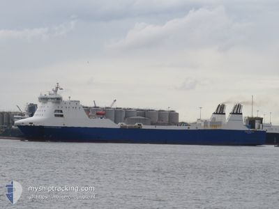
STENA FORETELLER
Ro-Ro Cargo
Current Trip
| Time Travelled | 16 h, 10 mins |
|---|---|
| Remaining Time | 3 h, 43 mins |
| Distance Travelled | 172.99 nm |
| Remaining Distance | 58.83 nm |
| AVG Speed | 11.8 Knots |
| MAX Speed | 15.8 Knots |
| AVG Wind | 7.8 knots |
| MAX Wind | 11.9 knots |
| MIN Temp | 11.8°C / 53.24°F |
| MAX Temp | 13.1°C / 55.58°F |
| Dybgang | 6.4 m |
| Position Modtaget | Nu |
Current Position
| Longitude | 2.82890° |
|---|---|
| Latitude | 51.88605° |
| Status | Under way using engine |
| Fart | 14.9 Knots |
| Kurs | 96.2° |
| Område | North Sea |
| Station | T-AIS |
| Position Modtaget | Nu |
Info
Information
The current position of STENA FORETELLER is in North Sea with coordinates 51.88605° / 2.82890° as reported on 2024-05-15 11:03 by AIS to our vessel tracker app. The vessel's current speed is 14.9 Knots and is heading at the port of HARWICH. The estimated time of arrival as calculated by MyShipTracking vessel tracking app is 2024-05-15 14:47 LT
The vessel STENA FORETELLER (IMO: 9214666, MMSI: 244110544) is a Ro-Ro Cargo that was built in 2002 ( 22 år gamle ). It's sailing under the flag of [NL] Netherlands.
In this page you can find informations about the vessels current position, last detected port calls, and current voyage information. If the vessels is not in coverage by AIS you will find the latest position.
The current position of STENA FORETELLER is detected by our AIS receivers and we are not responsible for the reliability of the data. The last position was recorded while the vessel was in Coverage by the Ais receivers of our vessel tracking app.
The current draught of STENA FORETELLER as reported by AIS is 6.4 meters
Weather
| Temperature | 12.2°C / 53.96°F |
|---|---|
| Wind Speed | 2 knots |
| Direction | 205° SSW |
| Pressure | 1006.5 hPa |
| Humidity | 95.2 % |
| Cloud Coverage | 100 % |
Featured Company
Last Port Calls
| Port | Arrival | Departure | Time In Port |
|---|---|---|---|
| 2024-05-14 14:54 | 2024-05-14 18:54 | 3 h | |
| 2024-05-13 05:34 | 2024-05-13 18:32 | 12 h | |
| 2024-05-10 14:53 | 2024-05-10 18:40 | 3 h | |
| 2024-05-09 14:55 | 2024-05-09 18:25 | 3 h | |
| 2024-05-08 14:55 | 2024-05-08 18:55 | 3 h | |
| 2024-05-07 14:46 | 2024-05-07 18:18 | 3 h | |
| 2024-05-05 10:36 | 2024-05-06 18:39 | 1 d | |
| 2024-05-04 06:28 | 2024-05-04 18:10 | 11 h | |
| 2024-05-04 06:12 | 2024-05-04 06:15 | 3 m | |
| 2024-05-02 06:17 | 2024-05-02 18:35 | 12 h |
Most Visited Ports (Last year)
| Port | Arrivals | |
|---|---|---|
| 80 | ||
| 11 |
Last Trips
| Origin | Departure | Destination | Arrival | Distance | |
|---|---|---|---|---|---|
| 2024-05-13 20:32 | 2024-05-14 16:54 | 227.25 nm | |||
| 2024-05-10 20:40 | 2024-05-13 07:34 | 229.04 nm | |||
| 2024-05-09 20:25 | 2024-05-10 16:53 | 227.96 nm | |||
| 2024-05-08 20:55 | 2024-05-09 16:55 | 226.23 nm | |||
| 2024-05-07 20:18 | 2024-05-08 16:55 | 227.00 nm | |||
| 2024-05-06 20:39 | 2024-05-07 16:46 | 227.82 nm | |||
| 2024-05-04 19:10 | 2024-05-05 12:36 | 203.28 nm | |||
| 2024-05-04 07:15 | 2024-05-04 07:28 | 0.49 nm | |||
| 2024-05-02 19:35 | 2024-05-04 07:12 | 383.21 nm | |||
| 2024-04-30 19:55 | 2024-05-02 07:17 | 386.10 nm |
Events
| Tid | Hændelsen | Detaljer | Position / Dest | Info |
|---|---|---|---|---|
| 2024-05-15 10:26 | Ændre havområde | Dutch part of the North Sea United Kingdom part of the North Sea |
51.91627 / 2.58628
North Sea
NL RTM <> GBHRW
|
Fart: 15 kn Kurs: 105.6° |
| 2024-05-15 06:54 | Status er ændret | Under way using engine Moored |
51.92938 / 1.31208
NL RTM <> GBHRW
|
Fart: 12.1 kn Kurs: 160.1° |
| 2024-05-15 06:29 | START Sejllads | 0.86 nm, North West of HARWICH |
51.94997 / 1.24723
NL RTM <> GBHRW
|
Fart: 3.3 kn Kurs: 86° |
| 2024-05-15 03:04 | ETA er ændret | 2024/05/15 15:00 2024/05/15 03:00 |
51.94820 / 1.24260
NL RTM <> GBHRW
|
Fart: Kurs: 264° |
| 2024-05-15 03:03 | Status er ændret | Moored Under way using engine |
51.94820 / 1.24260
NL RTM <> GBHRW
|
Fart: Kurs: 264° |
| 2024-05-15 02:52 | STOP Sejllads | 1 nm, West of HARWICH |
51.94877 / 1.24255
NL RTM <> GBHRW
|
Fart: 0.3 kn Kurs: 264° |
| 2024-05-14 22:32 | Ændre havområde | United Kingdom part of the North Sea Dutch part of the North Sea |
52.05563 / 2.68212
North Sea
NL RTM <> GBHRW
|
Fart: 14.5 kn Kurs: 269.5° |
| 2024-05-14 19:10 | Status er ændret | Under way using engine Moored |
51.99555 / 4.02865
NL RTM <> GBHRW
|
Fart: 14.9 kn Kurs: 296.3° |
| 2024-05-14 18:54 | Afsejlet fra sidste havn |
|
51.96865 / 4.11542
NL RTM <> GBHRW
|
Fart: 10.5 kn Kurs: 300° |
| 2024-05-14 18:43 | START Sejllads |
51.94812 / 4.12867
[NL] ROTTERDAM
|
Fart: 3.7 kn Kurs: 9° |