

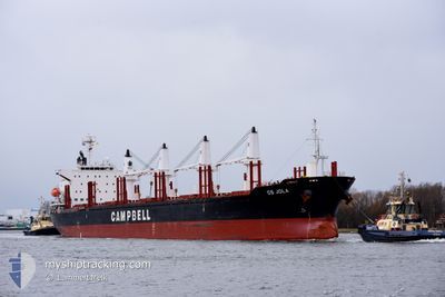
CS JOLA
Cargo

Current Trip
| Time Travelled | 41 days |
|---|---|
| Remaining Time | 4 days |
| Distance Travelled | 9791.76 nm |
| Remaining Distance | 1273.01 nm |
| AVG Speed | 9.9 Knots |
| MAX Speed | 15.6 Knots |
| AVG Wind | 14.8 knots |
| MAX Wind | 41 knots |
| MIN Temp | -1.1°C / 30.02°F |
| MAX Temp | 29.1°C / 84.38°F |
| Dybgang | 10.5 m |
| Position Modtaget | 11 h, 13 m siden |
Current Position
| Longitude | --- |
|---|---|
| Latitude | --- |
| Status | Under way using engine |
| Fart | 10.7 Knots |
| Kurs | 270.4° |
| Område | Laccadive Sea |
| Station | T-AIS |
| Position Modtaget | 11 h, 13 m siden |
Information
The current position of CS JOLA is in Laccadive Sea with coordinates 5.84639° / 80.12014° as reported on 2025-03-27 03:52 by AIS to our vessel tracker app. The vessel's current speed is 10.7 Knots and is heading at the port of KANDLA. The estimated time of arrival as calculated by MyShipTracking vessel tracking app is 2025-04-01 11:42 LT
The vessel CS JOLA (IMO: 9791896, MMSI: 538007348) is a Cargo It's sailing under the flag of [MH] Marshall Is.
In this page you can find informations about the vessels current position, last detected port calls, and current voyage information. If the vessels is not in coverage by AIS you will find the latest position.
The current position of CS JOLA is detected by our AIS receivers and we are not responsible for the reliability of the data. The last position was recorded while the vessel was in Coverage by the Ais receivers of our vessel tracking app.
The current draught of CS JOLA as reported by AIS is 10.5 meters
Weather
| Temperature | 28.6°C / 83.48°F |
|---|---|
| Wind Speed | 8 knots |
| Direction | 277° W |
| Pressure | 1008 hPa |
| Humidity | 74 % |
| Cloud Coverage | 65 % |


Featured Company
Most Visited Ports (Last year)
| Port | Arrivals | |
|---|---|---|
| 2 | ||
| 2 | ||
| 2 | ||
| 1 | ||
| 1 | ||
| 1 |
Events
| Tid | Hændelsen | Detaljer | Position / Dest | Info |
|---|---|---|---|---|
| 2025-03-27 03:55 | Status er ændret | Default Under way using engine |
5.84615 / 80.11169
INIXY
|
Fart: 10.7 kn Kurs: 270.4° |
| 2025-03-27 03:52 | Udenfor Dækning |
5.84639 / 80.12014
Laccadive Sea
INIXY
|
Fart: 10.7 kn Kurs: 270.4° |
|
| 2025-03-27 02:55 | Status er ændret | Under way using engine Default |
5.81275 / 80.27385
INIXY
|
Fart: 11.8 kn Kurs: 265° |
| 2025-03-27 02:45 | Status er ændret | Default Under way using engine |
5.81408 / 80.30758
INIXY
|
Fart: 11.9 kn Kurs: 270.2° |
| 2025-03-27 02:19 | Fundet i havområde | Sri Lankan part of the Laccadive Sea |
5.81595 / 80.39284
Laccadive Sea
INIXY
|
Fart: 12.2 kn Kurs: 269.5° |
| 2025-03-27 02:19 | Status er ændret | Under way using engine Default |
5.81594 / 80.39454
INIXY
|
Fart: 12.2 kn Kurs: 270° |
| 2025-03-27 02:15 | Indenfor Dækning |
5.81595 / 80.39284
Laccadive Sea
INIXY
|
Fart: 12.2 kn Kurs: 269.5° |
|
| 2025-03-21 15:57 | Status er ændret | Default Under way using engine |
1.20285 / 103.55417
INIXY
|
Fart: 12.6 kn Kurs: 275.8° |
| 2025-03-21 15:50 | Udenfor Dækning |
1.19966 / 103.57839
Singapore Strait
INIXY
|
Fart: 12.6 kn Kurs: 275.8° |
|
| 2025-03-21 15:47 | Ændre havområde | Malaysian part of the Singapore Strait Indonesian part of the Singapore Strait |
1.19785 / 103.59117
Singapore Strait
INIXY
|
Fart: 12.6 kn Kurs: 280.2° |