
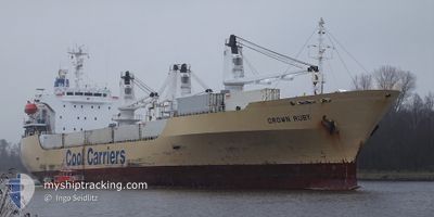
CROWN RUBY
Reefer
Current Trip
| Trip Time | 18 days |
|---|---|
| Trip Distance | 5951.56 nm |
| AVG Speed | 16.2 Knots |
| MAX Speed | 19.7 Knots |
| Dybgang | 6.9 m |
| AVG Wind | 9.5 knots |
| MAX Wind | 18.2 knots |
| MIN Temp | 17.2°C / 62.96°F |
| MAX Temp | 28.4°C / 83.12°F |
| Position Modtaget | Nu |
Current Position
| Longitude | --- |
|---|---|
| Latitude | --- |
| Status | Moored |
| Fart | |
| Kurs | 349° |
| Område | South Pacific Ocean |
| Station | T-AIS |
| Position Modtaget | Nu |
Info
Information
The current position of CROWN RUBY is in South Pacific Ocean with coordinates -37.64256° / 176.18149° as reported on 2026-03-22 03:54 by AIS to our vessel tracker app. The vessel's current speed is 0 Knots and is currently inside the port of TAURANGA.
The vessel CROWN RUBY (IMO: 9159103, MMSI: 311000796) is a Reefer that was built in 1997 ( 29 år gamle ). It's sailing under the flag of [BS] Bahamas.
In this page you can find informations about the vessels current position, last detected port calls, and current voyage information. If the vessels is not in coverage by AIS you will find the latest position.
The current position of CROWN RUBY is detected by our AIS receivers and we are not responsible for the reliability of the data. The last position was recorded while the vessel was in Coverage by the Ais receivers of our vessel tracking app.
The current draught of CROWN RUBY as reported by AIS is 6.9 meters
Weather
| Temperature | 20.2°C / 68.36°F |
|---|---|
| Wind Speed | 6 knots |
| Direction | 18° NNE |
| Pressure | 1023.3 hPa |
| Humidity | 67.1 % |
| Cloud Coverage | 38 % |
Featured Company
Last Port Calls
| Port | Arrival | Departure | Time In Port |
|---|---|---|---|
| 2026-03-21 02:48 | |||
| 2026-02-26 18:59 | 2026-03-02 05:25 | 3 d | |
| 2026-01-12 19:06 | 2026-01-18 23:40 | 6 d |
Most Visited Ports (Last year)
| Port | Arrivals | |
|---|---|---|
| 4 | ||
| 3 | ||
| 2 | ||
| 2 | ||
| 1 | ||
| 1 |
Last Trips
| Origin | Departure | Destination | Arrival | Distance | |
|---|---|---|---|---|---|
| 2026-03-01 22:25 | 2026-03-21 15:48 | 5951.56 nm | |||
| 2026-01-19 02:40 | 2026-02-26 11:59 | 9638.74 nm | |||
| 2025-12-21 17:35 | 2026-01-12 22:06 | 7279.19 nm |
Events
| Tid | Hændelsen | Detaljer | Position / Dest | Info |
|---|---|---|---|---|
| 2026-03-21 03:03 | Status er ændret | Moored Under way using engine |
-37.64240 / 176.18140
[NZ] TAURANGA
|
Fart: Kurs: 348° |
| 2026-03-21 02:59 | STOP Sejllads |
-37.64249 / 176.18122
[NZ] TAURANGA
|
Fart: 0.3 kn Kurs: 351° |
|
| 2026-03-21 02:48 | Skibe i havn |
|
-37.64018 / 176.17142
[NZ] TAURANGA
|
Fart: 6.9 kn Kurs: 120° |
| 2026-03-21 01:36 | START Sejllads | --- |
-37.61450 / 176.27063
NZTRG D
|
Fart: 3.1 kn Kurs: 90° |
| 2026-03-21 01:30 | Status er ændret | Under way using engine At anchor |
-37.61360 / 176.26870
NZTRG D
|
Fart: 0.6 kn Kurs: 99° |
| 2026-03-17 09:47 | Status er ændret | At anchor Under way using engine |
-37.61243 / 176.27006
NZTRG D
|
Fart: 0.9 kn Kurs: 194° |
| 2026-03-17 09:46 | STOP Sejllads | --- |
-37.61267 / 176.26984
NZTRG D
|
Fart: 0.2 kn Kurs: 189° |
| 2026-03-17 03:31 | Status er ændret | Under way using engine Default |
-36.60061 / 177.55301
NZTRG D
|
Fart: 18 kn Kurs: 228° |
| 2026-03-17 03:26 | Status er ændret | Default Under way using engine |
-36.58500 / 177.57466
NZTRG D
|
Fart: 17.8 kn Kurs: 228.2° |
| 2026-03-17 03:22 | Status er ændret | Under way using engine Default |
-36.57243 / 177.59163
NZTRG D
|
Fart: 17.7 kn Kurs: 227° |