
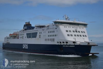
COTE DES FLANDRES
Ro-Ro/Passenger Ship
Current Trip
CALAIS - DOVER
| Time Travelled | 1 h, 37 mins |
|---|---|
| Remaining Time | --- |
| Distance Travelled | 23.64 nm |
| Remaining Distance | --- |
| AVG Speed | 16.8 Knots |
| MAX Speed | 18.5 Knots |
| AVG Wind | 14.4 knots |
| MAX Wind | 17 knots |
| MIN Temp | 10.5°C / 50.9°F |
| MAX Temp | 10.9°C / 51.62°F |
| Dybgang | 5.9 m |
| Position Modtaget | 1 m siden |
Current Position
| Longitude | --- |
|---|---|
| Latitude | --- |
| Status | Under way using engine |
| Fart | 0.1 Knots |
| Kurs | 103° |
| Område | North Sea |
| Station | T-AIS |
| Position Modtaget | 1 m siden |
Info
Information
The current position of COTE DES FLANDRES is in North Sea with coordinates 50.97797° / 1.87170° as reported on 2025-12-11 12:24 by AIS to our vessel tracker app. The vessel's current speed is 0.1 Knots
The vessel COTE DES FLANDRES (IMO: 9305843, MMSI: 228085000) is a Ro-Ro/Passenger Ship that was built in 2005 ( 20 år gamle ). It's sailing under the flag of [FR] France.
In this page you can find informations about the vessels current position, last detected port calls, and current voyage information. If the vessels is not in coverage by AIS you will find the latest position.
The current position of COTE DES FLANDRES is detected by our AIS receivers and we are not responsible for the reliability of the data. The last position was recorded while the vessel was in Coverage by the Ais receivers of our vessel tracking app.
The current draught of COTE DES FLANDRES as reported by AIS is 5.9 meters
Weather
| Temperature | 10.7°C / 51.26°F |
|---|---|
| Wind Speed | 13 knots |
| Direction | 194° SSW |
| Pressure | 1020.6 hPa |
| Humidity | 80.8 % |
| Cloud Coverage | 9 % |
Featured Company
Last Port Calls
| Port | Arrival | Departure | Time In Port |
|---|---|---|---|
| 2025-12-11 09:38 | 2025-12-11 10:49 | 1 h | |
| 2025-12-11 03:30 | 2025-12-11 04:43 | 1 h | |
| 2025-12-10 23:43 | 2025-12-11 00:30 | 47 m | |
| 2025-12-10 20:20 | 2025-12-10 21:24 | 1 h | |
| 2025-12-10 15:35 | 2025-12-10 16:45 | 1 h | |
| 2025-12-10 09:36 | 2025-12-10 11:51 | 2 h | |
| 2025-12-10 03:34 | 2025-12-10 04:45 | 1 h | |
| 2025-12-09 20:13 | 2025-12-09 21:19 | 1 h | |
| 2025-12-09 14:53 | 2025-12-09 16:03 | 1 h | |
| 2025-12-09 09:41 | 2025-12-09 11:05 | 1 h |
Last Trips
| Origin | Departure | Destination | Arrival | Distance | |
|---|---|---|---|---|---|
| 2025-12-11 04:43 | 2025-12-11 09:38 | 48.74 nm | |||
| 2025-12-11 00:30 | 2025-12-11 03:30 | 24.94 nm | |||
| 2025-12-10 21:24 | 2025-12-10 23:43 | 20.85 nm | |||
| 2025-12-10 16:45 | 2025-12-10 20:20 | 46.01 nm | |||
| 2025-12-10 11:51 | 2025-12-10 15:35 | 46.63 nm | |||
| 2025-12-10 04:45 | 2025-12-10 09:36 | 48.54 nm | |||
| 2025-12-09 21:19 | 2025-12-10 03:34 | 46.38 nm | |||
| 2025-12-09 16:03 | 2025-12-09 20:13 | 45.52 nm | |||
| 2025-12-09 11:05 | 2025-12-09 14:53 | 46.64 nm | |||
| 2025-12-09 04:36 | 2025-12-09 09:41 | 47.46 nm |
Events
| Tid | Hændelsen | Detaljer | Position / Dest | Info |
|---|---|---|---|---|
| 2025-12-11 12:16 | STOP Sejllads | 0.97 nm, North East of CALAIS |
50.97798 / 1.87162
CALAIS - DOVER
|
Fart: 0.1 kn Kurs: 102° |
| 2025-12-11 11:46 | Ændre havområde | French part of the North Sea French part of the English Channel |
50.96821 / 1.68346
North Sea
CALAIS - DOVER
|
Fart: 18 kn Kurs: 103° |
| 2025-12-11 11:22 | Ændre havområde | French part of the English Channel United Kingdom part of the English Channel |
51.00648 / 1.50769
English Channel
CALAIS - DOVER
|
Fart: 18.1 kn Kurs: 123.6° |
| 2025-12-11 10:49 | Afsejlet fra sidste havn |
|
51.12013 / 1.34627
CALAIS - DOVER
|
Fart: 9.3 kn Kurs: 120° |
| 2025-12-11 10:47 | START Sejllads |
51.12364 / 1.33966
[GB] DOVER
|
Fart: 7.8 kn Kurs: 159° |
|
| 2025-12-11 09:45 | STOP Sejllads |
51.12543 / 1.33897
[GB] DOVER
|
Fart: 0.3 kn Kurs: 162° |
|
| 2025-12-11 09:38 | Skibe i havn |
|
51.12103 / 1.34323
[GB] DOVER
|
Fart: 10.7 kn Kurs: 288.4° |
| 2025-12-11 09:37 | Ændre havområde | United Kingdom part of the English Channel United Kingdom part of the North Sea |
51.12054 / 1.34662
English Channel
CALAIS - DOVER
|
Fart: 11.6 kn Kurs: 281.2° |
| 2025-12-11 08:58 | Ændre havområde | United Kingdom part of the North Sea French part of the North Sea |
51.05273 / 1.58536
North Sea
CALAIS - DOVER
|
Fart: 17.7 kn Kurs: 315° |
| 2025-12-11 08:11 | START Sejllads | 0.9 nm, North East of CALAIS |
50.97958 / 1.86713
CALAIS - DOVER
|
Fart: 3.5 kn Kurs: 261° |